
Lost Cove
Click on any of the images on this page for full size/full resolution pic.
Lost Cove is a unique and special place to me. It was the home to a small community of people from the mid 1800's to the 1950's. Even though there now is no one living there, nor has there been for over 60 years, a hike into the cove still brings glimpses into this place's past, and one can definitely still feel the presence and spirit of those who lived here before.
The topography of the land that forms Lost Cove adds to the beauty of this place. The cove lays at the base of the very steep north face of Flattop Mountain, just south of the Nolichucky River. Most of Flattop Mountain is incredibly steep, as is Unaka Mountain, which lies on the other side of the Nolichucky. But the sheer, vertical elevation levels out to form this beautiful cove, which is fed by two streams and their numerous tributaries which drain down from the top of Flattop. If you hike down from the top of Flattop, you'll see the cove open out in front of you after coming down 2 very steep miles from the top.
Lost Cove has a unique and colorful history, which includes Daniel Boone, the Civil War, the railroad, the timber industry, and moonshine activities. A very thorough presentation is available on line: In 2007, Christy Smith, a student at East Tennessee University, did her masters thesis on Lost Cove, researching both written records, as well as interviewing surviving residents who had lived in the cove, providing an irreplaceable oral history to this place.
There are two routes into the Cove ... the most commonly used route is via Lost Cove Trail, a 2.5 mile trek down Flattop Mountain from an unlabeled trailhead on FS278. In recent years, the Forest Service connected the eastern end of Devils Creek Trail with Lost Cove Trail, and this provides an alternate, albeit longer route into the Cove (mileage distance is about twice as long going by way of Devil's Creek).
This page will present both routes, as well as descriptions of the area within Lost Cove, beginning with the route that comes down from the top of Flattop Mountain. Mileage via this route to the cove is 2.5 miles one way. You'll hike at least another mile or so as you explore the cove, and then it will be another 2.5 miles back out as you retrace your route. Adding in a trek down to the river adds another two miles (one mile there and another mile back).
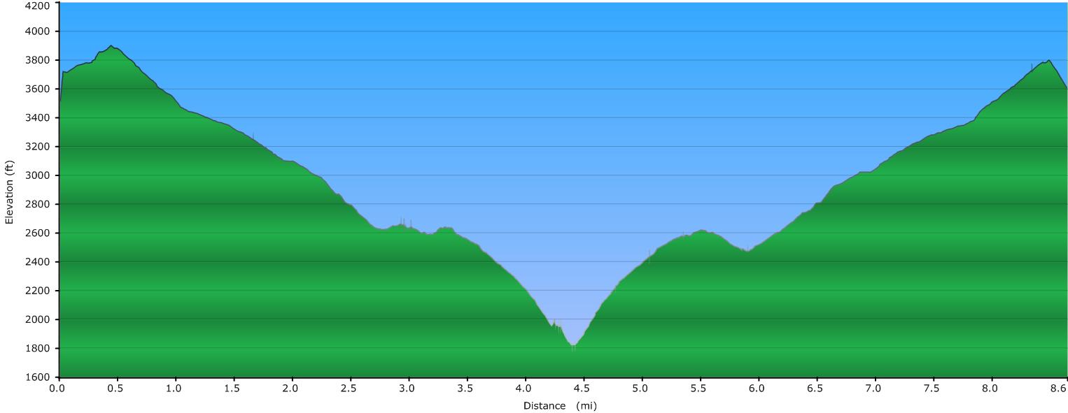
Elevation Profile
Click for larger image
Click here for a larger map
GPX data for download: GPS track for both routes to Lost Cove, including *.gdb format for Garmin users, as well as *.gpx format.
DIRECTIONS
The trailhead for this route into Lost Cove is located along FS278 (Flattop Road), a gravel road which climbs up Flattop Mountain from White Oak Flats Road (labeled as Howell Branch Road on some maps). White Oak Flats is a paved road which turns north off US19W.
To get here, take the Burnsville Exit off I-26 (exit 9), and head east towards Burnsville on US19. 10.6 miles from where you exit off the freeway, watch for a left turn onto US19W.
Take this left turn, and get comfortable. It is 16.6 miles to US19W's intersection with White Oak Flats road, and it will probably take you 25-30 minutes to drive those 16.6 miles. 19W follows the Cane River, and the course is very twisty and curvy. The scenery is great ... take your time and enjoy it.
A landmark to watch for as you're getting close to White Oak Flats road is a road sign indicating you've entered the community of Sioux, NC. Don't expect your GPS to find Sioux for you (most don't), but none the less, there is sign indicating when you've arrived, and you'll see a community of homes and a church.
Approximately one mile after passing the sign for Sioux, watch for a paved road to your right. It is labeled as White Oak Flats Road (also called Howell Branch Road). Turn onto this road, and it will climb rather steeply uphill for a little over a mile.
The road will end at a "T", with a gravel road going both to the left, as well as to the right.
Take the road to the left; this is FS278.
This road will continue to climb as you follow it for 2.0 miles, to the top of Flattop Mountain.
Just as you are about to reach the trailhead, the road levels out, and you can see it head straight ahead around a left-hand curve (up until this point you are winding steeply in and out of the various coves of the south side of Flattop Mountain). Just beyond the curve, is a gate, which has been closed every time I've been here. Just before the curve you'll notice a small parking area on the right, which has room for 3 or 4 cars. And, just before this parking area, is FS5505 ... a gated road which turns almost 360 degrees back to the right. You probably won't see this till you've passed it.
Park in the small parking area on the right.
If you look on the map with my GPS track (above), you'll notice a small loop of track between the two waypoints labeled 'Parking' and 'Joe Lewis Field'. When I made my first trip to Lost Cove, I headed up FS5505, and picked up a trail which wound around to the west and headed up to an open field (named Joe Lewis Field) at the top of Flattop Mountain.
In subsequent trips, this trail has all but disappeared. Instead, just take the most direct route, which is a steep, straight path that you'll see heads straight up the hillside in front of the parking area. After a distance of about 400 feet in which you gain over a hundred feet in elevation, you'll come out at the base of Joe Lewis Field.
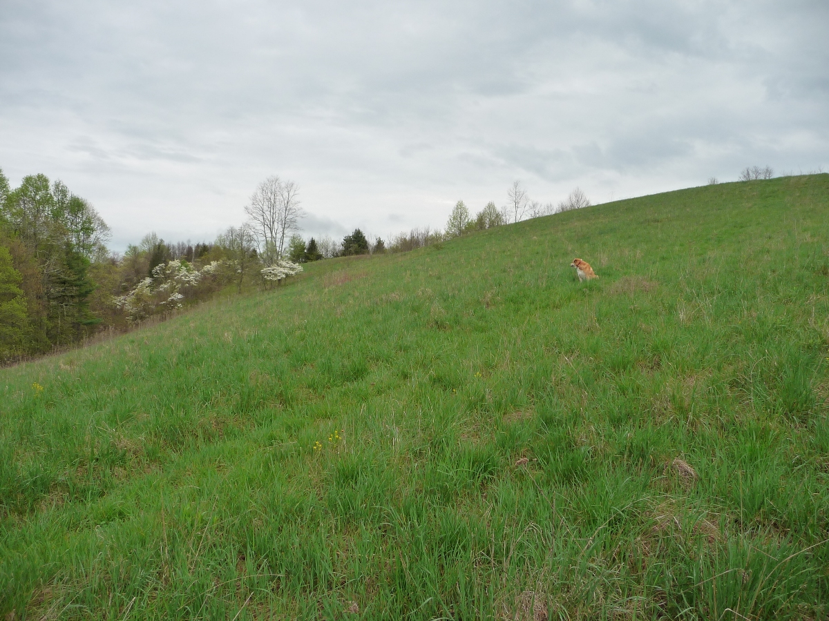
Joe Lewis Field
The trail down to Lost Cove begins along the ridge at top of this field. Head straight up the field to the ridgeline; generally there is a trail you can see that runs through the middle of the field. Sometimes in late summer this field has chest high growth, but a path is usually kept mowed up to the top.
Once you get to the top, turn left, and follow the narrow ridgeline. You'll have some great views to your right of the Nolichucky river valley, and to your left of Sugar Loaf and Cane Mountains on either side of the Cane River.

View of the Ridgeline that heads west from the top of Joe Lewis Field
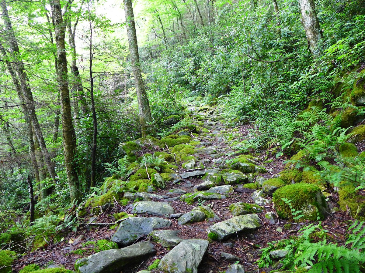
As you head west along the ridgeline, after about 400 feet or so, look for a clear trail that turns to the right, and begins to descend off the north side of the mountain. This is the beginning of Lost Cove Trail. It is not signed or blazed, but it is an easy to see and easy to follow, well worn trail.
As soon as you hit this trail, you quickly pass from the wide open, grassy ridge line to a forested, oftentimes rocky trail.
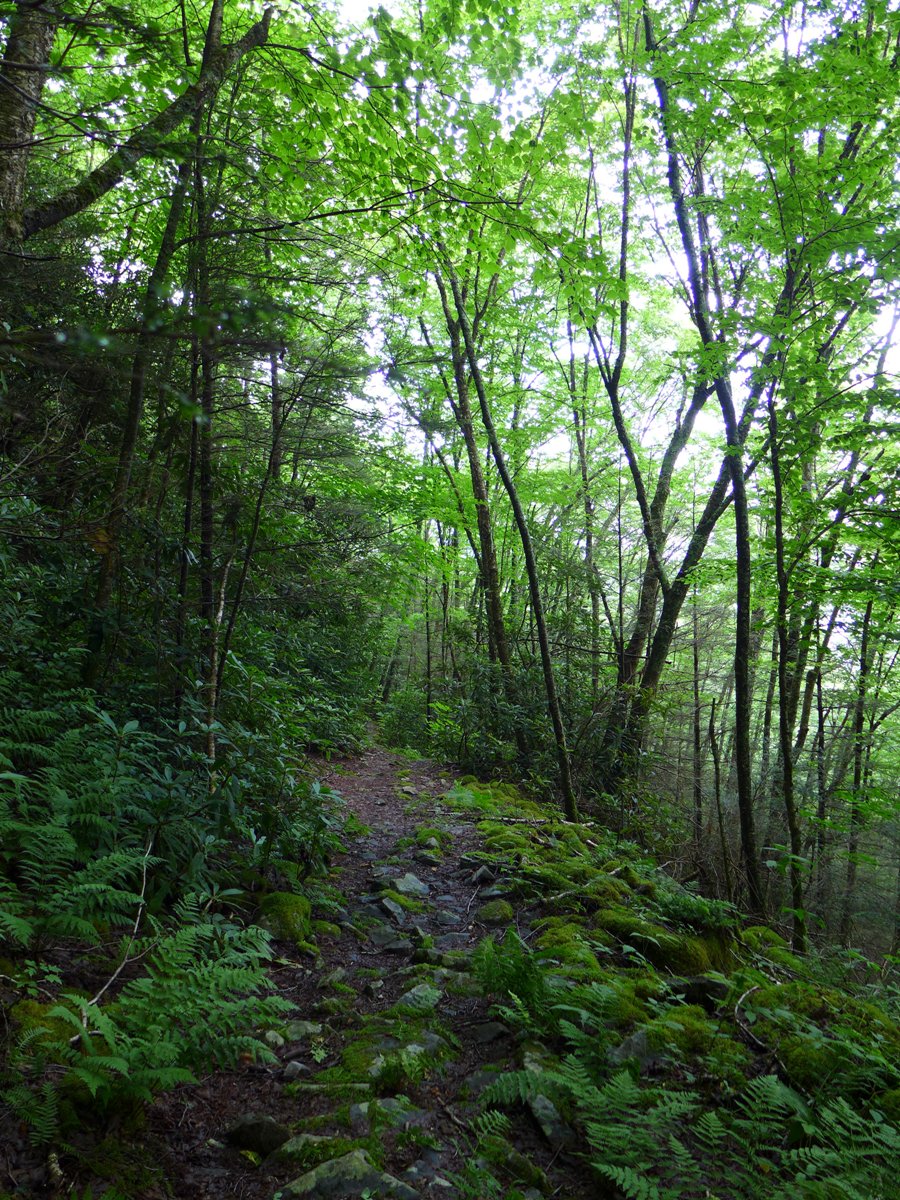
Lost Cove Trail, above and below
From here, you will descend steadily for approximately 2 miles, until you reach Lost Cove. You will lose about 1100 feet in elevation over these 2 miles. Halfway down, just past the 1 mile mark, you'll see Devil's Creek Trail come in from the left.
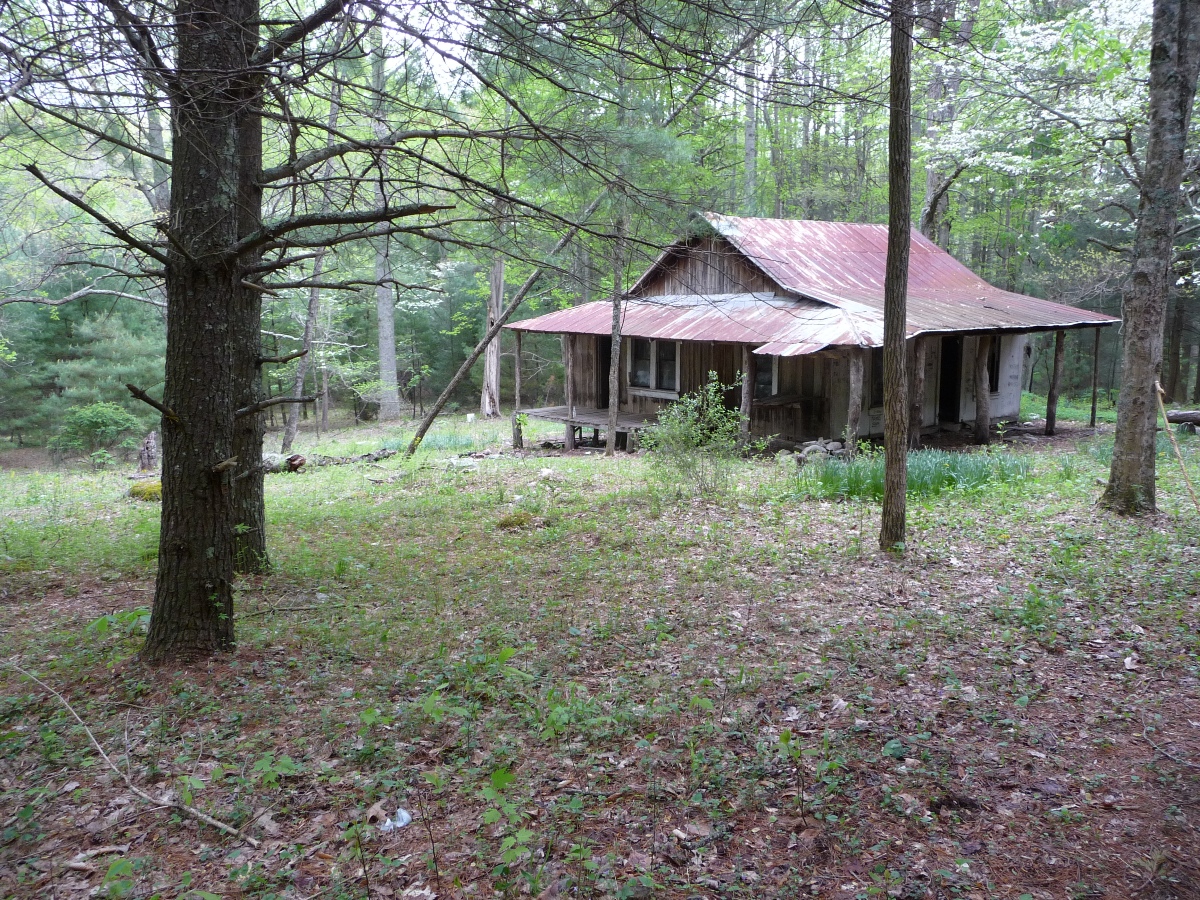
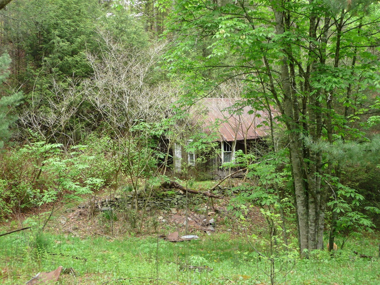
You will know you've reached the Cove when you arrive at the house pictured below. This is one of two remaining structures still standing in Lost Cove.
Lone remaining house in Lost Cove
Navigating Within Lost Cove
East End
Once you reach this house in Lost Cove, and have spent time checking it out, there are parts of Lost Cove to the west (left, as you're facing the house from the trail) and to the east.
I'm just going to give you some general directions, since half the fun of Lost Cove is "poking around" and discovering bits and pieces of its past. Every time I go, I find something new.
But to head east from this house, just continue on the main trail, downhill. In 0.2 mile or so, you will come to the second building that is still standing. Just before reaching that, look for some old concrete steps ... all that remain of the Cove's church.
This area shows some of the most rapid "taking over" by nature. All 3 of the photos below are shots of the same building.
2009

2013

2015
Many thanks to the 3 different readers who wrote to say that this old building is NOT the schoolhouse, as I had originally thought.
The trail continues past this old building, although it becomes much more overgrown. References about life in Lost Cove mention residents going to Poplar (a small community just upstream on the Nolichucky), and I'm curious if this old road heads there. See my webpage that describes my exploration of this old road which I did on a May, 2015 hike.
Navigating Within Lost Cove
West End
Once you've explored in this area of the Cove, head back the way you came, going back to the old house. Continue past the house for a couple hundred feet or so, and you'll see the trail you came in on from the top of Flattop Mountain bear off to your left, and the trail you're on continue straight ahead.
Continue on the trail that goes straight ahead. In a short distance, you'll cross one of the streams that feed into Lost Cove. Over the next 0.4 mile, there'll be a lot of old remains to explore along this trail. Take your time, and poke around and see what you find! Below you'll see a few of those things, but there's lot's more to discover!
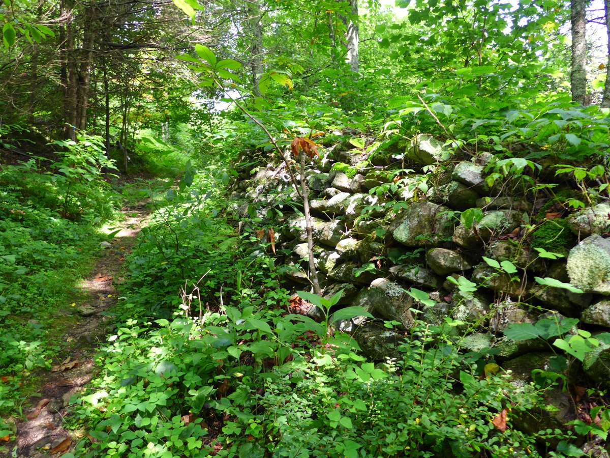
Old Stone Fence

Old Chimney
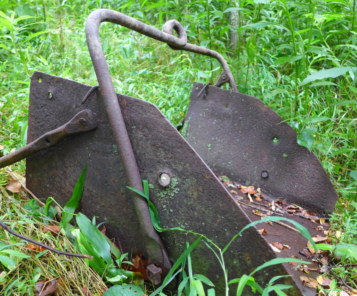
Old Backhoe
And of course .... the old truck:

According to the research paper referenced above, this is (was) a 1938 Chevy!
The one area of Lost Cove you'll want to be sure to visit is the cemetery, and this takes a few landmarks to find. Once you pass this old truck, keep going down the path a short ways, and you'll pass a small, low building (probably a barn of some sort, but it is only 4 feet high or so). On either side of this building is a trail that heads uphill to the left (if heading west), off the main trail. It is this trail that takes you to the cemetery. You'll need to walk uphill a short ways (a tenth of a mile, maybe a little more), and you won't see the cemetery until you crest this little knoll.
But the community of Lost Cove found one of the prettiest places in the cove to place this cemetery. The forest is open, and gently rolling. The cemetery itself is on a small, level knoll.
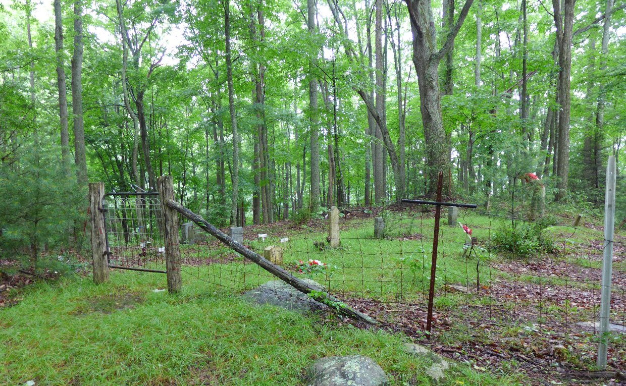
Lost Cove Cemetery
The cemetery marks the end of the old community of Lost Cove, but there's still more hiking available. If you continue down the trail for another mile, you come to the Nolichucky River. The route down to the river is rough and rocky, and drops about a 1000 feet in elevation over the mile course. The railroad (which is still active .... several trains run through this area each day) parallels the river.
The railroad/river view is quite nice, but you get a great "bird's eye" view of the river if you climb the steep ridge to your right just before reaching the river. You find yourself on a very narrow (knife-edge type narrow) rocky ridge that gives a great view of the river and surrounding area.

Nolichucky River
Another route to Lost Cove
As mentioned above, the Lost Cove Trail from its upper end at the ridge near Joe Lewis Field, down to the Cove is the most direct route here. But as shown in the GPS map above, Devils Creek Trail also intersects Lost Cove, and provides another access route. This route is almost twice as long, and while you still have some significant elevation change, it is not as much or as steep as the Lost Cove Trail.
The map below shows both routes, for comparison.
Click here for a larger map
Elevation Profile
Click for larger image
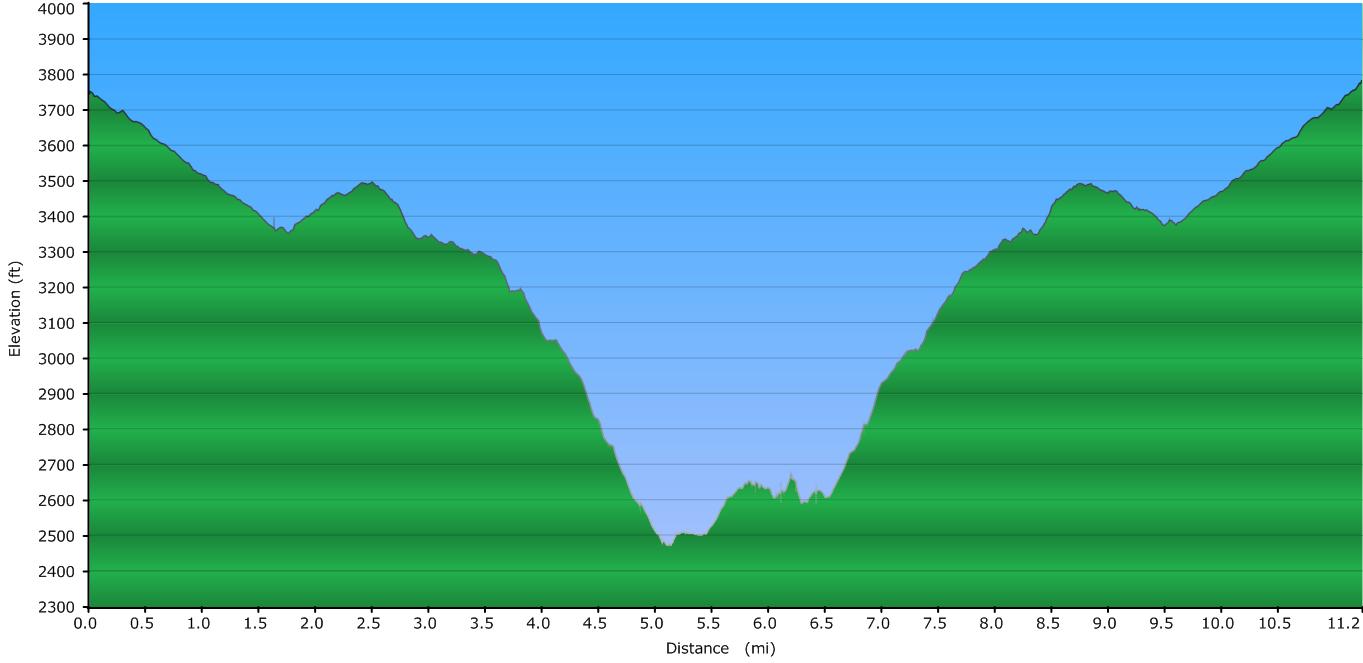
Note that this profile DOES NOT INCLUDE the one mile trek down to the river and back as the profile above does ... this profile is of a hike going only as far as the cemetery and back, going Devils Creek Trail both ways. If you go to the river, you'll need to add another two miles (one mile there, a second one back up) and 1000 feet elevation more down, and then back up.
So total mileage going to Lost Cove, by way of Devil's Creek is 11.2 miles round trip. Going by way of Lost Cove Trail is 6.8 miles. Both distances include going to both the east and west ends of the Cove, but do not include mileage to the river. Going there, adds 2 additional miles to the total.
Please see my Devil's Creek Page for directions to the trailhead, as well as route information to the junction with Lost Cove Trail.
Lots more photos in my SmugMug gallery.
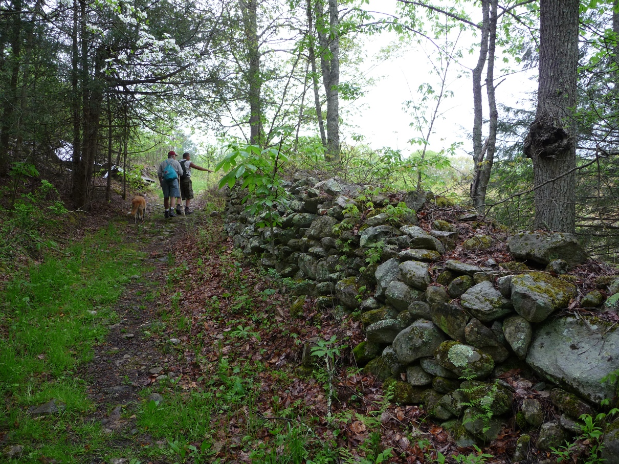
Along the old Stone Fence
Photo from 2009
NOTE: In December, 2012, Southern Appalachian Highlands Conservancy (SAHC) purchased a 95-acre tract which covers much of the area in which Lost Cove is located. I'm not sure who owned this area previously, but it has been an area that was used by folks who seemed to be able to carry all their stuff DOWN into the cove, but left all their trash behind in the Cove. The MASSIVE volume of trash was so incredibly disrespectful, not only of the land, but of the people who used to live here as well as the hikers who came to visit.
In an INCREDIBLE day of teamwork and WORK, SAHC, along with Americorp volunteers and USARaft, collected and removed ALL the trash that had accumulated in the Cove. Go read through this amazing post, and if you're like me, I think a donation to SAHC is MORE than appropriate for this fantastic effort which made such a huge difference in the look and feel of Lost Cove. I was just there in September, 2014, and could not get over the difference. Remember folks: LEAVE NO TRACE!