Bushwhack to
Waterfall on Right Fork
of the Davidson River
Including hike to
Shuck Ridge Falls
and
Pilot Mountain
Click on any of the images on this page for full size/full resolution pic.
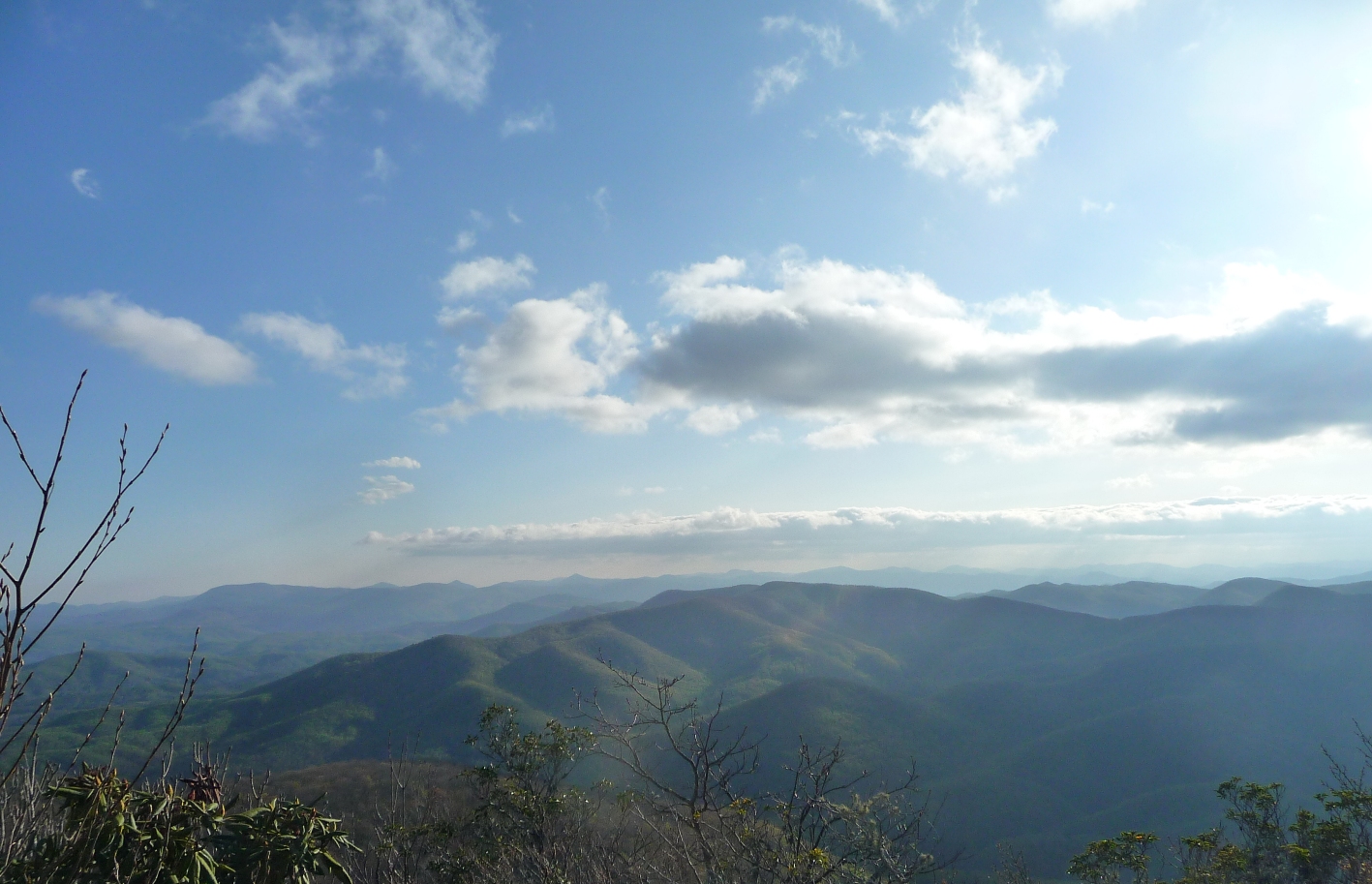
It was hard to pick a photo for the top of this page, since I like the top photo to be representative of the hike as a whole, or illustrate the featured hike's high point. But on this hike, you get a ton of gorgeous, gorgeous beauty: 3 waterfalls, 3 miles of river hiking with a multitude of rapids, hiking trails through open forest, wildflowers, and a mountain top view point.
So, I chose the mountain top photo!
This hike is long (12.2 miles) and strenuous (elevation changes range from a low of 2,891 feet to a high of 5,086 feet), but has so much to offer in terms of scenery, waterfall viewing, and fantastic hiking, that it's well worth doing. Alternatively, with the exception of Shuck Ridge Falls, you could also get to any one of the high points on this hike via shorter hikes from either of the two trailheads. Shuck Ridge Falls however, is pretty much right in the middle of this hike, and getting to it would involve an out an back hike of 9.2 miles round trip, beginning and ending from Daniel Ridge Trailhead.
One could also reach Shuck Ridge Falls via a round trip hike of approximately 5 miles, beginning and ending from Deep Gap, which is accessible from the end of FS229, but this route involves a going down, and then back up the 1 mile, 1000 foot elevation change portion of Farlow Gap Trail. FS229 begins at Gloucester Gap; parking is available for a handful of vehicles at the end of this road (about 2.5 miles from Gloucester Gap), and from here it is a short, level hike to pick up the Art Loeb Trail at Deep Gap. Continue north on Art Loeb to Farlow Gap, turn right on Farlow, and Shuck Ridge Falls will be at the bottom of the 1 mile descent.
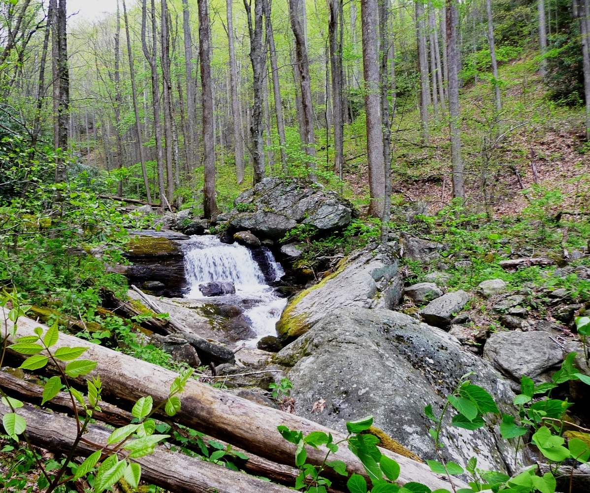
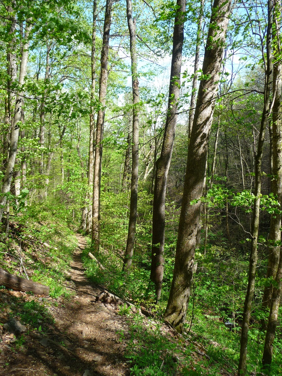
The portion of the hike that goes to the waterfall on the Right Fork of the Davidson River is off trail, and involves a bushwhack of approximately 1.8 miles round trip. As bushwhacking goes, this is pretty straight forward; enough folks must go to this waterfall since in many places there is an almost visible trail to follow. The forest is quite open, and there are very little briars or rhododendron thickets to deal with. I did the hike in the third week of April; a friend that went with me on this hike had done it another year in June and said at that time, he ran into a lot of stinging nettle, poison ivy, and gnats. Thankfully on this trip, we ran into none of those. There are three creek crossings. Crossing Lanning Branch is quite straight forward; the two crossings of the Right Fork creek are somewhat tricky, and could be difficult if the water is up.
Elevation Profile
Click for larger image

Click here for a larger map
GPX data for download (zip file which includes both GPX format, as well as GDB format for Garmin users):
Daniel Ridge Trailhead Toms Spring Branch Waterfall to Waterfall on Right Fork to Shuck Ridge Falls to Farlow Gap to Pilot Mountain.
DIRECTIONS
The two trailheads for this hike are the Daniel Ridge Trail Parking Lot and Gloucester Gap, both located on Forest Service Road 475 (Davidson River Road, also called Fish Hatchery Road). These two trailheads are 2.0 miles apart, making for a very easy car shuttle.
Daniel Ridge Trailhead is located on FS475, approximately 4 miles from US276. Drive north on US276 from Brevard for approximately 5.5 miles. FS475 branches off to the left, just past a bridge. There is a sign here for the Pisgah Center for Wildlife Education, which is located approximately 1 1/2 miles down FS475.
Once you've turned onto FS475, continue down this road for 4 miles. The road becomes gravel once you pass the Cove Creek trailhead. Daniel Ridge Trailhead is on the right, immediately after you pass over a small bridge. There is no sign, but the trailhead is quite popular, with room for a dozen or more cars.
Gloucester Gap is 2 miles further down FS475, at a junction of 4 gravel roads: FS475, FS1338 (Cathey's Creek Road, which heads SE and intersects US64 west of Brevard), FS1327, which heads SW towards Balsam Grove, and FS229 which is a very rough 2.5 mile road that climbs over 1300 feet in elevation, bringing you out very close to Deep Gap.
From the Daniel Ridge Trailhead, begin your hike by walking around the iron gate, and down a wide, gravel road, crossing a large, wide bridge over the Davidson River.
The first waterfall, Toms Spring Waterfall, comes very soon, about 0.6 mile from the trailhead. Once you cross the large, wide bridge, the wide gravel road you are following bears to the right, and a narrower, single track trail bears left. Continue following the wide road to the right. Tom's Spring Waterfall will be right on the trail on your left. It is a very tall, wide waterfall with much exposed rock face. There is a side trail you can scramble up to get a nice side view.
Tom's Spring Waterfall (above and below)
Continuing on with the hike, backtrack back to the juncture with the single track trail and follow that. You will pass a wide, flat area, that often has folks camping here.
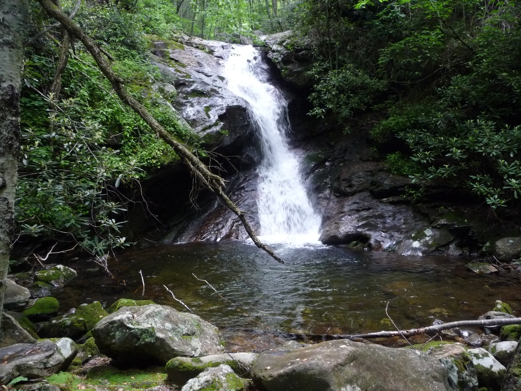
After approximately 0.58 mile from where you picked up the single track trail, after a view to your left of the river making a wide, 90 degree turn, you'll notice a wide trail bearing off to the left, with the main trail continuing straight. The trail to the left continues to follow the river, providing some great views of rapids, an old fish rearing area, and several campsites. It rejoins the main trail approximately 0.6 mile after it leaves it. The photo below is one of the waterfalls you see along this stretch.
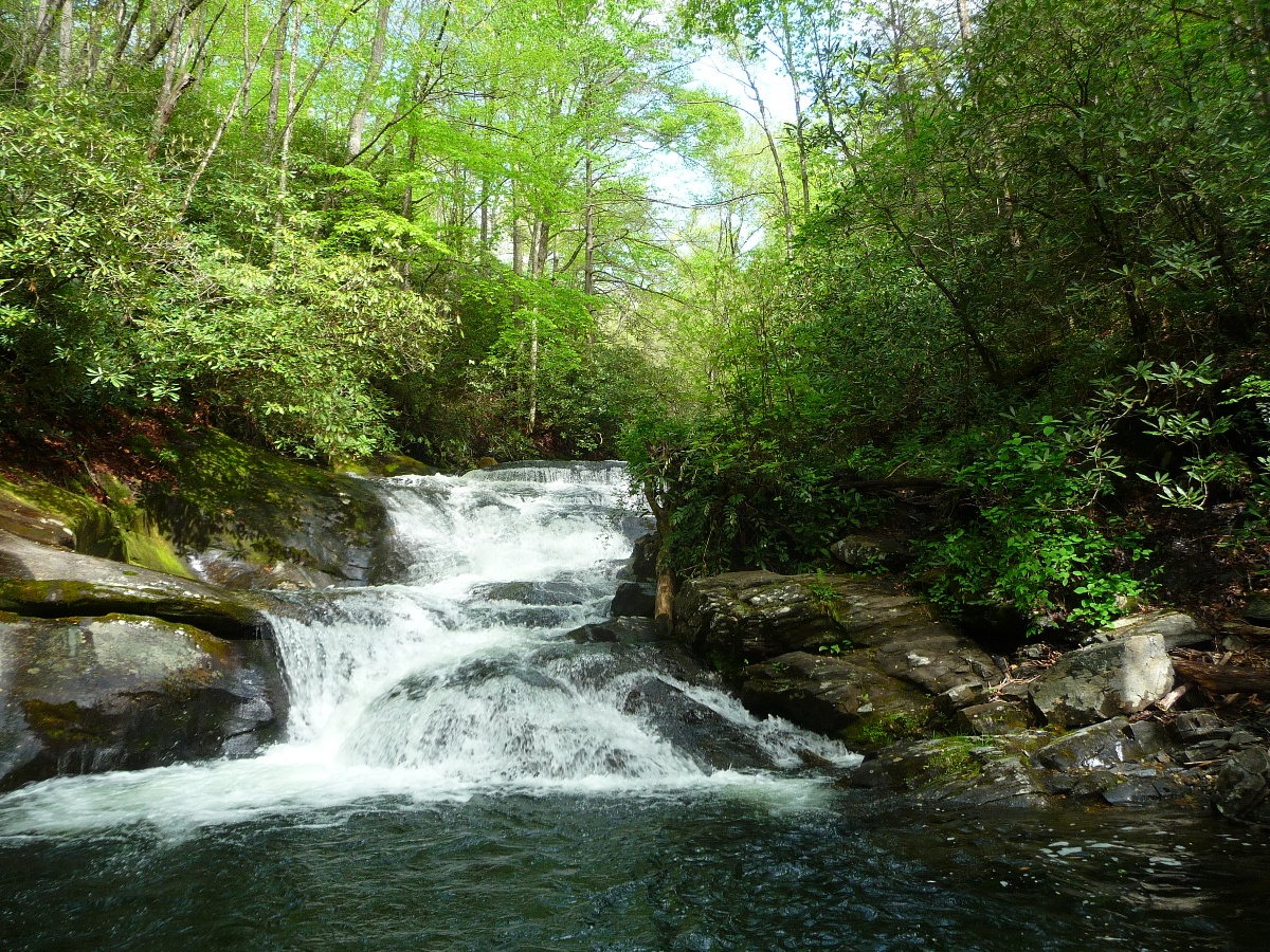
Small waterfall on the Davidson River
Once you join back up with the main trail, you continue to follow the river upstream, with numerous places to go down to river level. There are rapids, rock sluices, and other small waterfalls. You'll pass the remains of an old stone bridge ... which now has nothing except the except the old stone walls on either side of the river and just an empty span of air between the two.
After approximately 0.5 mile past this old bridge site, you'll come to the juncture of Daniel Ridge and Farlow Gap Trails. Daniel Ridge Trail makes a very sharp right hand turn, and in another 2-3 miles, comes out at the base of Tom's Spring Waterfall. This makes a very nice 5-ish mile loop hike.
To continue on to the Waterfall on Right Fork, bear straight ahead onto Farlow Gap Trail. Very soon you'll come to a stream crossing that normally is easily rock hopped. There used to be a bridge here, but the severe storms and flooding in 2004 washed that bridge away.
Once you rock hop across the stream, Farlow Gap Trail will begin an uphill climb, including several switchbacks. You'll then come to a short, steep climb up several steps built into the hillside. At this point the trail bears off to the left, but to get to the waterfall on Right Fork, you'll leave the trail here, bearing right.
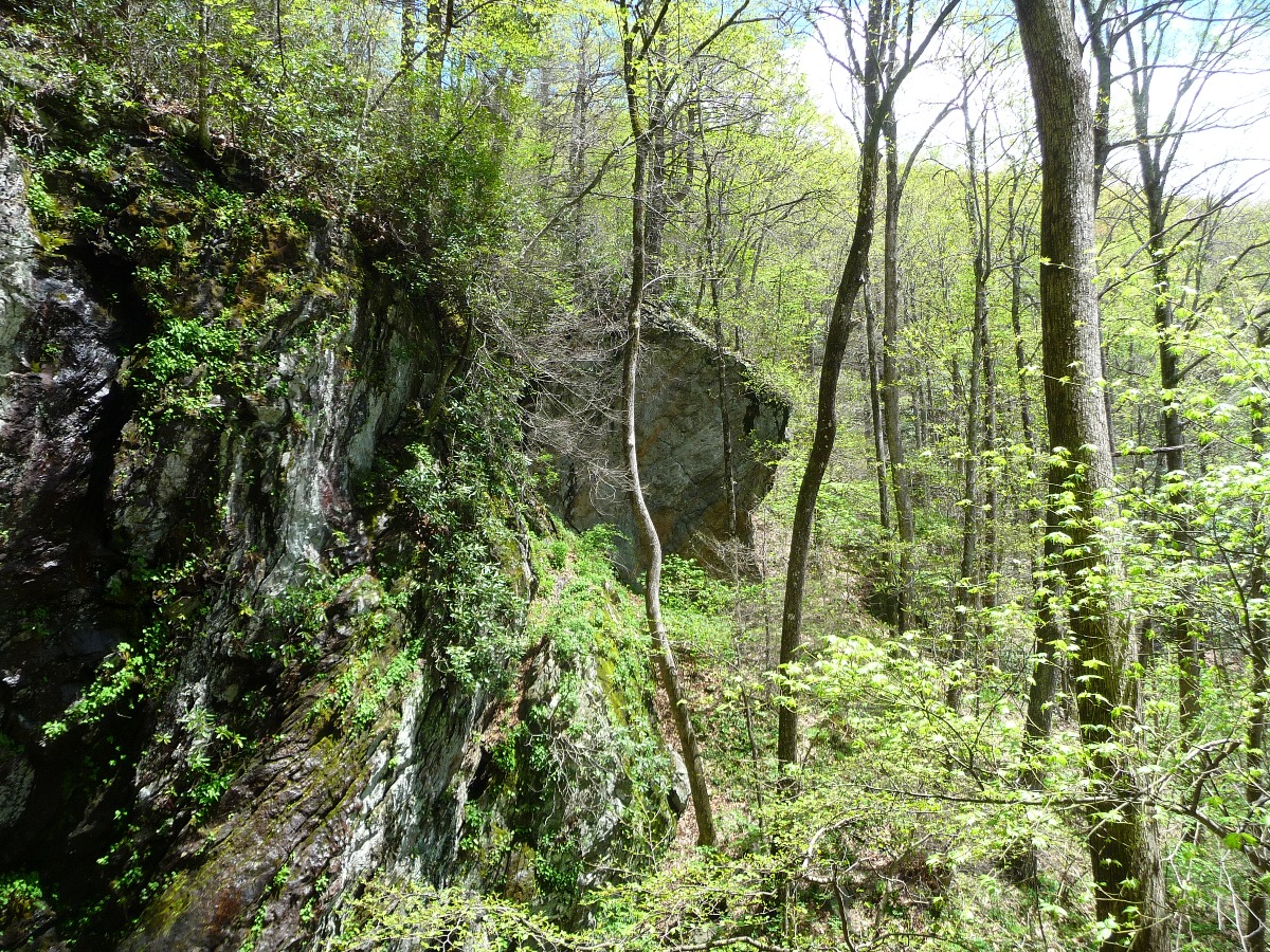
You initially follow an old railroad grade, and will see old metal cables and the occasional metal rail. Except for a short steep up and down crossing of a small tributary, this section is wide, flat and easy to follow. Just keep following the Right Fork upstream. Fairly soon you'll need to cross it; there are lots of rocks and boulders, and you should be able to get across by rock hopping.
If you're like me and prefer to just wade across, this is a safe and easy location in which to cross (ie, no steep rapids to avoid!)
View of Right Fork (above)
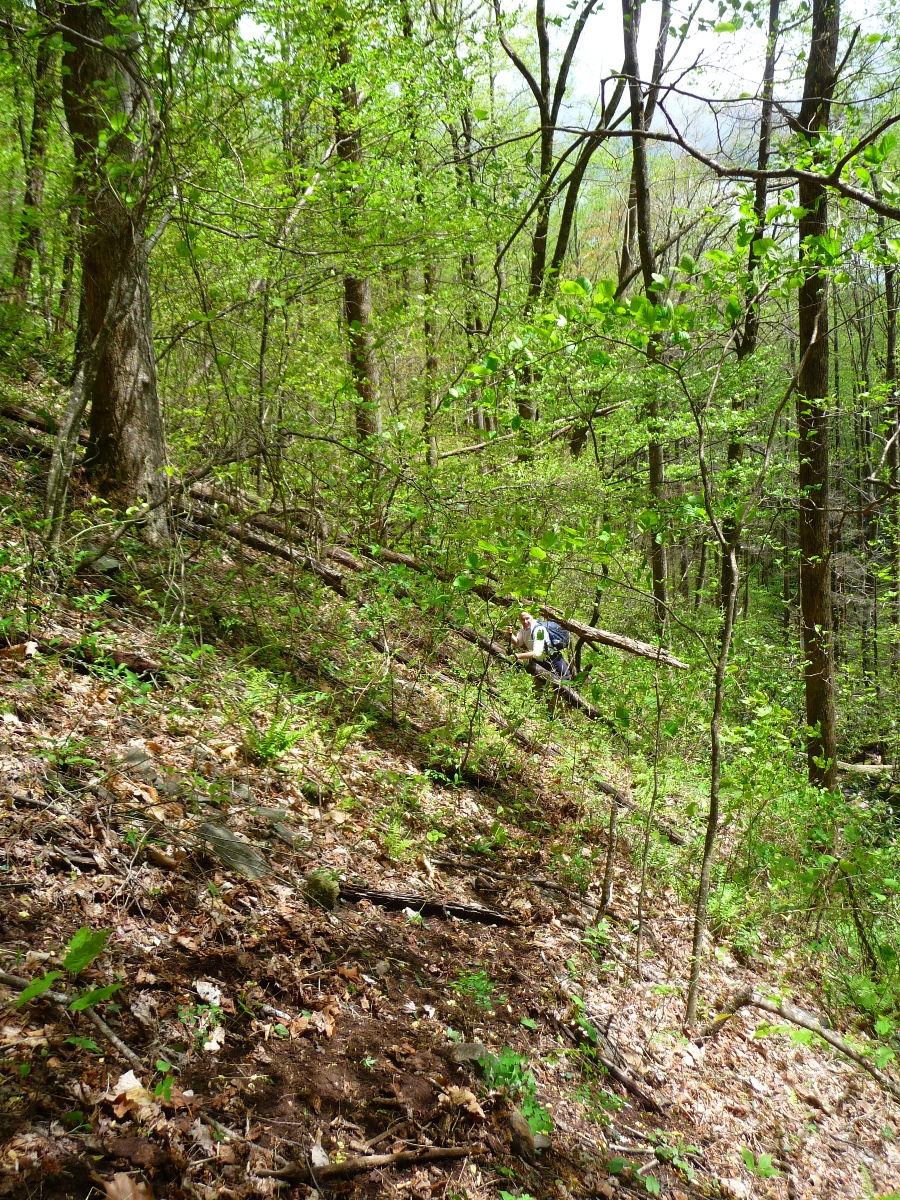
Bushwhacking Route (below)
Once back on the east side of the Right Fork, just keep heading upstream. Eventually you'll cross the small, narrow Lanning Branch Creek.
Once across Lanning Branch, stay on the right (east) side of Right Fork, and climb up the ridge a bit. The day we did this hike, there was a fairly clear path to follow.
You'll find yourself fairly high above Right Fork, on a steep sloping hillside. Just keep following the creek upstream. As Kevin Adams says in the description of this hike in his book North Carolina Waterfalls, "Don't spend a lot of time trying to stay on the path. Just keep heading upstream by the route of least resistance."
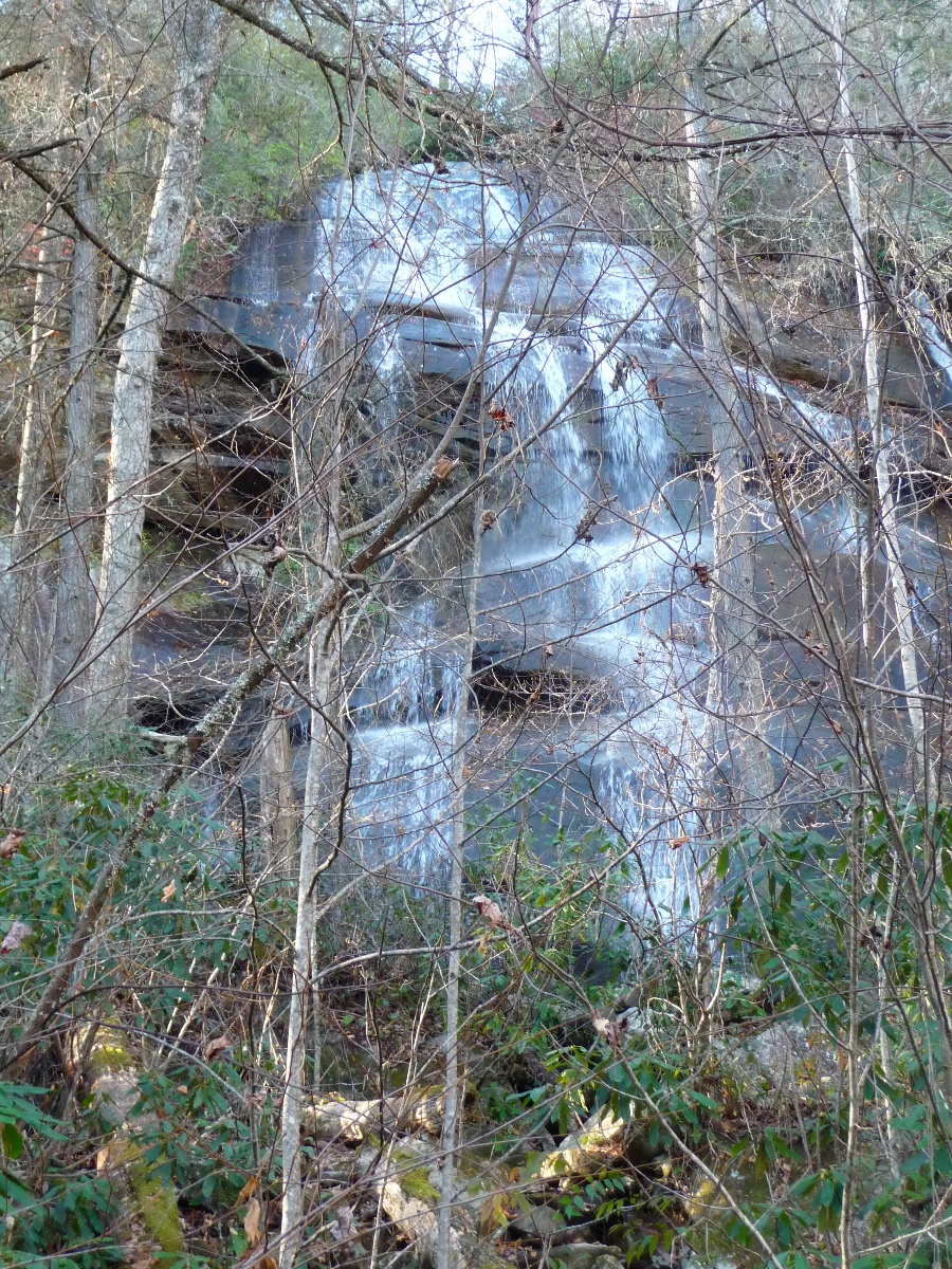
Further upstream, you'll catch a glimpse of the waterfall a ways ahead of you. From this vantage point, you can see both the main falls, as well as the wide, vertical smaller drop above the main falls. This upper drop is not visible once you reach the waterfall itself.
Once you catch sight of the falls, you'll find yourself heading back down to creek level and crossing the creek. Once you do this, it is a very short, steep push to the waterfall itself. The waterfall has a sheer, vertical drop, coming off a large wide rocky cliff. Across from the waterfall is a great grassy perch perfect for lunch and waterfall viewing!
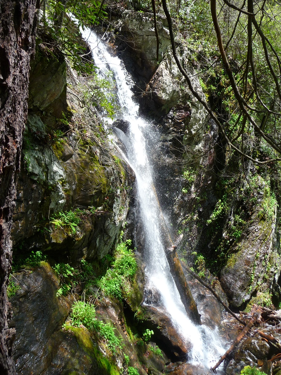
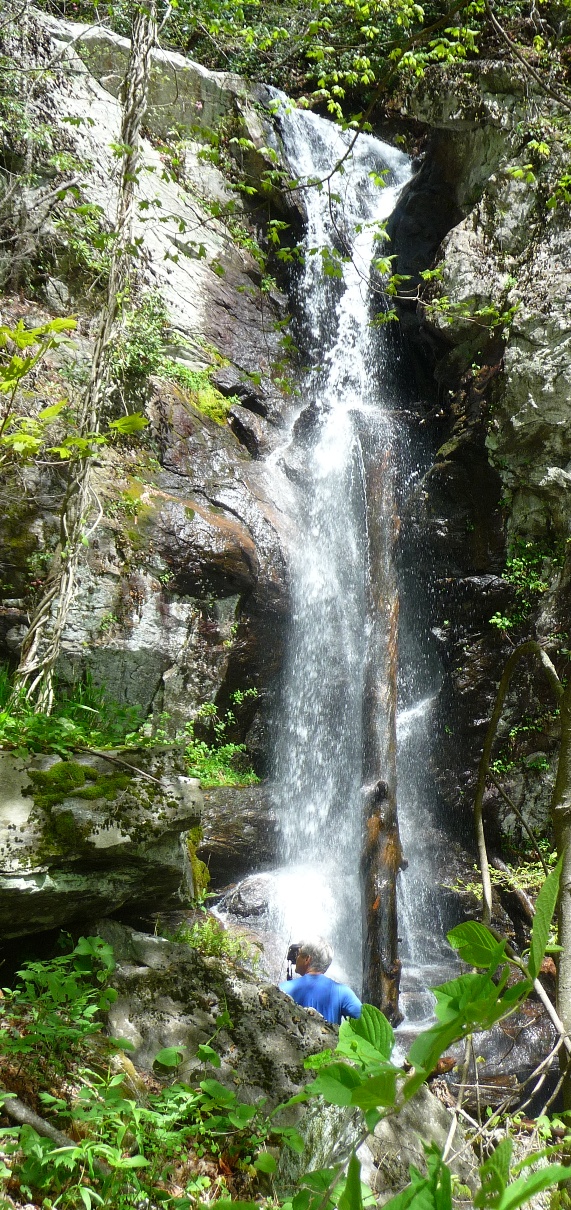
Waterfall on the Right Fork (above)
Rocky Cliff from which the waterfall drops (below)
Stop over at Andy's photostream on flickr for some great shots that he got of this waterfall.
According to my GPS track, the length of the bushwhack from where you leave Farlow Gap Trail is about a mile. My track showed the distance 0.8 mile going, and 1.0 mile returning. Each stretch took just under an hour.
Next Stop: Shuck Ridge Falls
Once you return back to Farlow Gap Trail, Shuck Ridge Falls comes in another 2 miles. This portion of Farlow Gap Trail is one of my favorite hiking trails. You wind in and out of the coves along the south facing mountain range just below the Blue Ridge Parkway. You cross Daniel Ridge Creek, as well as a couple other smaller tributaries. The trail, while going steadily uphill, has a very gentle grade, and you are going through open forest. You get wonderful long-range vistas across the river valleys below you, with great views of the mountain ridges beyond those river valleys.
As you get close to Shuck Ridge Creek, the trail passes a campsite on the left, and then begins going steeply downhill, finally crossing Shuck Ridge Creek at the top of the falls. An unusual aspect of these falls is that while you can hear the falls, you cannot see them from this top perspective.
To get to the base, as soon as you cross the creek, Farlow Gap trail continues straight, heading uphill, but look for a very noticeable side trail to the left, that starts out level, but quickly drops steeply down the side of the hillside to the base of the falls. The distance is short, but this trail is quite tricky to navigate. It used to be a faint scramble trail that you had to look for, with lots of roots and trees for hand holds, but over time, the trail has gotten very clear, but also lacking in good handholds in the steepest spot. One tree that I used to use for handholds has since fallen, and the trail is steep, and if it has rained at all, pretty slick and muddy. Going down isn't hard ... gravity takes care of that!! It's coming back up that is tricky!!
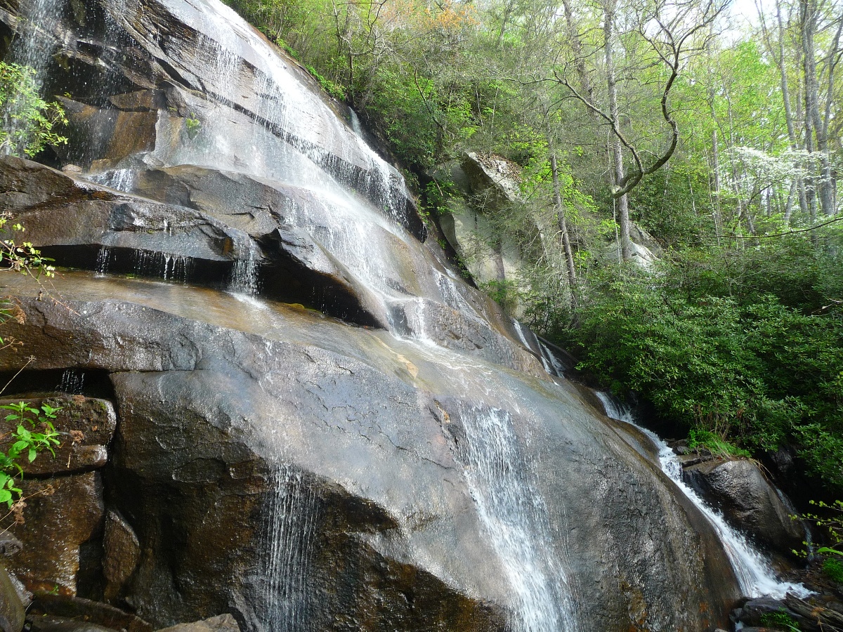
But what a treat you're in for at the base ... Shuck Ridge Falls drops down into a deep, gorgeous pool of water. Near vertical rocky walls encircle the falls and half of its pool. There's a great place to sit and enjoy the scene at the edge of the pool across from the falls.
Shuck Ridge Falls
Once you climb back up the side trail and rejoin the main trail, your next stop is Farlow Gap. Between Shuck Ridge Falls and Farlow Gap is a one mile, 1000 foot elevation climb along a trail that is often rocky and very tough hiking. No way around it ... this portion is tough.
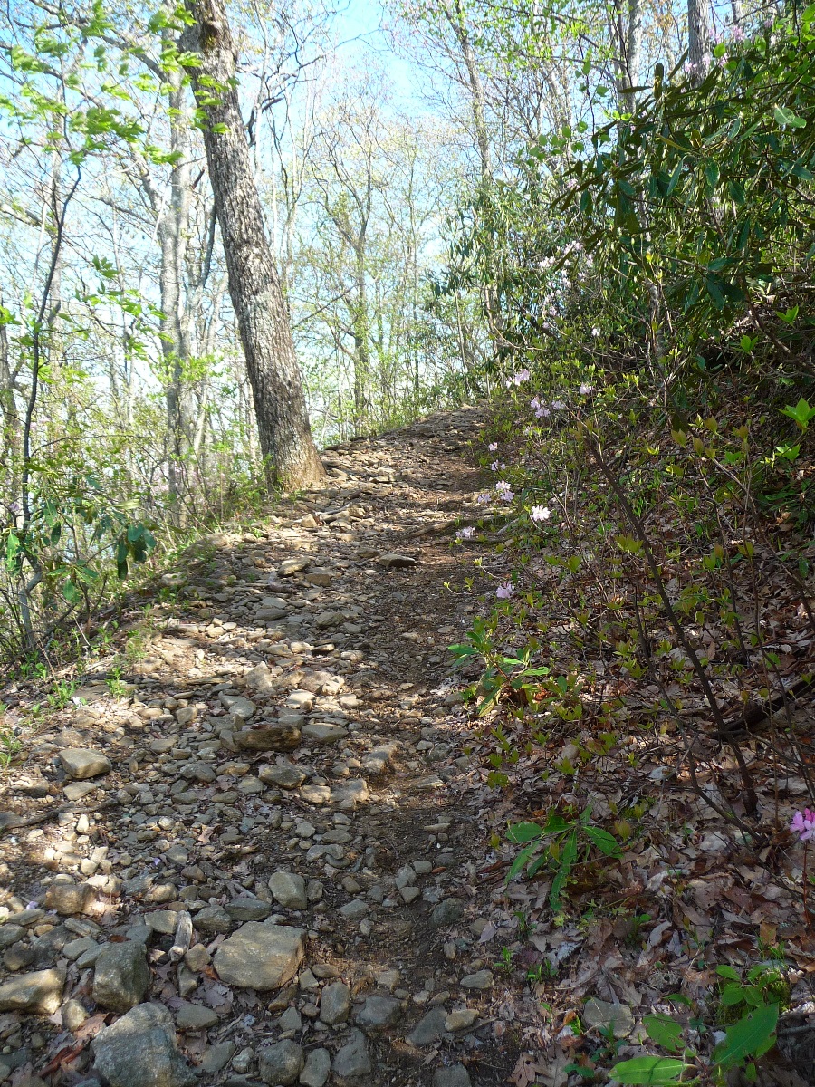
Farlow Gap Trail (above and below)
But, you are greeted to the wide, flat, open Farlow Gap once you reach the top, with lots of places to take a break, and rest up for the next portion of the hike.
Farlow Gap
Photo by Brad Allen
Next Stop: Pilot Mountain
At Farlow Gap, Farlow Gap Trail ends and joins the Art Loeb Trail.
To the north (right) on Art Loeb, the trail follows the ridge line eventually crossing the Blue Ridge Parkway and heading up to Silvermine Bald.
For this hike, you will turn left and head south along Art Loeb, crossing through the relatively flat gap. A trail will soon split off to the left from Art Loeb. Art Loeb goes right, up and over Sassafras Knob. The left hand trail remains more or less level (although it is awfully rocky), going along the east facing slope of the Knob, more or less along the 4630 foot contour level, and comes out at the top of FS229, one of the gravel roads mentioned above that converge at Gloucester Gap.
Art Loeb Trail goes up and over Sassafras Knob. On the way up the Knob, be sure and periodically look behind you at the great views off to the north and northeast.
As you near Deep Gap, which lies between Sassafras Knob and Pilot Mountain, you'll pass a trail shelter.
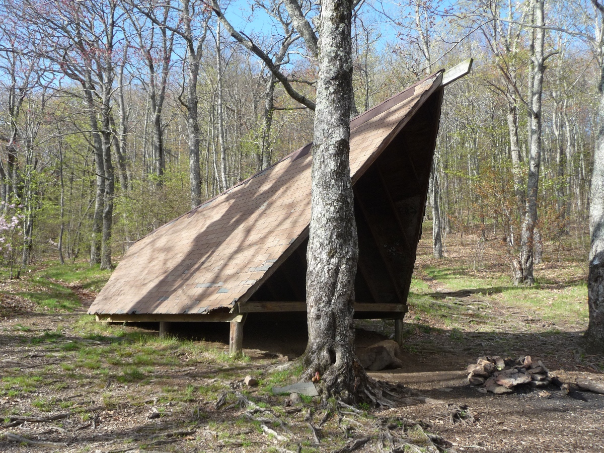
Deep Gap Shelter
Once past the shelter, watch the trail markings closely (Art Loeb is blazed white) to catch the trail up to Pilot Mountain. The foot trail that extends from the end of FS229 comes in here, and if you're not careful, it easy to end up on that trail, instead of staying on Art Loeb.
You'll know you're on the right trail once you start yet another climb. The climb to the top of Pilot Mountain has a number of switchbacks, and climbs 500 feet in about a half a mile.
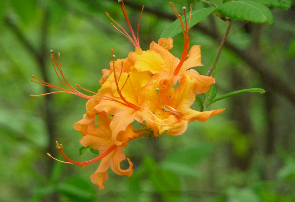
This trail is well known for its showy display of a multitude of pink azaleas in the spring:
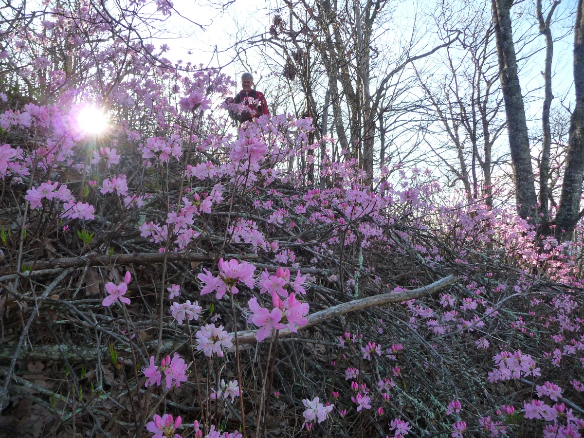
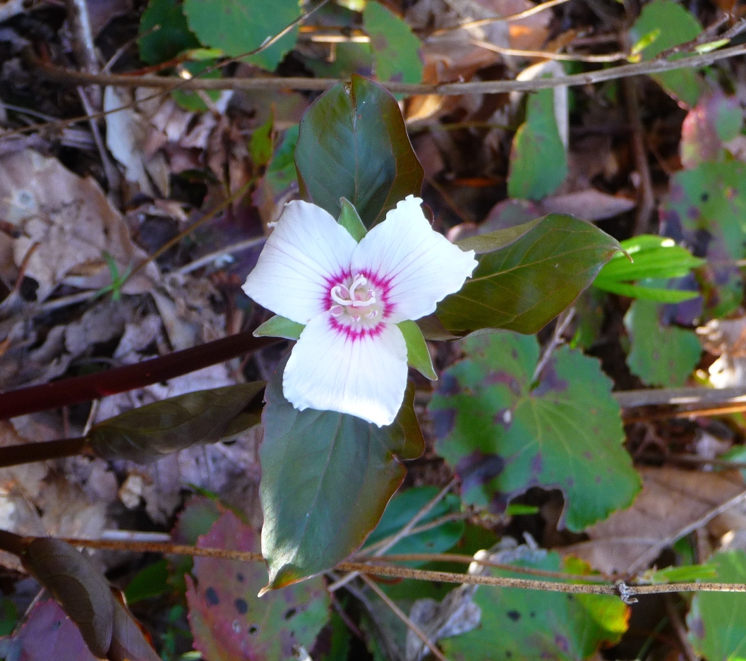
On my most recent trip along this trail, I also saw a Painted Trillium, as well as flame azaleas.
Many of the mountain tops in this area of North Carolina do not have clear views from their peaks due to tree cover; Pilot Mountain is a wonderful exception. The site used to have a fire tower; that is long gone, but there is still an unobstructed, almost 360 degree view all around.
Views from Pilot Mountain (above and below)
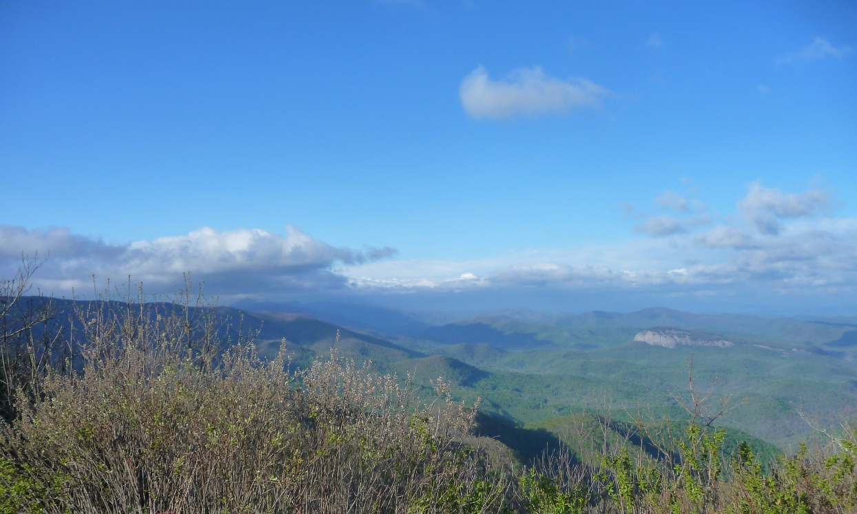
In the picture directly above, you can see that you have a fantastic view of Looking Glass Rock, 4.7 miles to the northeast, and almost 1000 feet lower than your vantage point! (Best seen in full size.)
Continuing on from Pilot Mountain's peak, Art Loeb Trail heads down to Gloucester Gap along a fairly steep grade that drops over 1750 feet in elevation over 1.75 miles. Art Loeb crosses FS229 twice in rather quick succession along its downward trek.
More pictures in my flickr set from this hike.