
Daniel Boone Boy Scout Camp
to
Fork Mountain Trail
to
Ivestor Gap Trail
Click on any of the images on this page for full size/full resolution pic.
One neat thing about the internet is that it allows you to connect with folks you probably never would have met otherwise.
Such was the case when a local reader who, after reading through some of my hiking reports, sent me an email. We got together for a hike, and she showed me a neat way to get up to Birdstand Mountain, the highest point on Fork Mountain Trail. The “official” trail to Birdstand mountain begins on highway 215, and has one climbing straight up almost 2000 feet in elevation in close to 2 miles.
Additionally, this trail does not lend itself to any sort of loop trail.
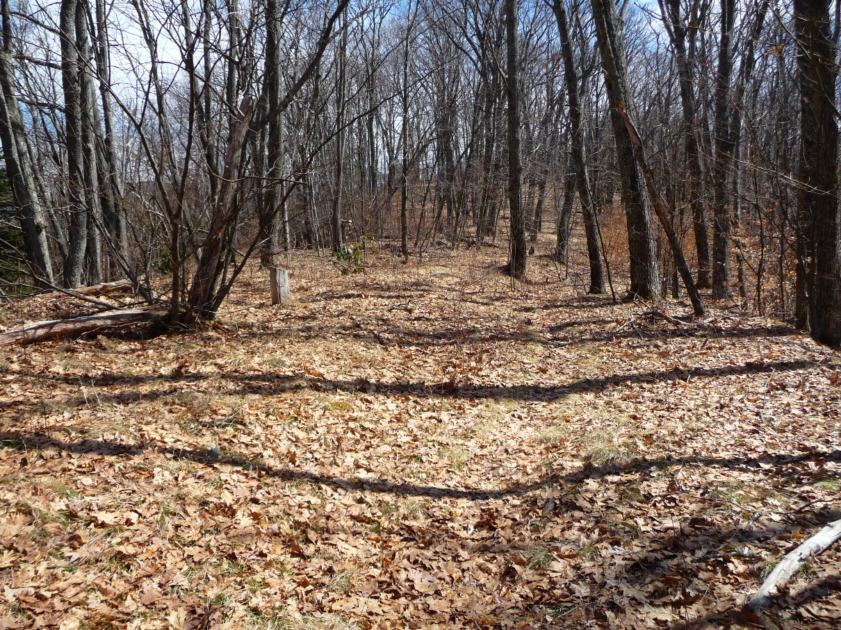
The route we took up to Fork Mountain starts at the Daniel Boone Boy Scout Camp that is located east of Lake Logan, off highway 215, and brings you up to Fork Mountain Trail from the east, winding up old logging roads through Cathy’s Cove and Cathy’s Ridge.
One still climbs over 2000 feet, but this route takes 4 miles or so to reach the summit, making the climb downright pleasant.
Additionally, one is hiking through fairly open forest, giving a lot of visual interest along the way. As you climb higher, you get some great views of Cold Mountain, Deep Gap, and Shining Rock Ledge.
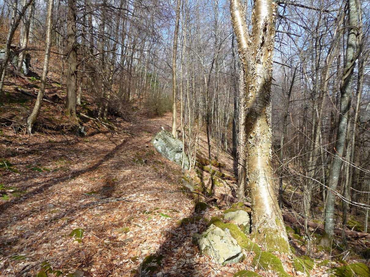
Above: Old Logging Road heading up Cathy's Ridge
Below: View of Cold Mountain and Deep Gap

This route to Fork Mountain also opens up several nice options for loop hikes involving Little East Fork Trail, Ivestor Gap Trail, and Art Loeb.
The old logging trail we followed (and there are several others that crisscross through this area) comes out onto Fork Mountain Trail just southeast of this trail’s highest point at Birdstand Mountain.
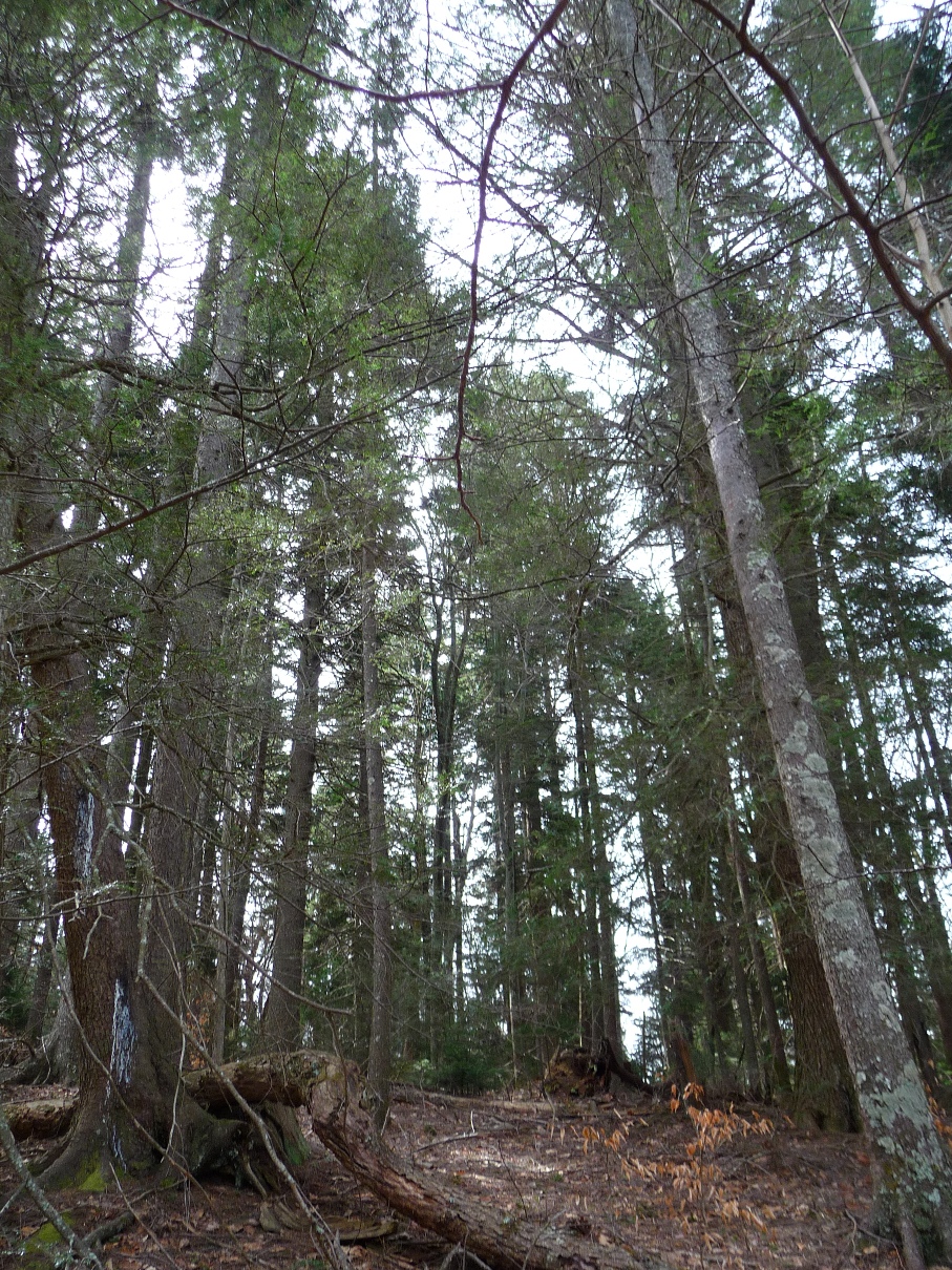
Hiking along Fork Mountain Trail is a sharp contrast from the old logging road. The trail is very narrow, and because it follows the ridge, it goes rather steeply up and down.
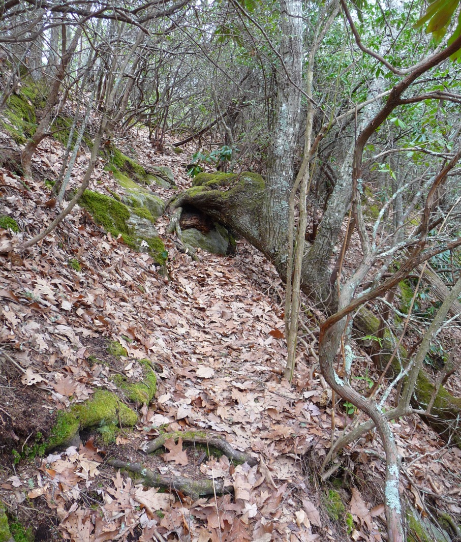
Above and Below: Views of Fork Mountain Trail
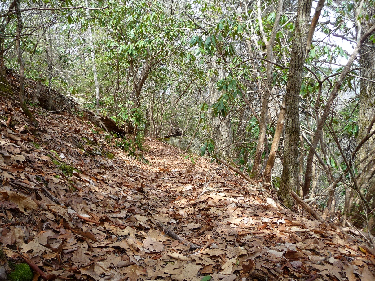
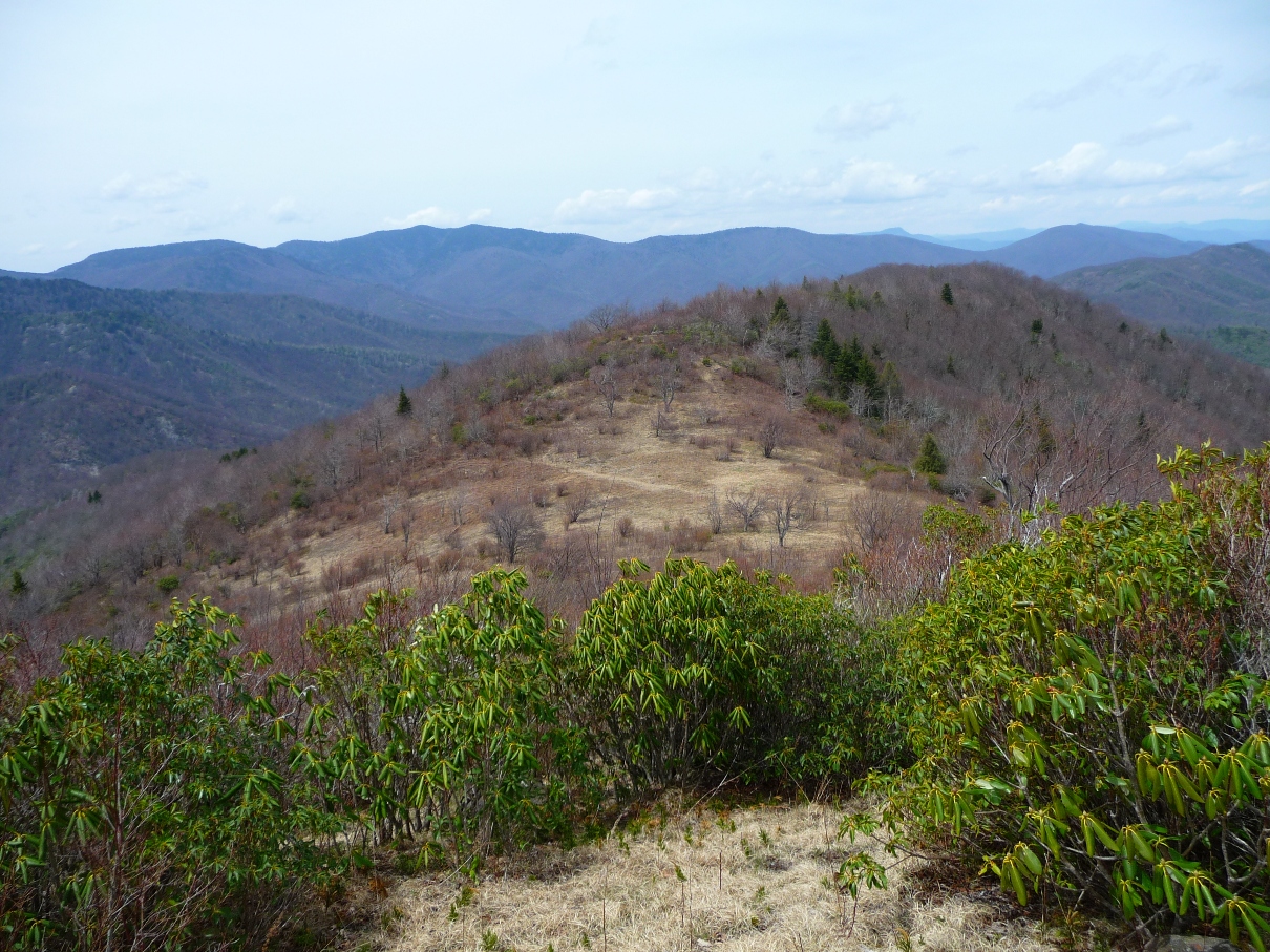
Close to a mile and a half from where one joins Fork Mountain Trail, you come to the top of Firescald Ridge, and the terrain opens up significantly. Look closely, and you’ll see old signs of logging from decades ago … a lot of old, steel cables lie curled around on the ground.
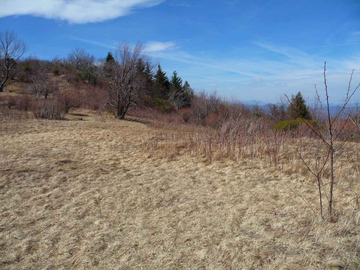
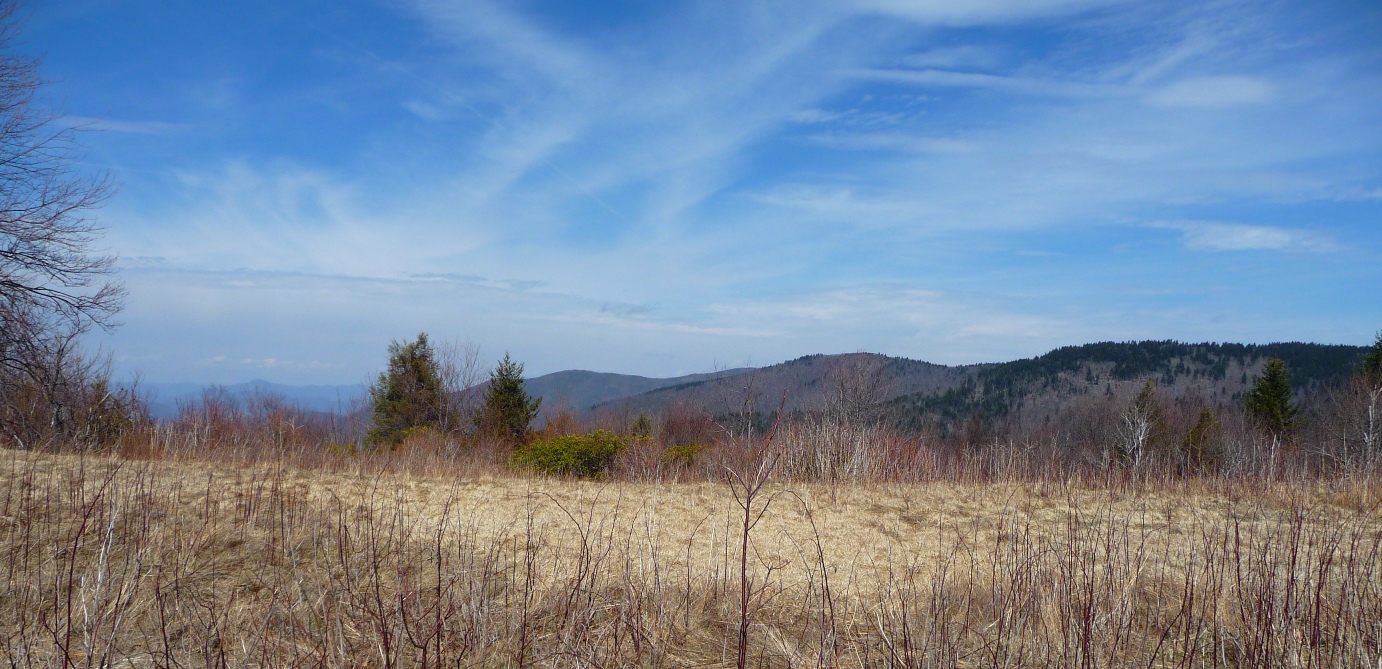
Just beyond the top of Firescald is a beautiful open meadow, that gives great views in all four directions.
Above: Top of Firescald Ridge
Below: Views from the meadow

On this day, instead of continuing on to Ivestor Gap Trail, we retraced our steps back down Fork Mountain Trail and again picked up the old logging road, and continued following it as it wound in and out of 3 different coves on the north facing slope of Fork Mountain, until it came out on Little East Fork Trail, just downstream from where that trail crosses the Little East Fork river.
We then turned north, and followed that trail 2.9 miles back to the Boy Scout Camp.
LOOP TRAIL OPTION
Several weeks later, I made a loop hike starting at Daniel Boone Boy Scout Camp, going up Little East Fork Trail all the way to Ivestor Gap Trail, then taking that trail south and picking up the southern terminus of Fork Mountain Trail, taking that to the cut off to the old logging road and back to the Boy Scout Camp that way.
This loop was 13.6 miles and with one exception (described below), the trails were all very easy to locate and follow.
In 2010, much of the upper half of Little East Fork Trail was totally blocked by downed trees from a winter's storm, but all of that has been cleared now.
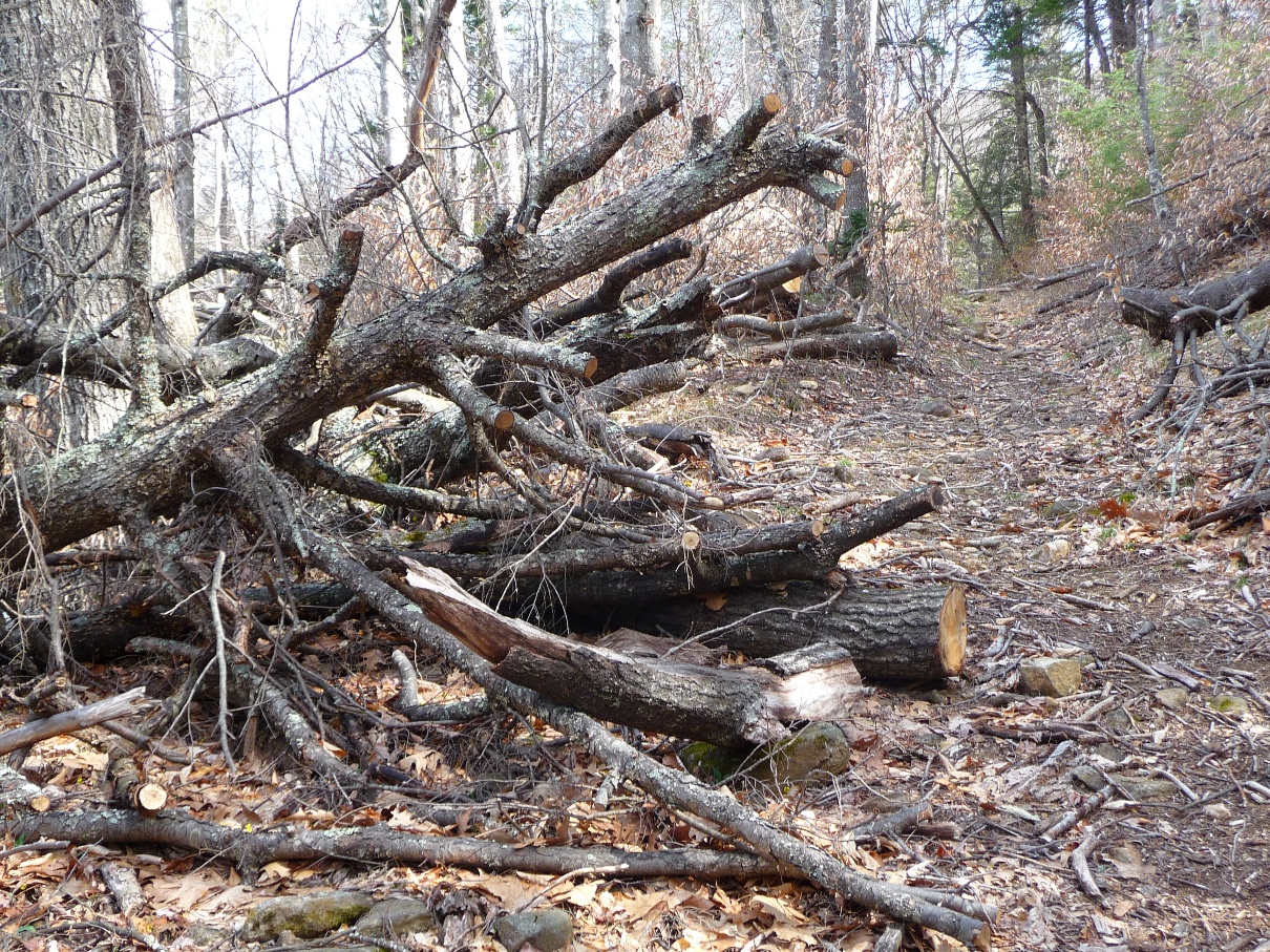
Remains of one of many downed trees
One member of my hiking group mentioned that the far upper section of Little East Fork Trail had also been blocked by very thick, thorny brambles. I did this hike in spring (April, 2011), and while there was one short section of scraggly briars, it was nothing that would impede a hiker. Whether these briars will get thick again by summertime, I'm not sure.
I very much enjoyed the climb from the crossing of Little East Fork River up to Ivestor Gap Trail. As you climb in elevation, the foliage changes from hardwoods, to rhodos and mountain laurel to conifers. In fact, I saw some of the healthiest hemlock trees around in this section.

Above: Mid section of Lower East Fork Trail
Below: Conifers in upper section of Lower East Fork Trail
The one difficult-to-find trail in this loop was the juncture of Ivestor Gap and Fork Mountain Trails. I'd been by this area several times on other hikes and never did see the Fork Mountain trail, but never really thought too much about it, since I wasn’t going that way.
Well, on this day's hike I WAS going that way, and if I didn't find it, I was looking at backtracking 8 miles back the way I'd come!
Studying the topo map, I saw that the trail according to the map (Trails Illustrated #780) placed the trail just on the northeast face of a "finger" that extends northwest from Ivestor Gap Trail down to the meadow I'd been to on the first hike. I "drew" this trail into my GPS (via GPSVisualizer's "draw" mode).
Studying the map, another (seemingly easier) way was to stay on Ivestor Gap a little further to where the "finger's" ridgeline joins that trail. The topo map showed almost no elevation change going this way, until one descended to the meadow, so I also marked that route into my GPS.
Once I hit the spot where the "official" trail (per the map) came to Ivestor Gap Trail, I did notice a small path heading into the shrubbery, but it seemed to drop right off the side of the mountain (the topo does show a quick drop of almost 200 feet elevation).
So, I stayed on Ivestor Gap, and picked up the ridgeline of the "finger" and followed it down to the meadow.
There actually is a fairly well worn trail that way, but it is very, very hard to see due to the very thick shrubbery that totally engulfs you. It was so thick that I was unable to walk with my hiking pole at my side, instead having to drag it behind me. The trail, while clear, could only be seen ahead for about 2-3 feet at a time, since the shrubbery occluded any signs of it up ahead.
Without a GPS, if you're comfortable identifying terrain about you and comparing it to a topo, you’ll be able to follow this route ... the finger's ridgeline is noticeable enough that you can see the terrain going downhill on either side of you.
It is just over a mile from when you leave Ivestor Gap Trail until you emerge from the thick foliage and can see the meadow below you. From here, it is very easy to identify Fork Mountain Trail, and you can follow it to the cut off just before Birdstand and pick up the logging road to take back to the Boy Scout Camp.
Above: View of meadow and Fork Mtn. Trail as you emerge from the thick foliage
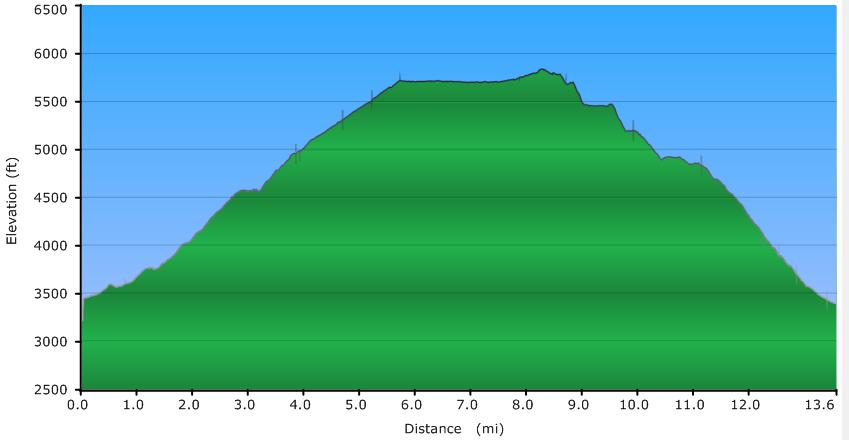
Below: Elevation Profile of loop (including going up to Ivestor Gap Trail)
Click here for a larger map
GPX data for download:
Daniel Boone Boy Scout Camp to Fork Mountain to Little East Fork.
DIRECTIONS
The northern terminus of the Little East Fork Trail begins right at the Daniel Boone Boy Scout Camp, located southeast of Waynesville, NC. Take highway 215 south (if coming from Waynesville) and turn left onto Little East Fork Road (SR 1129) There is a small sign at this intersection for the camp, and the turn comes immediately after the second of two concrete bridges on the highway that are less than 1/2 mile apart.
Follow Little East Fork road until you come into the camp (approximately 3 1/2 miles from highway 215 ... I didn't measure this ... just a rough estimate). The road becomes a well maintained dirt road. Continue driving through the camp until you come to the place where pavement begins going straight ahead and where the camp's road turns right (often gated), crossing the river on a bridge.
Straight ahead is private property, and is labeled as such. Just before the gated road to the right, there are spots for parking for hikers (signed with the slightly confusing "Forest Service Parking Only"). Park here, and begin your hike by crossing the creek on the bridge. The road continues through more of the camp, and then enters the Shining Rock Wilderness of Pisgah National Forest.
Since this entire hike is within the wilderness area, no trails are blazed or signed. The old logging roads are more or less easy to locate and follow. At times they narrow down quite a bit to almost single track width, and in some places have a lot of overgrowth and fallen limbs, but nothing significant. Fork Mountain Trail (with the exception noted above) is well worn and easy to follow, as is Little East Fork trail.