
Hospital Rock to Falls Creek Falls
Jones Gap State Park, SC
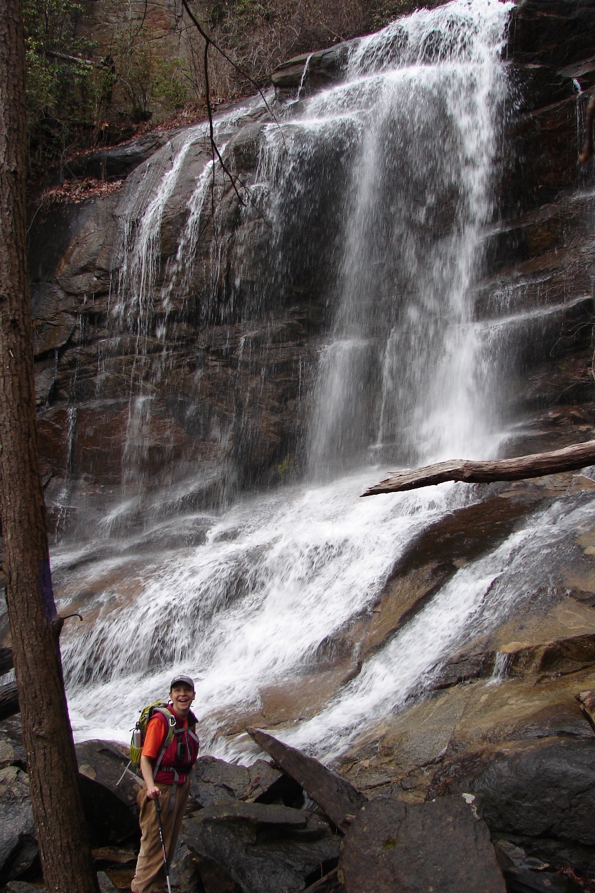
Photo Credit: Darrin Hamlin
Click on any of the images on this page for full size/full resolution pic.
This is a very strenuous, all day hike that gives the hiker tons of rewards for all the effort this trek requires. 2 major waterfalls, one of which you get to cross right at its base. A 70-100 foot cascade on a nearby creek. A house-sized boulder with a large open cave underneath. Views of the Cleveland Cliffs, a section of sheer, vertical rock outcroppings just south of the NC/SC state line.
But you don't get all this beauty for free!! This is an 8 mile shuttle hike, with 1600-1800 foot elevation change. Whichever direction you do this hike, you'll have steep uphills going, and steep downhills on the other end. I've done this hike in both directions, and it is perhaps a little easier going east to west (Duckworth Trailhead to the State Park), if only because in that direction you get the most of the steepest climbing out of the way right at first. Going west to east, has your steepest climbing nearing the top of the climb after you already have done a couple miles of uphill hiking.
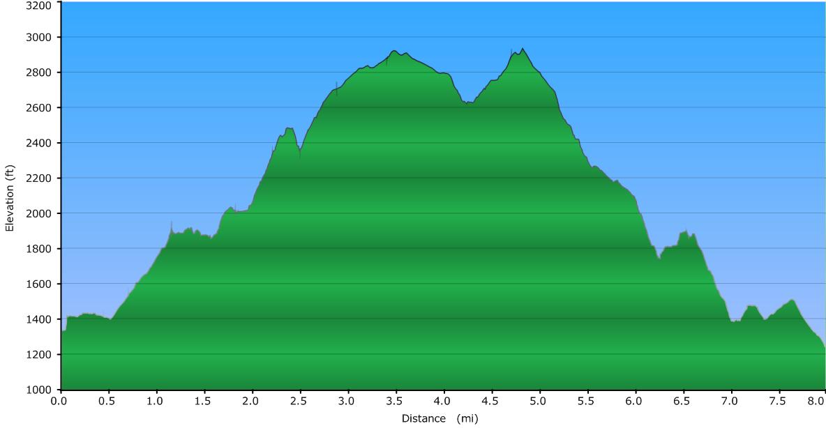
Elevation Profile
Click for larger image
Click here for a larger map
GPX data for download (zip file which includes both GPX format, as well as GDB format for Garmin users):
Hospital Rock to Falls Creek Falls Trail.
DIRECTIONS
Jones Gap State Park is located in northern Greenville County, SC at the end of Jones Gap Road (also labeled as River Falls Road or County Road 97 on various maps). Turn on to the road from US276/Hwy 11 (Geer Highway). The turn is 5.6 miles north of Marietta, SC. An "F Mart" convenience store is located on this corner. Once you turn onto this road, it is 5.75 miles to the State Park.
As mentioned, this is a shuttle hike. The shuttle portion of this hike is short ... 2.7 miles. But unless you are an exceptionally strong hiker, I would not recommend trying to make this a loop hike. The 2.7 miles of road walking is flat, but after 8 miles and 1800 feet of elevation climbing and descending, I was very glad to have a second car waiting to shuttle me back to the beginning!
The two trailheads are both within Jones Gap State Park. The western end is in the parking lot of the Park itself, where Jones Gap Road ends.
The eastern trailhead is at the end of Duckworth Road, which turns east off Jones Gap Road, 1.75 miles from the park's parking area. Turn on to Duckworth, following signs to Palmetto Bible Camp. Soon after passing this camp on the right, you will come to a small trailhead on the left, with room for 2 or 3 cars. There is a small sign board here, with Falls Creek Falls Trail beginning steeply uphill right in front of you, up several steps.
This trailhead is immediately adjancent to a home, and other private property, so please respect these homeowners' property.
This trail report is written doing the hike in a west to east direction ... from the State Park's main parking area to the small trailhead on Duckworth Road.
*******************************
Beginning the hike in the parking area for the State Park starts your hike going over a bridge over the Middle Saluda River, then along a paved footpath that leads to a small pond, restrooms, and the Park's office. To follow this trail, once you pass the pond, follow the paved path towards the restrooms and then to the right, away from the main part of the park. The trail is well marked, blazed with orange blazes. The trail begins its uphill climb soon enough. Get used to it ... you'll be going uphill for a while!!
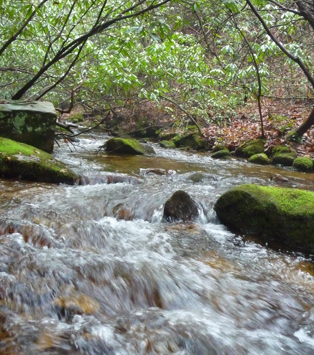
Just over a mile from the parking lot, you will come to a crossing of Rocky Branch Creek.
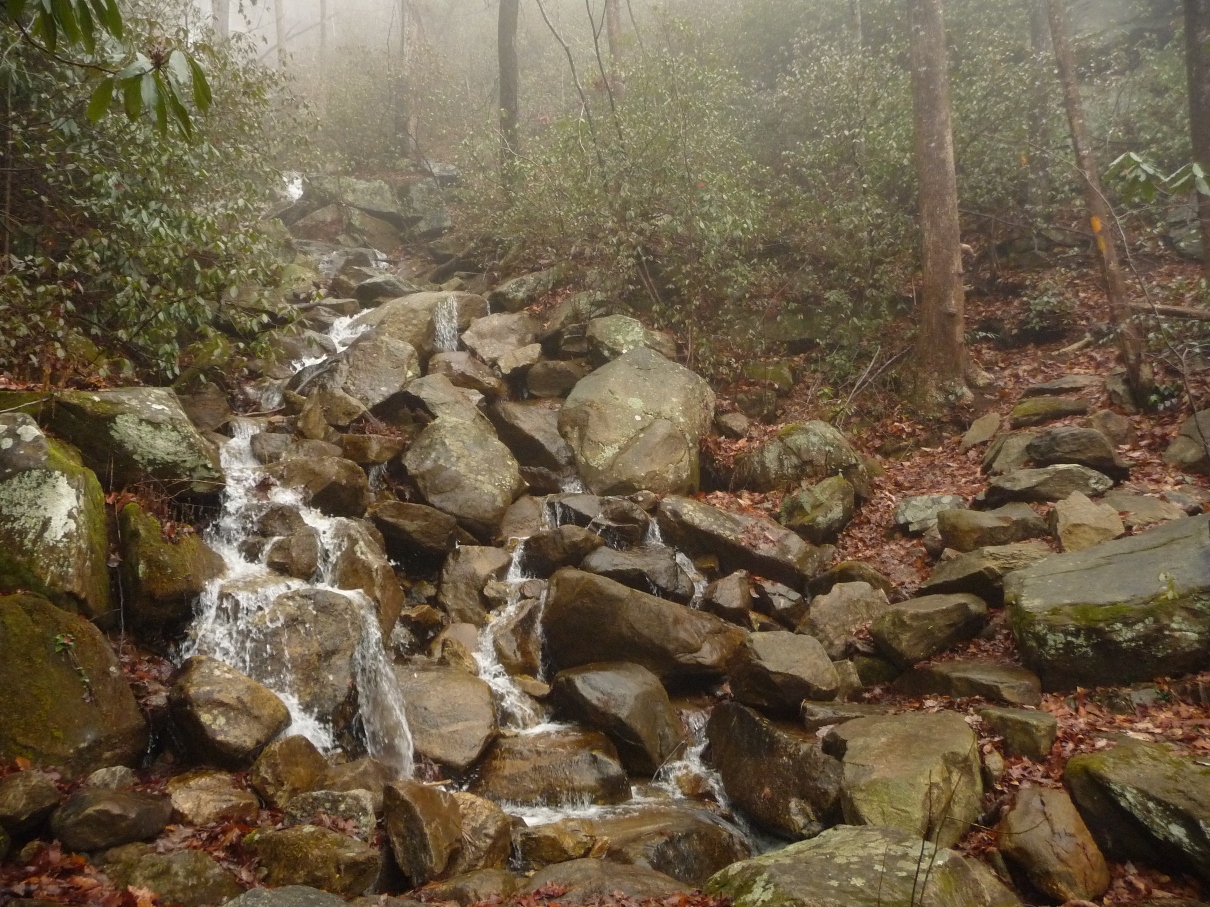
Rocky Branch Creek, on a very foggy morning
Once you rock hop across Rocky Branch Creek, Hospital Rock Trail continues straight ahead, but look for a trail to the left that follows the creek upstream. 200 feet up this narrow trail will bring you to the first of the waterfalls you get treated to on this hike: Buckeye Falls.
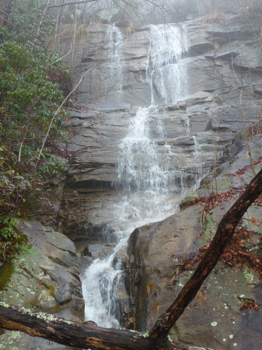
Buckeye Falls
Leaving this waterfall, you continue your uphill climb. The photo below shows the terrain that is typical of this area. Of note, this portion of the trail has been re-routed in recent years, which required much manual labor getting the stone steps you see below into place.
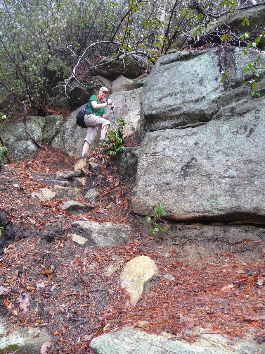
Darrin, along Hospital Rock Trail
2/3 of a mile from Buckeye Falls, you come to this trail's namesake: Hospital Rock --- a massive boulder that lies over a large, open cave. Part of this area's history includes stories that Civil War deserters hid out here. I can only imagine how tough it was to get here in those days, and how weary the soldiers must have been from horrors of that war.
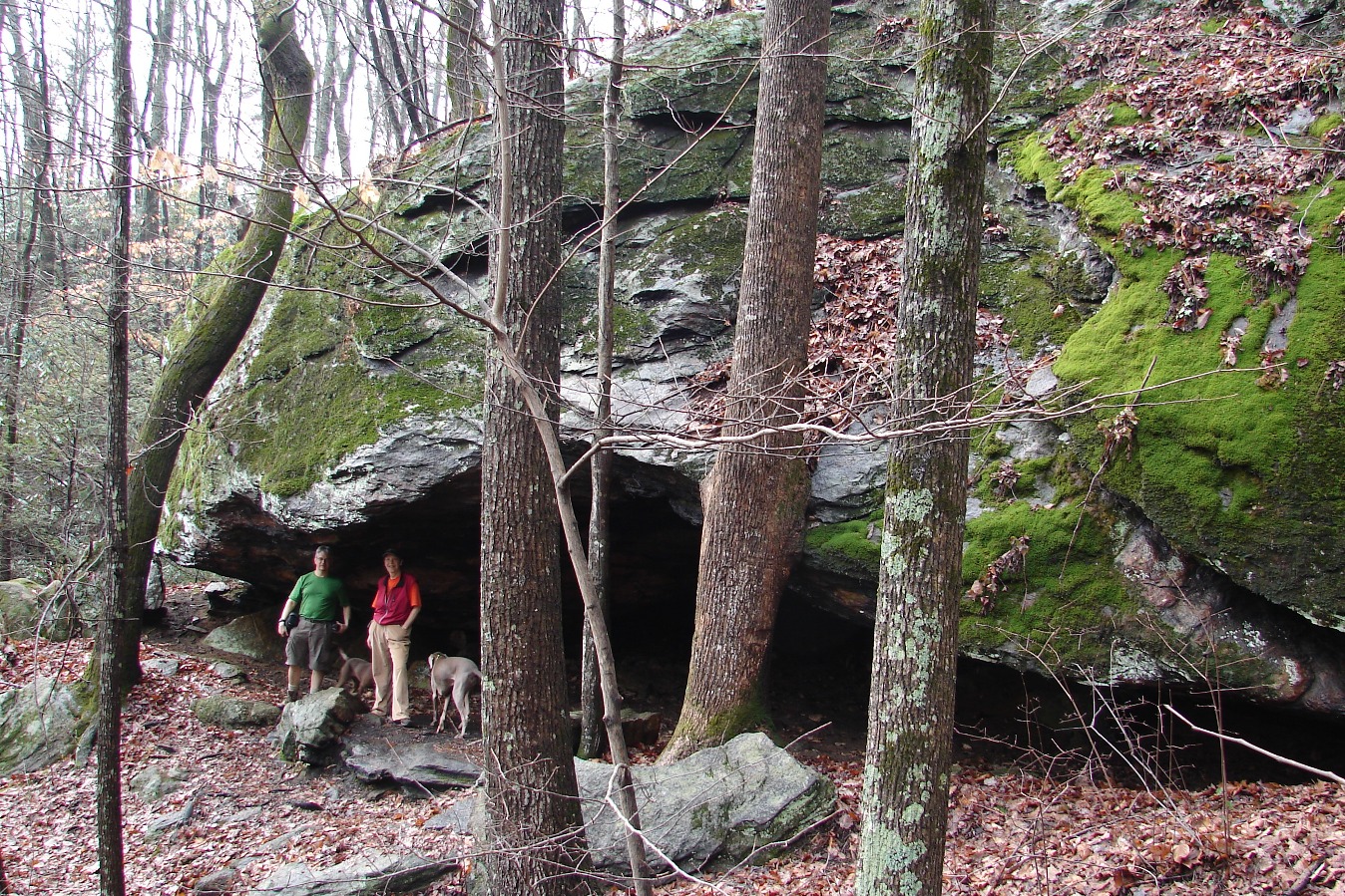
Photo Credit: Darrin Hamlin
Hospital Rock
From here, you will climb over 800 feet in elevation over the course of the next mile. As you get higher in elevation, you get some nice views of the "Cleveland Cliffs" to the east (right), as well as the hills and valleys that are now well below you.
Once you reach the top of the ridge, the land levels out into a nice open forest, and you get to enjoy your first section of level trail. The Cleveland Connector Trail comes in from your left in this area. This is a short trail (0.5 mile) that takes you to the 4-wheeled drive road that is just north of you at this point. Symmes Chapel ("Pretty Place") is 1.5 miles down this road, to the west.
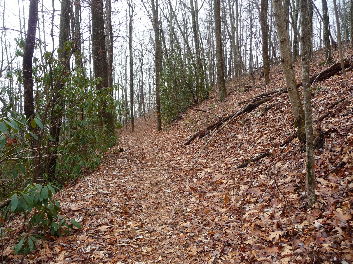
Portion of Hospital Rock Trail
as you near the
Cleveland Connector Trail
From here, the trail (still remaining more or less level) joins the headwaters of Headforemost Creek, providing yet another type of terrain. The trail narrows, and winds along the creek, bordered by thick rhododendron forest.
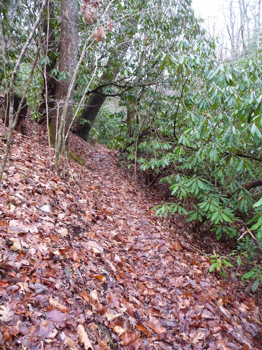
Hospital Rock Trail along Headforemost Creek
The trail eventually leaves the creek and climbs a small knoll. This section has a number of old, overgrown roads criss-crossing through here. At one of these intersections, the trail makes a sharp right turn, and signs are provided to make sure the hiker does not miss this turn. Particularly if you are doing this hike from east to west, it would be quite easy to miss this turn were it not for this sign.
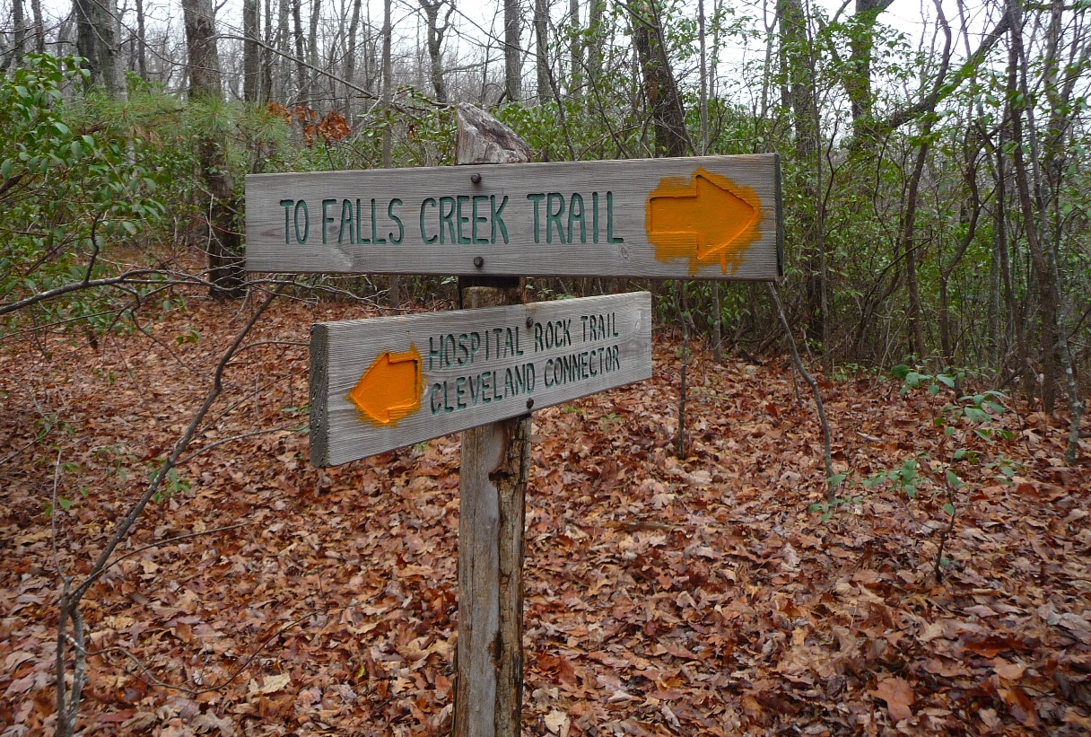
Sign along the upper end of Hospital Rock Trail
From here, you begin a descent of 600 feet in elevation over the course of 0.8 mile to reach the upper end of Falls Creek. The forest is quite open thru here, and the trail makes many switchbacks. Keep an eye on the blazing (orange) to make sure you stay on the trail and don't inadvertenly leave it. There's a couple spots where we did just that.
Reaching Falls Creek is a visual treat, as well as a break for you legs as the grade becomes much more gentle downhill. The trail stays right along the creek for about 0.4 mile.
Falls Creek, upriver from the waterfall
The trail then leaves the creek in order to start its steep (200 feet elevation drop in 0.2 mile) descent to the falls. The descent begins just after a rock outcropping that gives you a view of the surrounding area. It is from here that you see just how close this portion of Jones Gap State Park is to privately owned property. Below you to the south are a number of houses, fields, and lakes. Views to the east avoid the view of houses and the occasional McMansion and treat you to more State Park land.
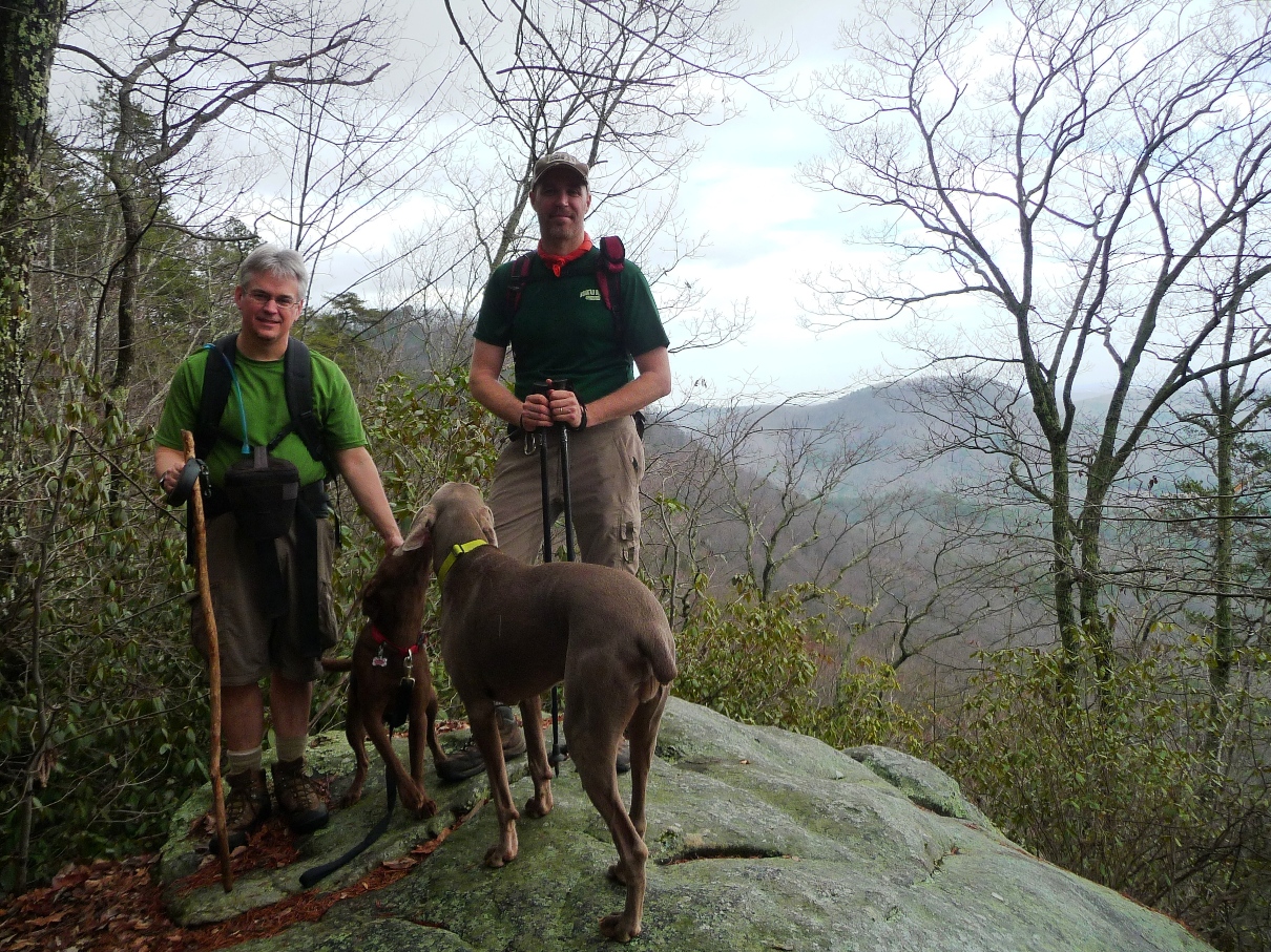
Andy and Darrin with
Boone and Kona, our canine companions
on the rocky outcropping above Falls Creek Waterfall
Leaving this rocky outcropping takes you steeply down to the Falls Creek Waterfall. Your first glimpse from behind a rock that is jutting out gives you a glimpse of the massive waterfall you are about to enjoy:

From here, enjoy the views from the left, mid creek, right, and upper section from the right:
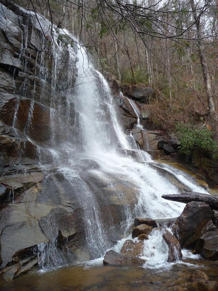
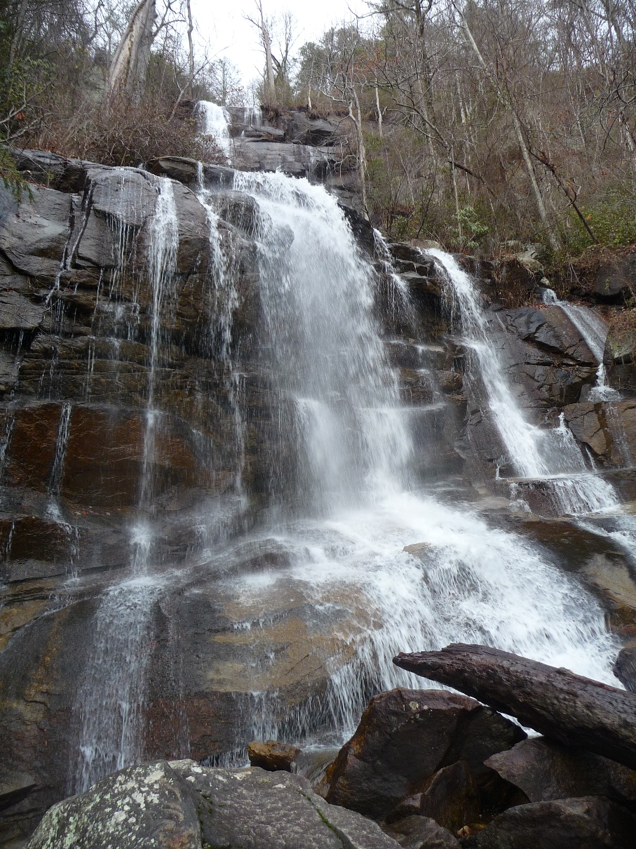
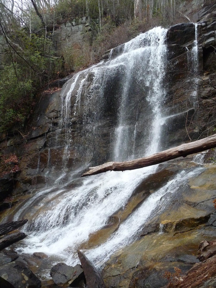
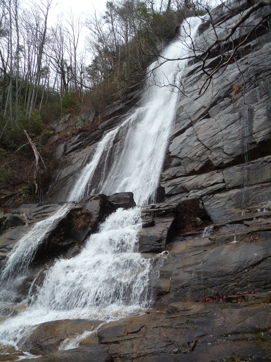
Once you cross the creek at the base of the waterfall (where the second picture, above, was taken), the trail officially changes from Hospital Rock Trail to Falls Creek Falls Trail. The blazing turns from orange to purple. From here it is a little over a mile to the Duckworth road trailhead. Park maps label the distance as 1.7 miles; my GPS recorded 1.2 miles. The trail along here is heavily used, and while you may not run into many other hikers on the Hospital Rock portion, you are sure to run into a good many hikers on this section, particularly on a weekend.
The day I and my companions did this hike, the area had received 2 days of pretty steady rain, and as the trail neared the point where Falls Creek joins Little Falls Creek, we noticed a wide cascade not far off the trail. A short (0.1 mile) distance north from the trail through open forest brought us to the base of a long, angled cascade that had a large water volume raging down.

More pictures in my flickr set from this hike. This set includes pictures from both my hikes along this trail: one day was very sunny, the other very foggy!!
Many thanks to Darrin Hamlin, both for two of the best photos on this page, as well as for his many hours of volunteer work with this area's park system.
He helped with the trail building when Hospital Rock was re-routed, as well as (over the course of a year) re-painting all the blazes along the 50+ miles of trails that are part of the 40,000-acre wilderness known as the Mountain Bridge. This area lies along the Blue Ridge Escarpment in the northwestern corner of South Carolina. Jones Gap State Park is a part of this area, as is Caesars Head State Park.