
Bracken Mountain Preserve
in Brevard, NC
Click on any of the images on this page for full size/full resolution pic.
Bracken Mountain, an undeveloped area northwest of Brevard, NC has recently been opened to the public via a network of hiking/mountain biking trails. The area officially opened July 27, 2012.
There are 2 main trails on the 395 acre parcel: Bracken Mountain Trail and Brushy Creek Trail. A third trail, Mackey Ridge Trail, is really just a very short connector trail (not even a tenth of a mile in length).
This recreation area and its associated trails connects northern Brevard with Pisgah National Forest near the Art Loeb Trail, connecting to FS475C, which leads to the Fish Hatchery and Wildlife Education Center off Davidson River Road. (Brevard's other bike/hike connector to Pisgah National Forest is at the east end of town where the Eastoe Trail connects the town's bike path along Ecusta Road with the trail along Davidson River. This trail continues north, connecting with Art Loeb's southern terminus and the Davidson River Campground.)
The on-line newspaper BlueRidgeNow has a very informative article on this new recreation area, discussing the area's previous history as Brevard's protected watershed area, and the process of obtaining access to the area (the area is landlocked). Many thanks to landowner Josephine Ranzulli, who granted the city a 50-foot right-of-way across her land to permit access to this area. And kudos to the city of Brevard for putting such a high priority on preserving a large undeveloped area that is adjacent to the community!!
In late November, 2012, I hiked from Bracken's trailhead to the Fish Hatchery, cutting up to the Art Loeb Trail from FS475C. One is only on the forest service road for 0.7 mile that way. A look at the National Geographic Map 780 (Pisgah Ranger District Map), shows FS475C coming within 0.2 mile of Cat Gap, where Art Loeb and Cat Gap Trails intersect. Please see my webpage on that hike for further details.
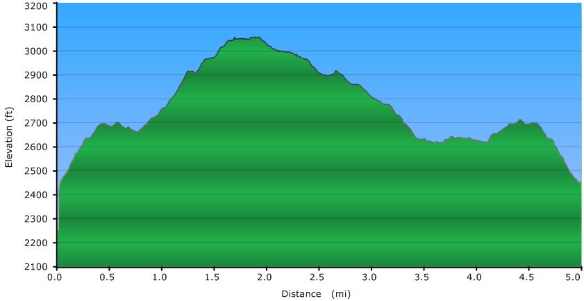
However, my first hike in this area was a loop hike that took Bracken Mountain Trail up to the Mackey Ridge Trail, and returning on Brushy Creek Trail. Total distance for this loop is 5.0 miles, and it is this hike that is profiled on this webpage.
Elevation Profile
Click for larger image
Click here for a larger map
GPX data for download (zip file which includes both GPX format, as well as GDB format for Garmin users):
Bracken Mountain Trail to Brushy Creek Trail.
DIRECTIONS
The trailhead for this hike is adjacent to the Brevard Music Center.
- From downtown Brevard, head west on Main Street, past the post office.
- Turn Right on Oaklawn Avenue and travel approximately 400 feet.
- Turn Left on Probart Street and travel 7/10 of a mile.
- Take a right on Music Camp Road.
- After 3/10 of a mile Music Camp Road turns into Pinnacle Road.
- At this point the Brevard Music Center entrance is on your right and Waterford Place is on your left.
- Continue straight onto Pinnacle Road, which is the gravel road.
- Continue 2/10 of a mile up Pinnacle which ends at the Bracken Preserve parking lot.
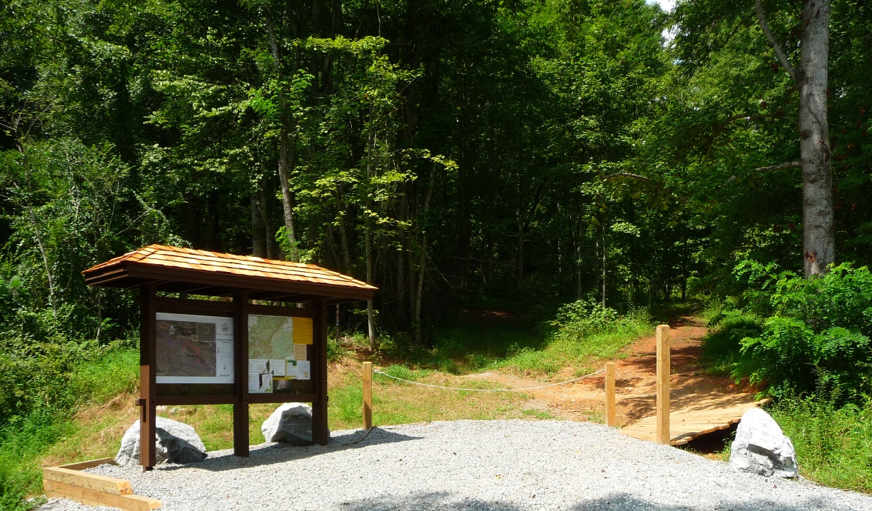
Trailhead for Bracken Mountain Preserve
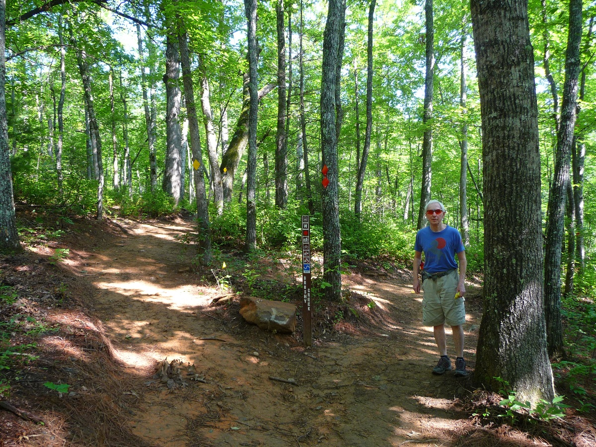
The first 0.6 mile from the trailhead goes along the right of way granted by the landowner for access to Bracken Mountain. Entry into the Preserve itself is marked with a sign referencing the "Clean Water Management Trust Fund".
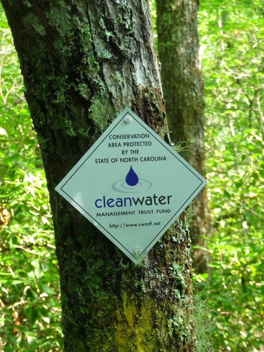
According to the BlueRidgeNow article referenced above, much of the development of this area was funded by the city selling its development rights of the property to the Clean Water Management Trust Fund.
According to the Clean Water Management Trust Fund's webpage, CWMTF was established by the North Carolina General Assembly in 1996, and funds projects that
- Enhance or restore degraded waters,
- Protect unpolluted waters, and/or
- Contribute toward a network of riparian buffers and greenways for environmental, educational, and recreational benefits.
In less than a tenth of a mile after passing the CWMTF sign, you come to the southern terminus of Brushy Creek Trail, which bears off to the right. This trail traverses the southwestern side of Southern Mountain, winding in and out of coves that drain into Brushy Creek. The day we did this loop, we continued straight on Bracken Mountain Trail, and returned on Brushy Creek.
Doing the loop in this direction brings you (in another 0.9 mile) to the southern junction of the very short Mackey Ridge Trail and Bracken Mountain Trail.

Bearing to the right onto Mackey Ridge Trail, brings you to the upper end of Brushy Creek Trail in another 500 feet or so (as mentioned ... a VERY short trail!!)
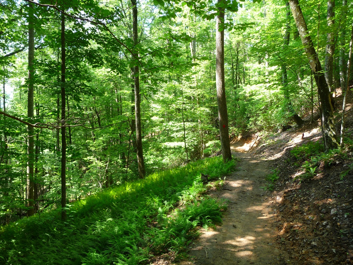
Up until this point, you have been going steadily uphill, right from the very start, gaining about 650 feet in elevation over a little more than 1.5 miles. Turning onto Brushy Creek Trail rewards you for that effort with 2.8 mile downhill that crosses Brushy Creek and its tributaries over a number of bridges. The vegetation is more lush in this section, and the four different crossings of the creeks provides some pleasant waterplay. The photo at the top of the page is taken in this section.
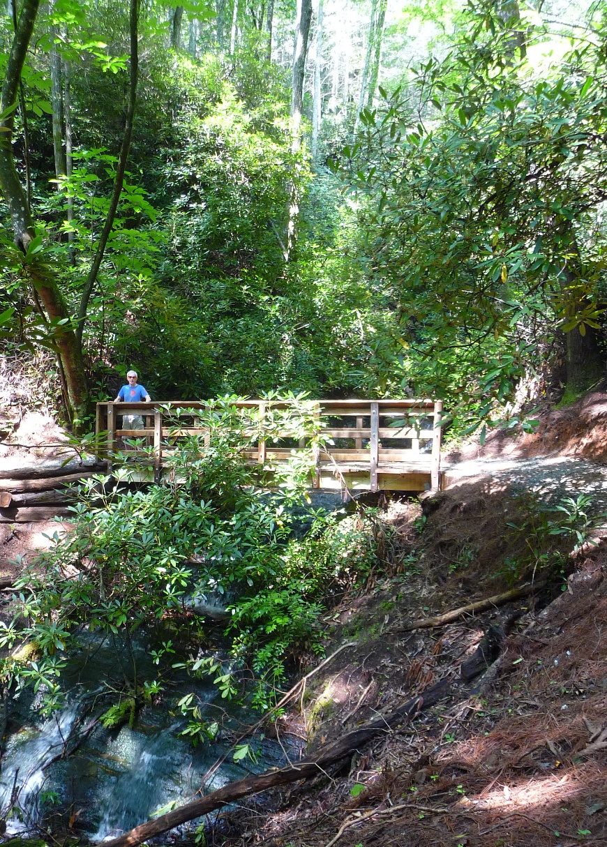
The bridge in the upper photo crosses a portion of the creek that has some nice cascades both upstream as well as downstream

Brushy Creek Trail ends at a "T" at Bracken Mountain Trail. Turning left will bring you back to the parking area in 0.7 mile of more downhill hiking.
Map of the area: The City of Brevard provides a free 17" by 11" color map of the area (shown below). To get one, go to City Hall (95 West Main Street, 828-885-5630). This is one and a half blocks northwest of the County Courthouse, on West Main, one block SE of the Post Office. Go upstairs to the the Planning Office and ask for a map.
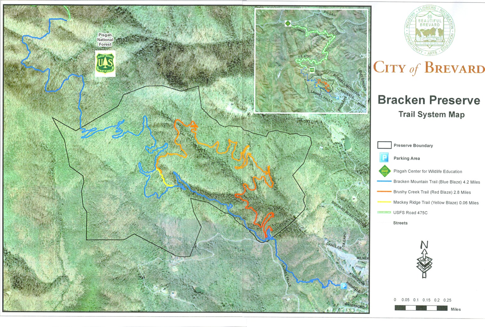
Click on Map for a Larger Image
A few notes on this trail: This trail system is very newly developed, and the trails are very indicative of this --- the ground is soft, with lots of evidence of freshly cut vegetation which created the trails' pathways. In time, the ground will firm up, and new growth will make this less "new" looking. UPDATE AS OF NOVEMBER, 2012: The trails are beginning to look much less new now ... they have a nice layer dirt on them in some places, as well as fallen leaves.
This trail is open to mountain bikers, and although I saw a fair amount of mountain bike tracks in the dirt, the day I did the hike, I ran into only other hikers, no mountain bikers. Hunting is NOT permitted anywhere in the Preserve.
One aspect of the trail system I found unpleasant as a hiker: all of the trails are gently (and in some places, not so gently) sloped towards the downhill direction. In no section of this 5 mile loop was the trail level from a left to right perspective (I don't mean uphill/downhill ... I'm referring to from the right side of the trail to the left side). Now, because of the constantly changing terrain, sometimes the trail sloped to my right, and other times to my left, but still, by about the 3rd or 4th mile, my knees were complaining about the constant slope.
More pictures in my flickr set from this hike.