
Bracken Mountain Preserve
to
John's Rock and Fish Hatchery
in Brevard, NC
Click on any of the images on this page for full size/full resolution pic.
Bracken Mountain Preserve is an almost 400 acre parcel of land that lies between the northern edge of Brevard, NC and Pisgah National Forest. The main trail that traverses this Preserve (Bracken Mountain Trail), enters the National Forest at the ridge line, goes down the north facing side, and connects with the upper end of FS475C. This Forest Service road then heads east, eventually wending its way to the Fish Hatchery.
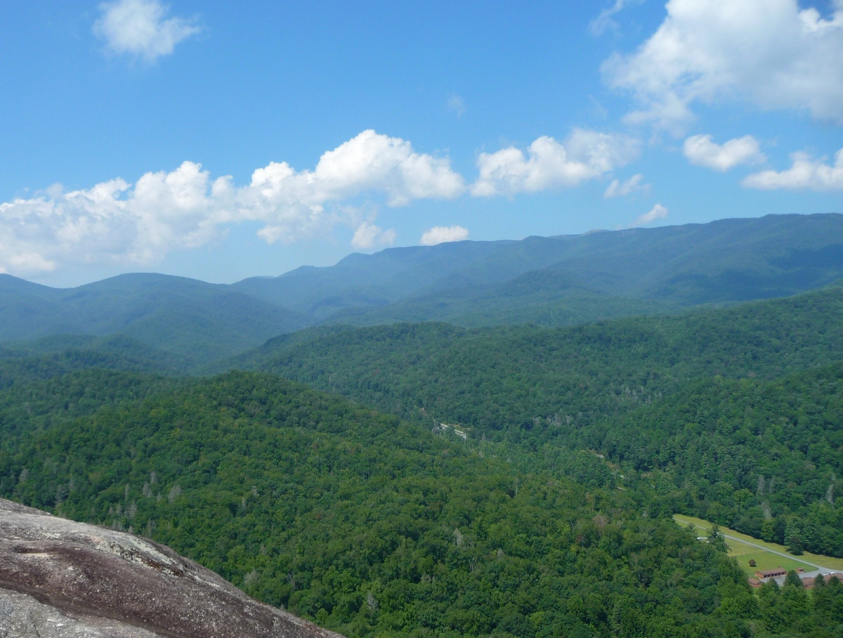
However, less than three quarters of a mile beyond where Bracken Mountain Trail connects to the upper end of FS475C, this forest service road comes within 0.2 mile from the Art Loeb Trail at Cat Gap. A short uphill trail takes the hiker up to Cat Gap, giving several options for how to descend to the Fish Hatchery, one of the most spectacular of which is to head along the spine of John's Rock, coming out on the bare rock face that looks north over Looking Glass Rock and areas north. The picture above is taken from John's Rock.
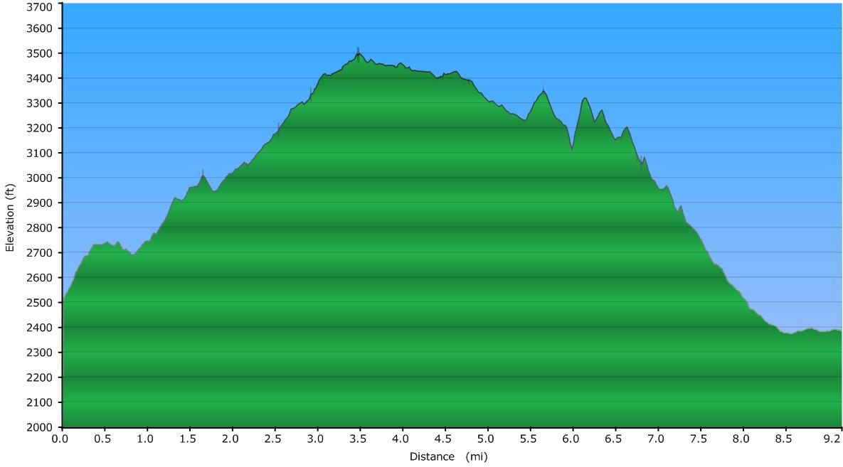
Elevation Profile
Click for larger image
Click here for a larger map
GPX data for download (zip file which includes both GPX format, as well as GDB format for Garmin users):
Bracken Mountain Trail to Cat Gap to John's Rock to Fish Hatchery.
DIRECTIONS
I did this one way, shuttle hike from south to north, beginning at the trailhead for Bracken Mountain Preserve. This trailhead is adjacent to the Brevard Music Center. To get there:
- From downtown Brevard, head west on Main Street, past the post office.
- Turn Right on Oaklawn Avenue and travel approximately 400 feet.
- Turn Left on Probart Street and travel 7/10 of a mile.
- Take a right on Music Camp Road.
- After 3/10 of a mile Music Camp Road turns into Pinnacle Road.
- At this point the Brevard Music Center entrance is on your right and Waterford Place is on your left.
- Continue straight onto Pinnacle Road, which is the gravel road.
- Continue 2/10 of a mile up Pinnacle which ends at the Bracken Preserve parking lot.
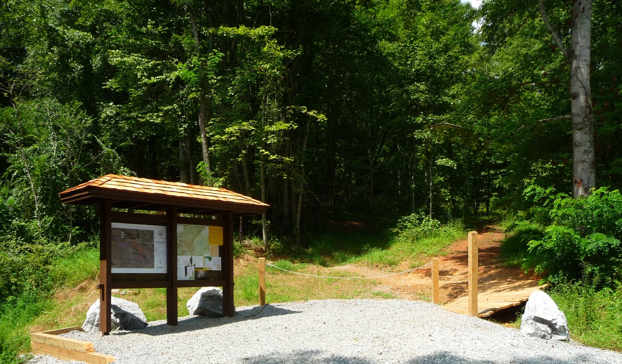
Trailhead for Bracken Mountain Preserve
Bracken Mountain Preserve has 3 trails within its borders, open to hikers and mountain bikers. Please see my webpage on a 5 mile loop which can be done on these trails within the Preserve. That web page also discusses the development of this land for recreational use.
For this hike, to the Fish Hatchery, you will remain on the main trail, Bracken Mountain Trail, the entire way.
Starting out on Bracken Mountain Trail, you will pass a turn off to Brushy Creek trail 0.6 mile from the parking area. Remain on Bracken Mountain Trail. In another mile, you will come to a juncture with Mackey Ridge Trail. Mackey Ridge is a very short (0.1 mile) trail which connects back to Bracken Mountain Trail at its upper end (and also has a turn off to the upper end of Brushy Creek Trail.)
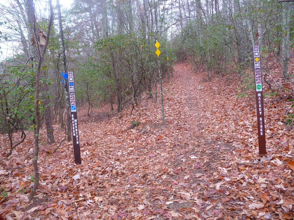
Lower Junction of Bracken Mountain Trail and Mackey Ridge Trail
Bracken Mountain Trail drops approximately 100 feet off the ridge line from this juncture, and follows the contours of the upper edges of Bracken Creek's valley below, joining the upper end of Mackey Ridge a half mile later. Mackey Ridge Trail continues straight along the ridge line, and takes 0.1 mile to cover the same distance.
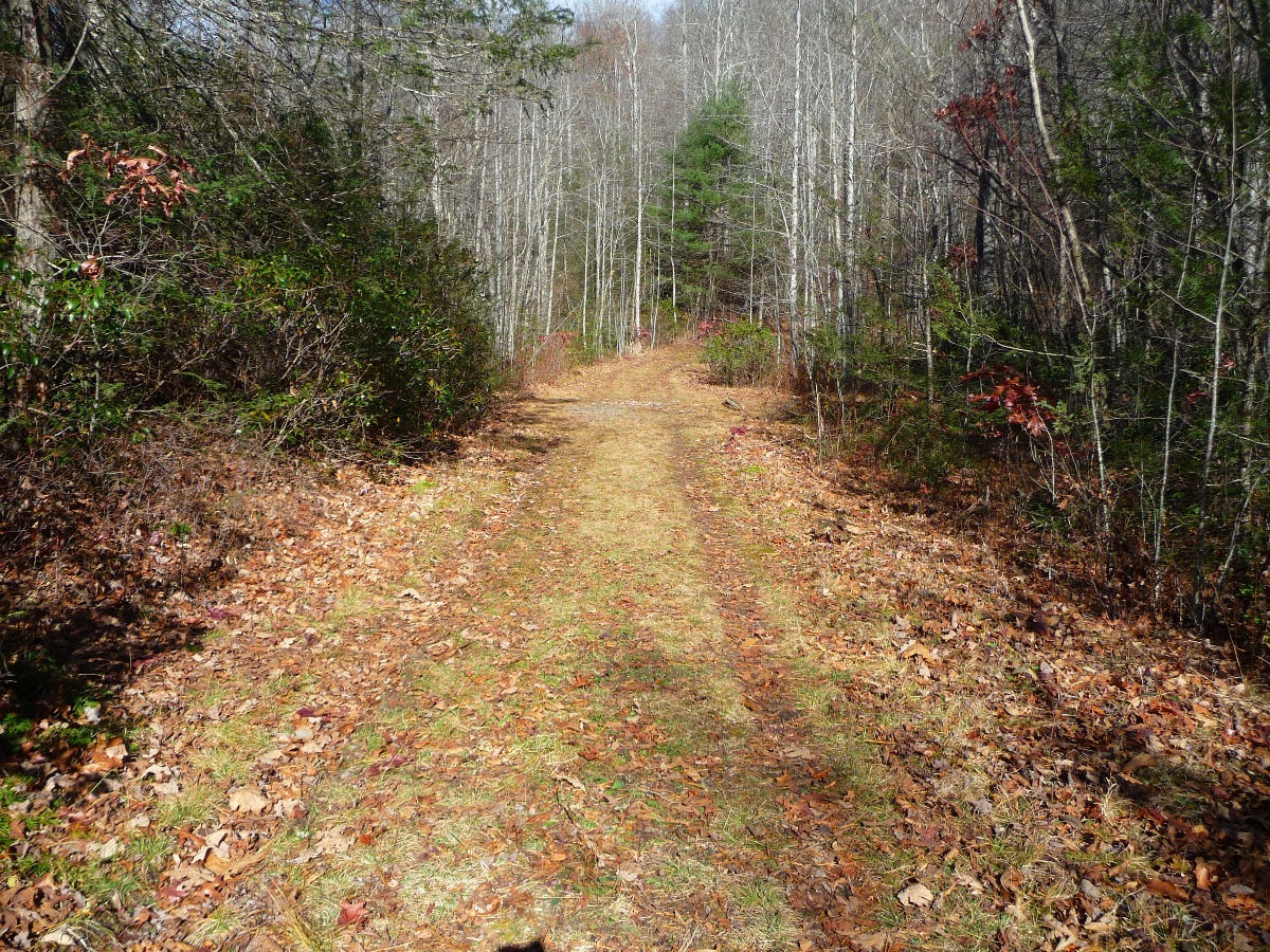
3.5 miles from the beginning of the hike, Bracken Mountain Trail crests the ridgeline, bringing you to the highest elevation point on this hike, just under 3,500 feet (1,067 meters).
Ridgeline (above and below)
Photos from November, 2012
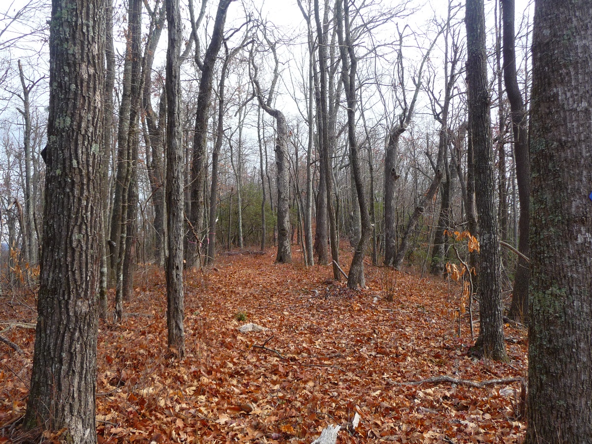
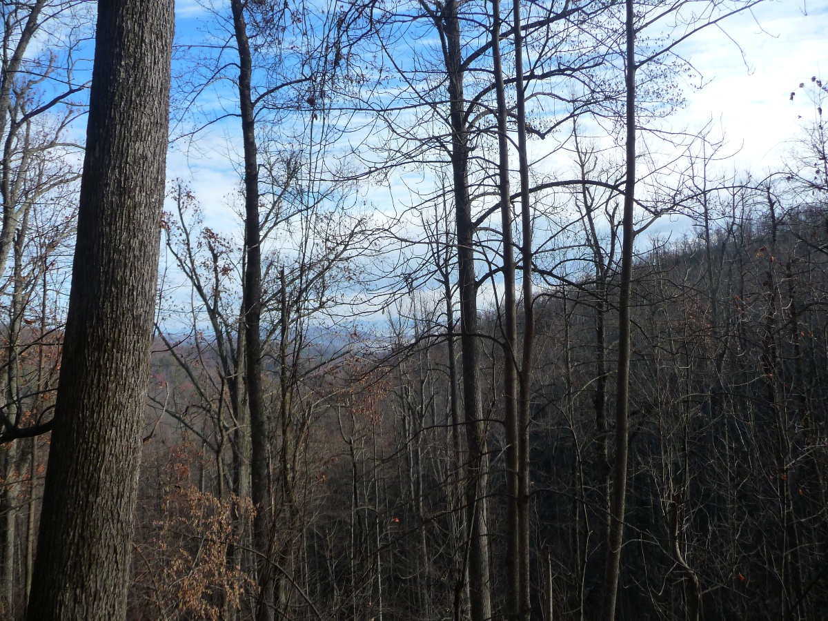
Bracken Mountain Trail continues down the north side of the ridge. Your long range views now are of Pisgah National Forest.
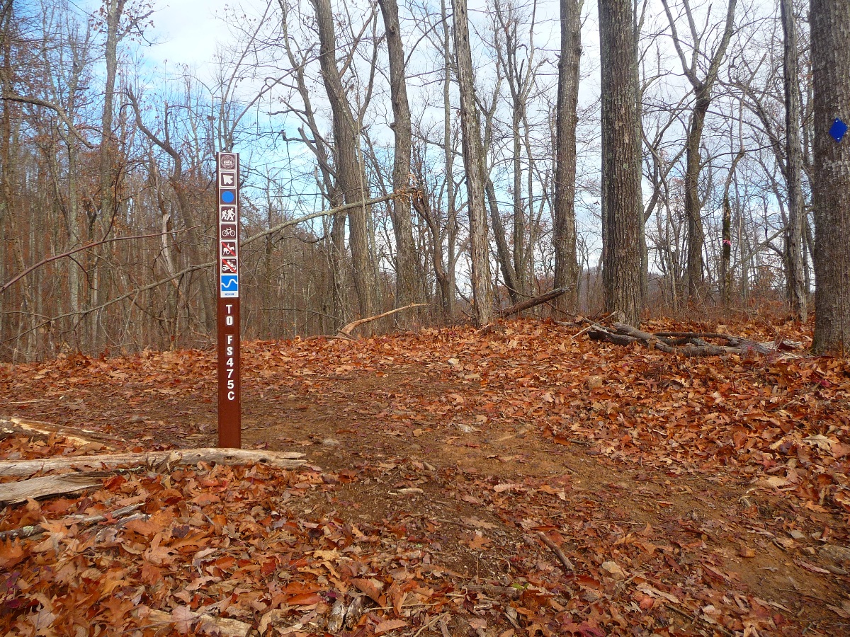
1.3 miles after cresting the ridgeline, Bracken Mountain Trail joins the northern terminus of FS475C, changing from a single track trail to a wide forest service road. A sign at this point indicates it is 7 more miles to the Fish Hatchery:
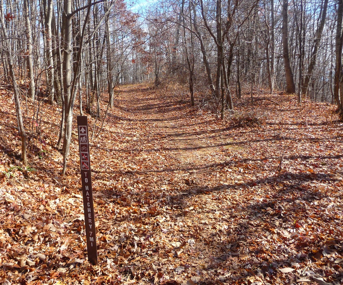
The trail sign indicates it is 7 more miles to the Fish Hatchery
However, that distance can be cut in half for hikers (but not mountain bikers).
0.7 miles from the sign shown above, FS475C comes within 0.2 mile of the Art Loeb Trail at Cat Gap. Art Loeb and the trails north from there are open to hikers, but not mountain bikers. There is a clear trail from the forest service road up to Cat Gap, although it is not marked. The photo below shows a wide, level area, with a campsite off to the right. The trail up to Cat Gap is just beyond this point to the left, and is marked with a pink trail ribbon.
Forest Service Road 475C
just before the point where a trail turns off to the left to head to Cat Gap
Trail up to Cat Gap shown below
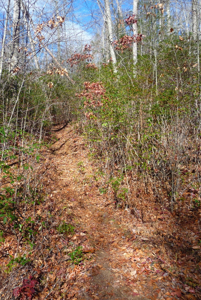
This trail comes out at Cat Gap, where both the Art Loeb Trail and Cat Gap Loop Trails join, and are clearly marked. To continue the hike, bear right, and follow Cat Gap Loop (blazed orange/red). Cat Gap Loop Trail descends steeply downhill, and in 0.4 mile comes to a gap and another trail intersection. To continue to John's Rock, go straight onto John's Rock Trail (blazed yellow). Bearing to the right will take you onto Cat Gap Loop Trail, down along Horse Cove creek and brings you to the Fish Hatchery in 1.3 miles shorter distance than if you go via John's Rock. But you miss that great view from the top!!
To continue to John's Rock, go straight. The trail will again begin climbing, heading up to the spine of John's Rock. The open exposed rock face where you are treated to the great view shown at the top of this page is about 3/4 mile from here. There are several, well worn trails off to the left which take you from the trail out to the rock face.
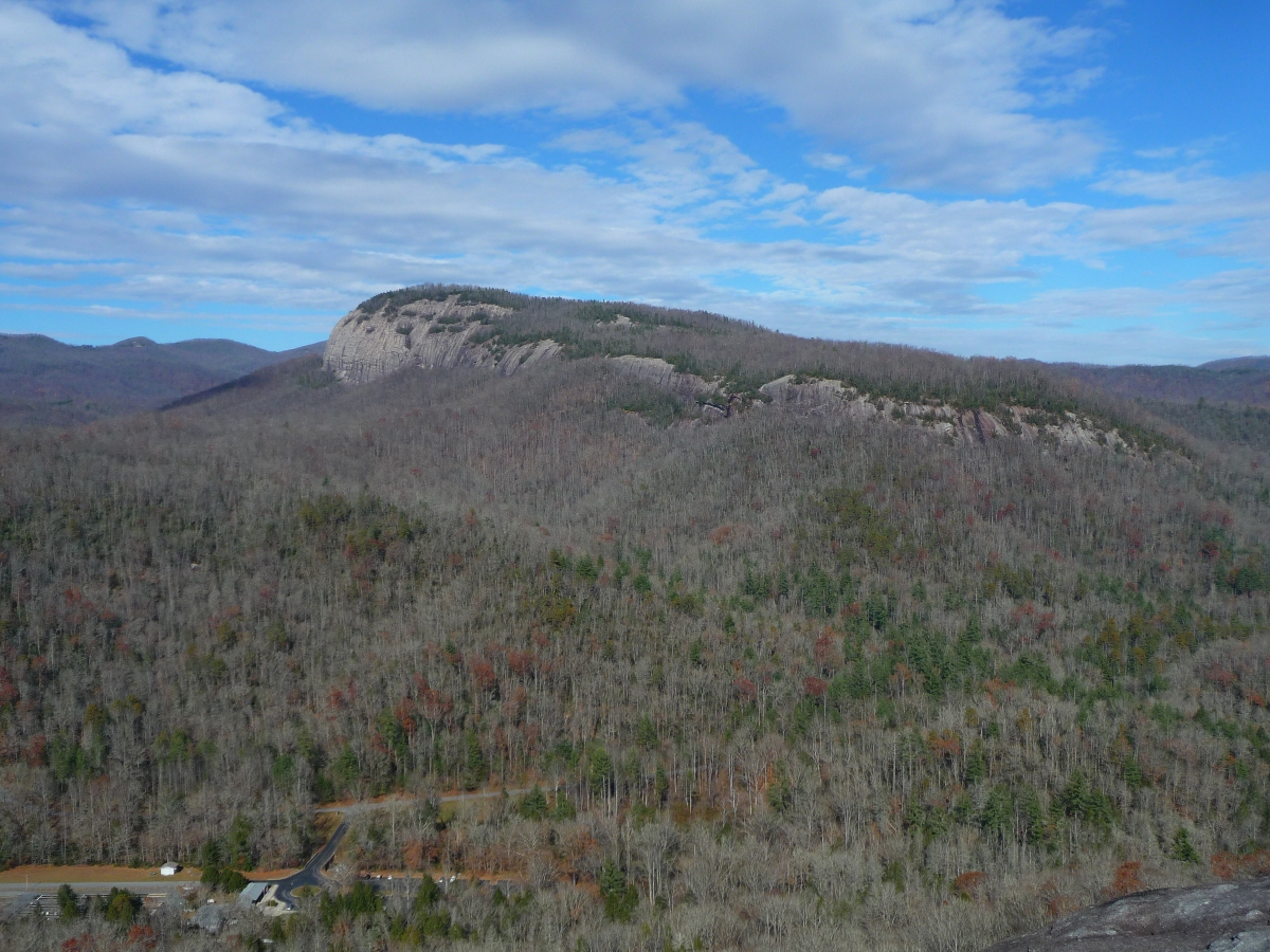
Wintertime Views of Looking Glass Rock, as seen from John's Rock
After enjoying a break and taking in the views, return to the yellow blazed John's Rock Trail which brings you down (in 0.9 mile) to Horse Cove Creek and the lower juncture with Cat Gap Loop.

One of several log bridges along John's Rock Trail (above)
Wide, level trail at the base (below)

Once you get to the bottom of the descent and turn left onto Cat Gap Loop Trail, it is another 1.5 miles to the Fish Hatchery. This portion of the trail is wide, flat, and follows Horse Cove Creek the entire way. You come out at the far end of the parking lot.
A few notes on this trail: The trail system in Bracken Mountain Preserve area is very newly developed, and the trails are very indicative of this --- the ground is soft, with lots of evidence of freshly cut vegetation which created the trails' pathways. However, I saw a big difference in the trails from my first hike there this summer, and this hike done in November. The trails are beginning to look much less new now ... they have a nice layer dirt on them in some places, as well as fallen leaves.
The trails in Bracken Mountain Preserve, as well as FS475C, are open to mountain bikers, and although I saw a fair amount of mountain bike tracks in the dirt, the day I did the hike (a weekday in November), I didn't run into a single person until I got to John's Rock.
Hunting is NOT permitted in Bracken Mountain Preserve. It is permitted in the adjoining Pisgah National Forest.
More pictures in my flickr set from this hike.