Devil's Creek Trail
and a
Loop Hike around Flattop Mountain
Includes Connection with Lost Cove Trail
Click any of the photos
for full size/full resolution image
This page has been updated due to significant changes to Devil's Creek Trail. In the summer of 2013, I hiked the trail down to Lost Cove, and was very surprised to see that the Forest Service had connected the Devil's Creek Trail with the Lost Cove Trail. The two trails came within 0.3 mile of each other, but as my old page on this trail mentioned, you really needed a GPS to connect the two trails, since Devil's Creek Trail just sort of petered out along a narrow ridge on the side of Flattop Mountain, with no real landmarks to use for attempting to connect the two trails. My old page also mentioned lush growth of greenery all along Devils Creek Trail, to the point that often, if you looked down at your feet, you could not even SEE the trail (or your feet!).
The Forest Service did some significant work clearing this trail when they connected it with Lost Cove, and that description is no longer accurate. The trail is well cleared, and while it takes away some of the lushness of the trail, it also makes hiking it much easier. The trail is quite rocky, and now you can actually SEE those rocks you have to walk on rather than just feeling around for them with your feet as you had to when you were wading through the thick greenery.
The other change I noticed in this area, is that the devastating loss of all the hemlocks is really apparent as you get close to Lost Cove's Trail.
I made a return trip to this area later that summer, and did a loop hike around Flattop Mountain, starting and ending at the Devil's Creek Trailhead. This 9.1 mile hike includes the 2 miles along Devil's Creek Trail, 1.2 miles along Lost Cove Trail, and the remainder of the mileage along old (gated) 4WD roads ... a 1.6 mile stretch at the beginning of the hike, and a 4 mile stretch at the end. I did this loop on a Saturday in September, and the only folks I saw the entire way were a group of horseback riders along the 4 mile section of the 4WD road.
Elevation Profile
Click for larger image

Click here for a larger map
Note that this map includes waypoints for some of Lost Cove's landmarks.
Turning left onto the Lost Cove Trail would bring you into the Cove in just over a mile.
GPX data for download (zip file which includes both GPX format, as well as GDB format for Garmin users):
Devil's Creek Trail and Loop around Flattop Mountain.
DIRECTIONS
This trip report begins and ends at the Devils Creek Trailhead, and describes the loop going in a clockwise direction. The trailhead is at Devil's Creek Gap, where forest service roads 278 and 5506 and the Appalachian Trail all intersect. This is just south of the Tennessee/North Carolina state line, near Spivey Gap, which is on US19W.
US19W is a very twisty, narrow road, that is very slow going (albeit very scenic!) from either direction (Erwin, TN from the north, or Burnsville, NC from the south). I've found the easiest way to get here is to take Interstate 26 to exit 46 south of Erwin, TN (There's a rest area at this exit). If coming from Erwin, TN, turn right off the exit ramp and head to the "T" up ahead. If coming from the other direction (Burnsville, Asheville, NC, etc), turn LEFT off the exit ramp, and go over the interstate. Continue PAST the entrance ramp for I26 east to the "T" up ahead.
At the "T", turn left onto Clear Branch Road, a narrow, twisty country road comes to a "T" at Tilson Mountain Road. Turn left onto Tilson Mountain Road. When this road comes to a "T", you will be at US19W. Going this way, it is less than 2 miles from the interstate to US19W. Turn right onto 19W, and you'll come to Spivey Gap in approximately 7.5 miles (once you cross into North Carolina, it is less than a mile). See map.
Once at Spivey Gap, turn north off of US19W onto FS road 278. If coming from Tennessee, this will require a 360 degree left turn, as FS278 parallels US19W for a short ways.
Follow FS278 until you get to Devil's Creek Gap (approximately 1.3 miles). This is a well maintained gravel road, and pretty much any vehicle should be able to traverse it.
FS278 continues straight ahead (you'll be coming from this direction at the end of your hike). FS5506 is a downhill left turn at the gap, and has been gated each time I've been here. An unlabeled, overgrown gated forest service road also bears off to the right at this gap. And the Appalachian Trail crosses here, and is well labeled as such.
Park here at the gap, and begin your hike down FS5506.
You'll follow this wide, 4-wheel drive road for about 1.6 miles, until it ends at a large, open field. As old forest roads go, this one is pretty scenic, especially the second half of it.

FS5506, above and below

The open field at the end of FS5506.
Devil's Creek Trail is located at the very beginning of this field, on the right.
Once you reach this field, stay to the right, following the edge of the woods, and start looking for the single track hiking trail --- this is the beginning of Devil's Creek Trail. It is labeled with a forest service trail sign. This trail comes very soon after entering the field ... only about 40 paces or so.
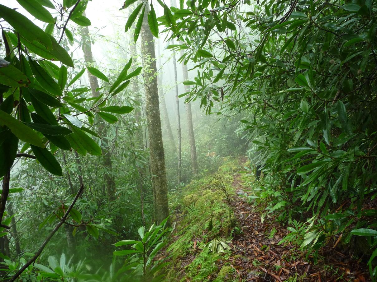
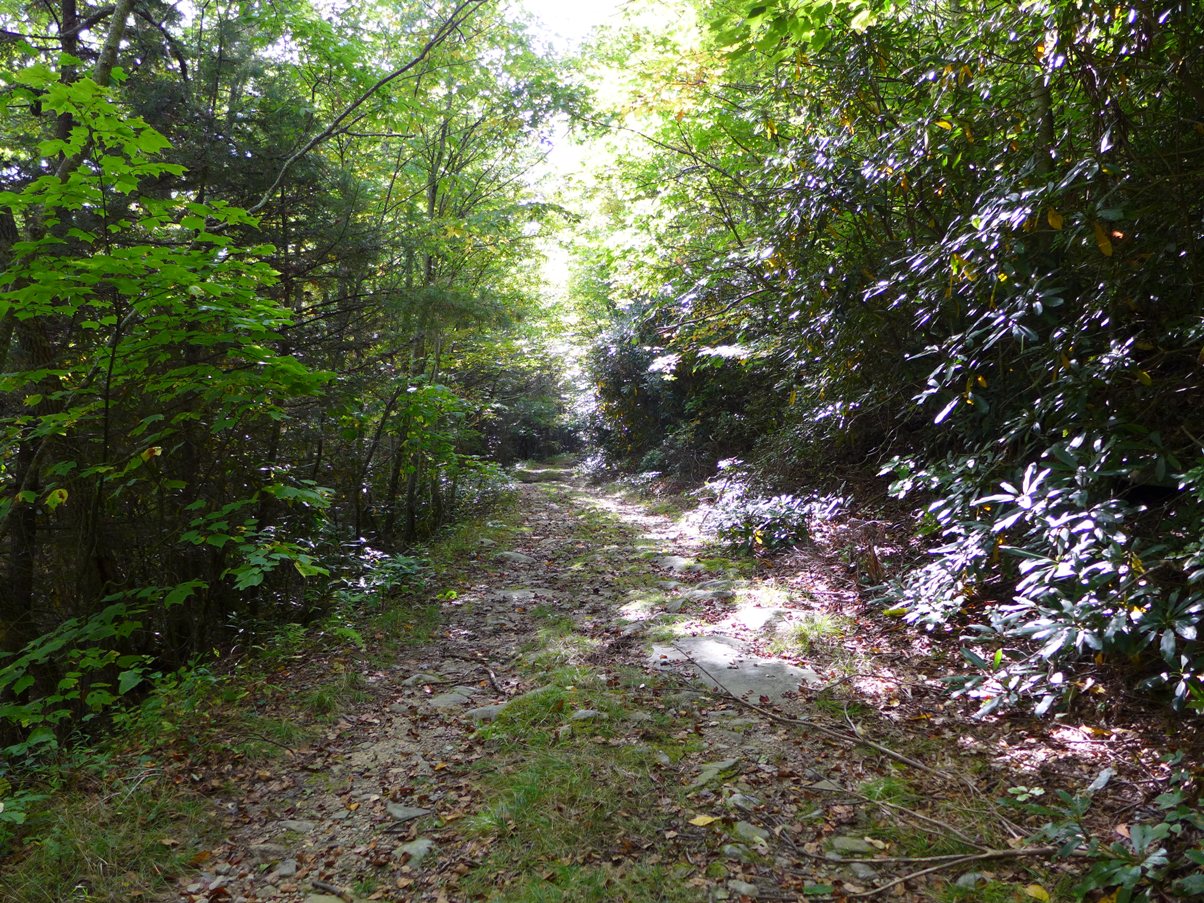
The trail immediately narrows, and takes you into the thick forest, which is a welcome relief after almost a mile and a half of forest service road walking.

As the trail makes one of its turns, it opens out into a sunny curve, which after walking most of the trail in thick overgrowth, is a marked change from all the rest of the trail.

This next section is where the FS has really made a big difference in the trail ... the section that traverses the steep north-facing side of Flattop Mountain. This portion of the trail is very rocky, but now at least you can SEE those rocks you have to walk along!
You get some wonderful long range views of the Nolichucky River gorge (although you never see the river itself). The train track that follows the river through this gorge is still active, and several times a day trains run along it. From the trail, you can hear their whistles as they wend their way through this river gorge.
The topo map shows just how steep the north face of FlatTop Mountain is, where this trail traverses. Many times you'll look straight down off the trail, to see the landscape fall away below you hundreds of feet in elevation down.
2 miles from its beginning at the open field, Devil's Creek Trail ends at its junction with Lost Cove Trail.

Junction of Devil's Creek and Lost Cove Trails
You can see the many, many dead hemlocks in this area.
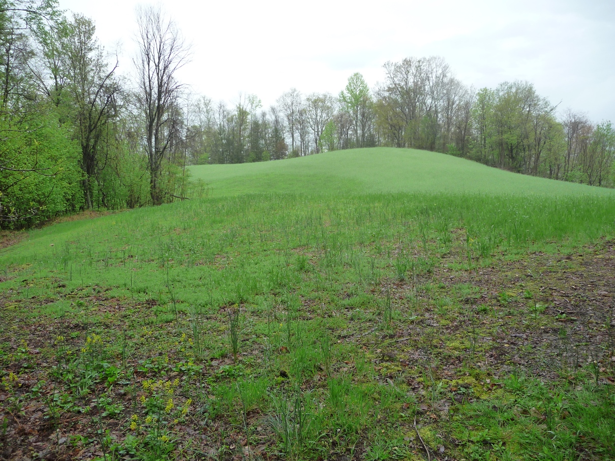
Lost Cove is 1.1 miles down this trail to the left. However, for this loop hike, turn right onto Lost Cove trail. Over the next 1.2 miles, you'll climb 600 feet in elevation, coming out on the ridge that runs between Flattop Mountain and Joe Lewis Field. At the top of Lost Cove Trail, bear left to head to the top of Joe Lewis Field.
Looking up to the top of Joe Lewis Field
Lost Cove Trail comes in along the ridge to the left.
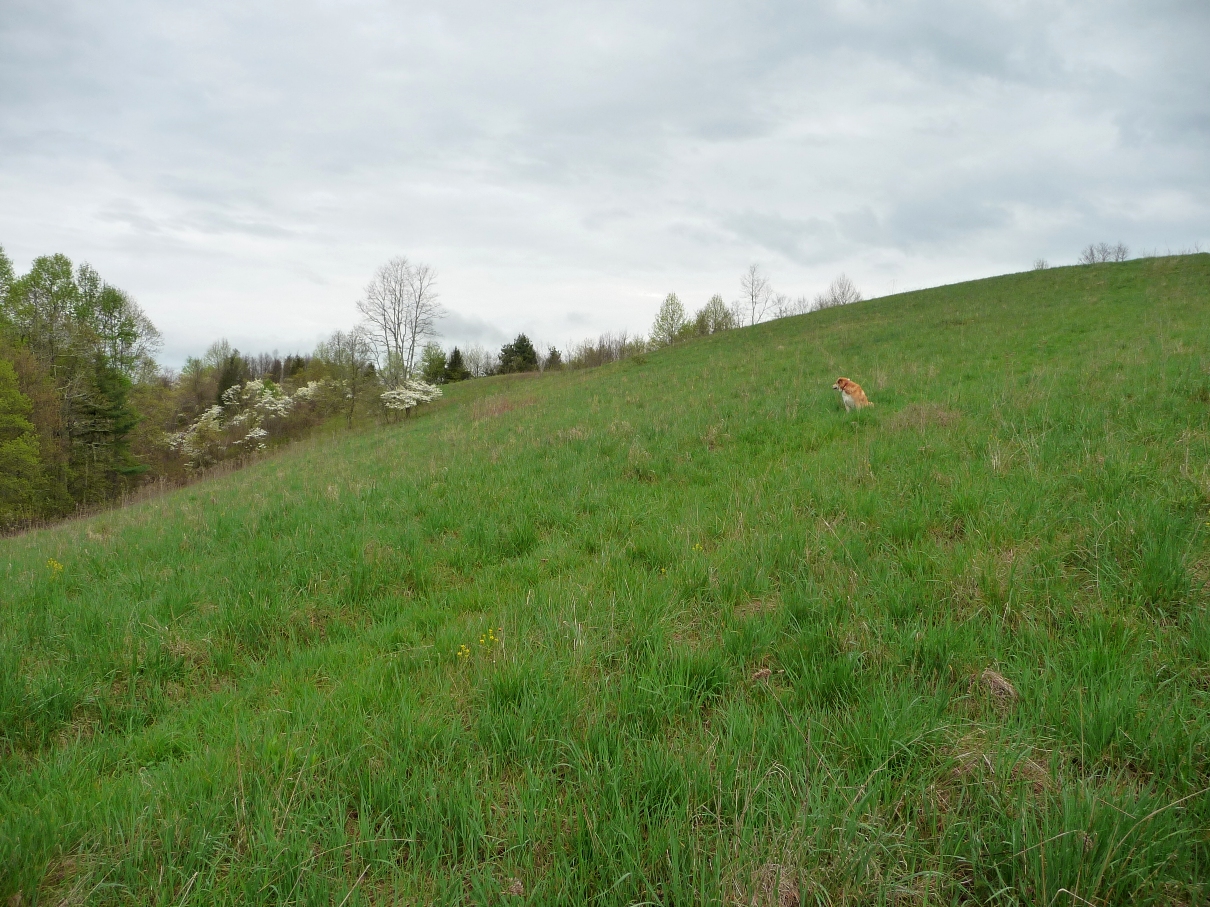
Walk down the path that goes straight down to the bottom of the field. Once there, look through the trees that border the base of the field straight ahead of you for a continuation of this trail that drops steeply off the hillside. This will bring you down to FS278, at an area that has room for several cars to park. This is the Lost Cove trailhead. Do not follow the path that bears to the left at the bottom of the field and follows the treeline (this brings you out onto another FS road (FS#5505) which joins FS278 a short distance up the road).
Once down onto FS278, turn right. You'll soon pass a gate, as well as a small weather station on the left. This FS road winds around the southern slope of Flattop Mountain, and, in 4 miles, comes out where you began your hike, at the Devil's Creek Trailhead.
FS road 278