
Devil's Creek Trail
including how to connect to Lost Cove Trail
Click any of the photos
for full size/full resolution image
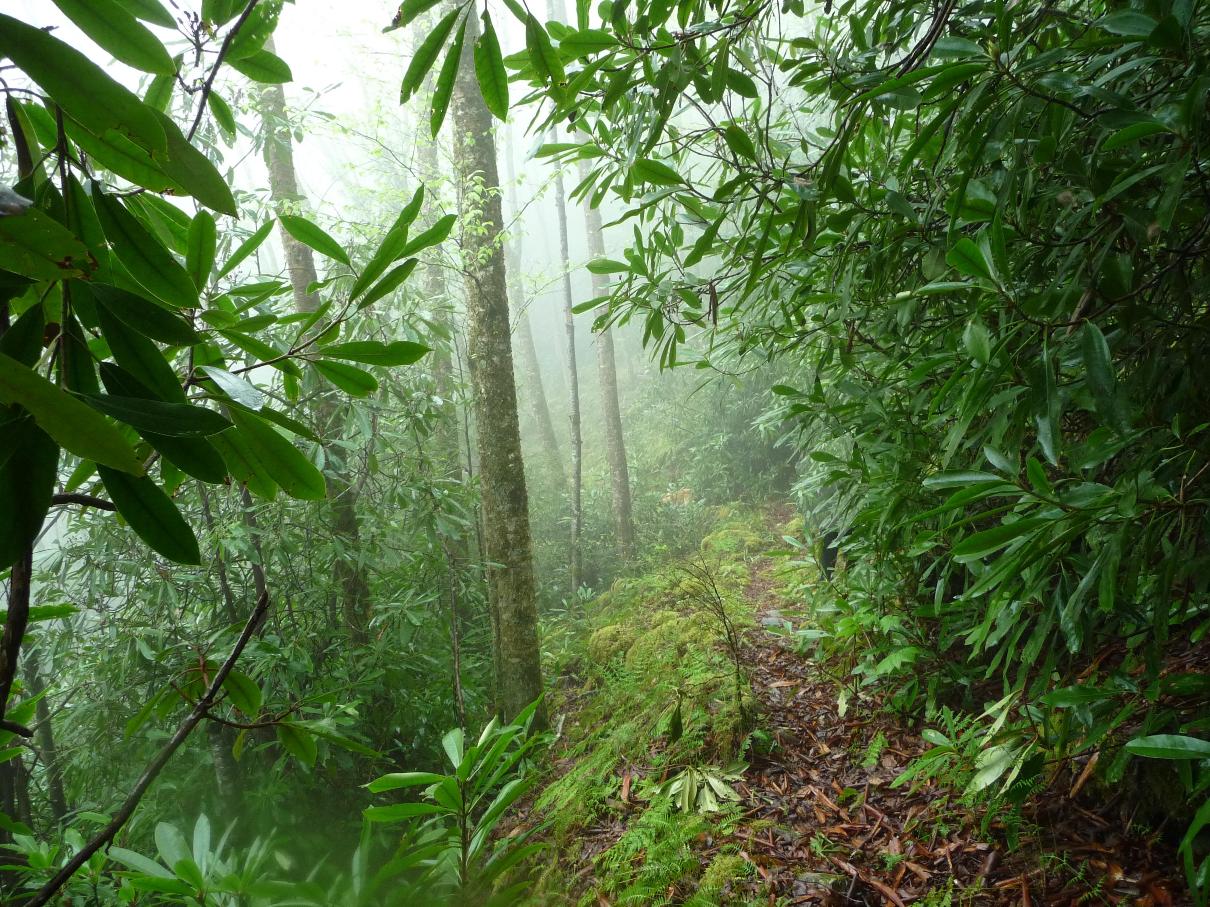
Devil's Creek Trail is a challenging trail ... not so much in terms of length (only 1.9 miles, one way), or in terms of elevation gain (the trail pretty much follows the 3,300-3,400 foot contour lines as seen on a topo map). However, as the trail winds in and out of the coves of the northern face of FlatTop Mountain, you'll find the terrain is very, very narrow, rocky underfoot in many places, and, due to the lush growth of greenery all around, if you look down at your feet, you often cannot even SEE the trail (or your feet!). Hiking this rocky section, one has to just "wade through" undergrowth that is knee to thigh high in places.
Another disadvantage is the 1.6 miles (each way ... 3.2 miles round trip) that have to be walked along FS 5506 to reach Devil's Creek Trailhead. (I find hiking 4-wheeled drive forest service roads very boring!)
Yet another disadvantage is that the trail just sort of peters out near the top of a ridge at about the 1.9 mile point (3.5 mile point if you include the 1.6 miles hiked along FS 5506).
Yet this is one of my favorite trails to hike! Its lush, thick greenery reminds me of a tropical rain forest at times (see top image).
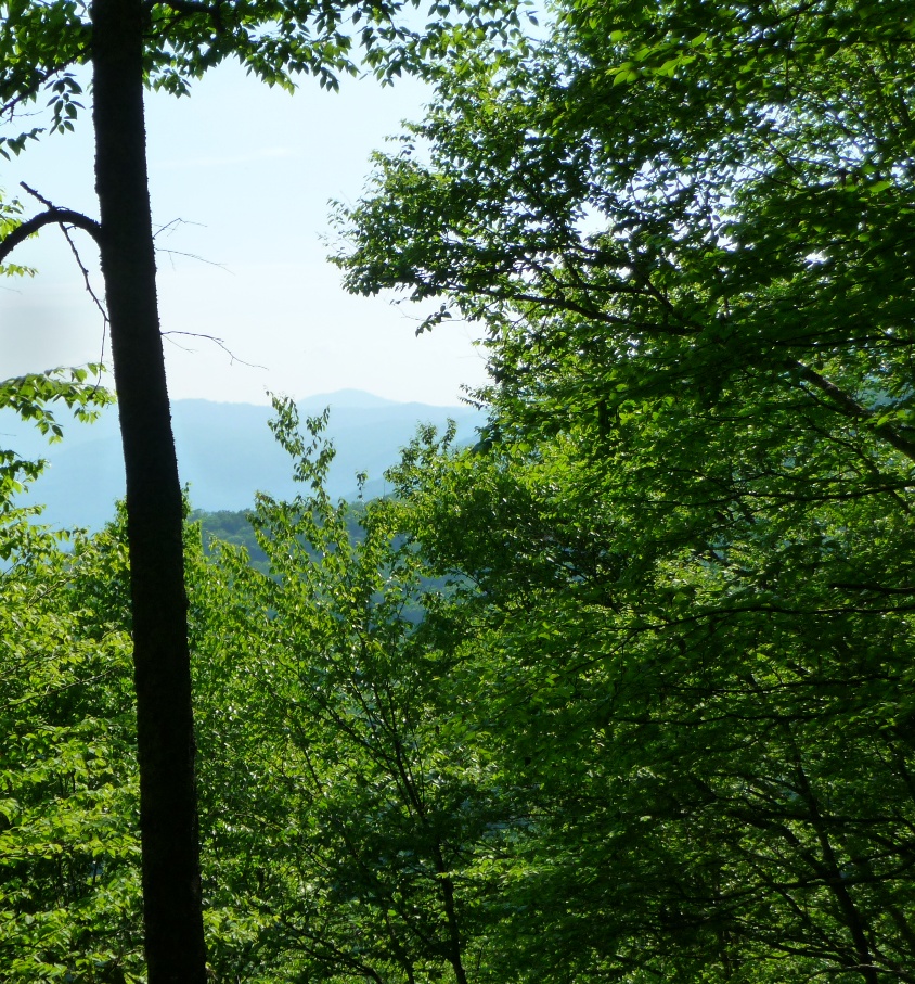
And if you're looking for a remote trail, this is it. You'll probably never run into another person along here. You get some wonderful long range views of the Nolichucky River gorge (although you never see the river itself). The train track that follows the river though this gorge is still active, and several times a day trains run along it. From the trail, you can hear their whistles as they wend their way through this river gorge.
GPX data for download: Devil's Creek Trail into Lost Cove.
The topo map shows just how steep the north face of FlatTop Mountain is, where this trail traverses. Many times you'll look straight down off the trail, to see the landscape fall away below you hundreds of feet in elevation down.
The northeastern end of this trail (that peters out into nothing along the ridge) is tantalizingly close to the Lost Cove Trail, the trail that goes from the eastern side of FlatTop Mountain down to the abandoned community of Lost Cove. Before I had a GPS, I had tried to "connect the dots" of the two trails (without success!) on a week's vacation in the area in 2009.
But once I had a GPS and did this trail, I headed down the ridge from where the trail peters out, and within 0.3 mile, found the Lost Cove Trail. As this GPS track shows, I did go down into Lost Cove (making the entire day's hike just over 11 miles), but spent very little time there this visit, just checking out the western section of the area (see below for more info on Lost Cove).
Once back at the place along Lost Cove Trail where I came out from Devil's Creek Trail, using the GSP's trackback function, I was able to easily find my way back up the ridge to where this trail once again becomes visible. As the GPS track shows, it is not a "straight line down" stretch to the Lost Cove Trail ... instead following the curve of the hillside north, then southeast, until one reaches Lost Cove Trail. Without a GPS, heading down and finding the Lost Cove Trail would not have been hard ... the problem would have been finding Devil's Creek Trail once again as you tried to head back up the ridge.
DIRECTIONS
The trail head is at Devil's Creek Gap, where forest service roads 278 and 5506 and the Appalachian Trail all intersect. This is just south of the Tennessee/North Carolina state line, near Spivey Gap, which is on US19W.
US19W is a very twisty, narrow road, that is very slow going (albeit very scenic!) from either direction (Erwin, TN from the north, or Burnsville, NC from the south). I've found the easiest way to get here is to take Interstate 26 to exit 46. If coming from Erwin, TN, turn right off the exit ramp and head to the "T" up ahead. If coming from the other direction (Burnsville, Asheville, NC, etc), turn LEFT off the exit ramp, and go over the interstate. Continue PAST the entrance ramp for I26 east to the "T" up ahead.
At the "T", turn left onto Clear Branch Road, a narrow, twisty country road comes to a "T" at Tilson Mountain Road. Turn left onto Tilson Mountain Road. When this road comes to a "T", you will be at US19W. Going this way, it is only a couple miles (if that far) from the interstate to US19W. Turn right onto 19W, and you'll come to Spivey Gap in approximately 5.5 miles (once you cross into North Carolina, it is less than a mile).
Once at Spivey Gap, and turn north off of US19W onto FS road 278. If coming from Tennessee, this will require a 360 degree left turn, as FS278 parallels US19W for a short ways.
Follow FS278 until you get to Devil's Creek Gap (approximately 1.3 miles). This is a well maintained gravel road, and pretty much any vehicle should be able to traverse it.
FS278 is often ungated, allowing traffic on beyond this point .... FS5506 is a downhill left turn at the gap, and has been gated each time I've been here. An unlabeled, overgrown gated forest service road also bears off to the right at this gap. And the Appalachian Trail crosses here, and is well labeled as such.
Park here at the gap, and begin your hike down FS5506.
You'll follow this wide, 4-wheel drive road for about 1.6 miles, until it ends at a large, open field.
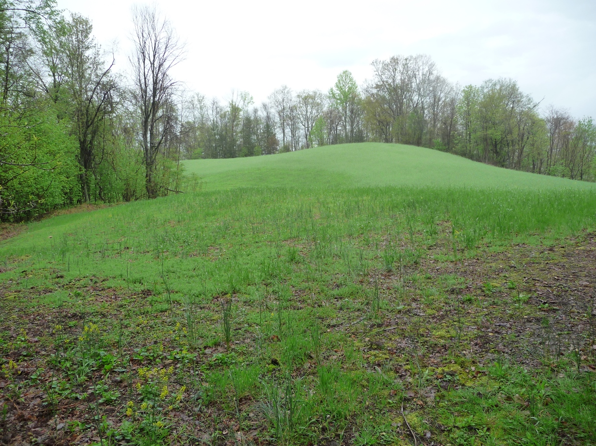
Once you reach this field, stay to the right, following the edge of the woods, and start looking for the single track hiking trail --- this is the beginning of Devil's Creek Trail. It is labeled with a forest service trail sign.
This trail comes very soon after entering the field ... only about 40 paces or so. The last time I was there, there were some tree limbs from a fallen, dead tree piled up right in front of the trail's beginning!! Having been there before, I knew where to find the trail ... but it could have been easy to miss if I'd not been there before.
The trail immediately narrows, and takes you into the thick forest, which is a welcome relief after almost a mile and a half of forest service road walking.

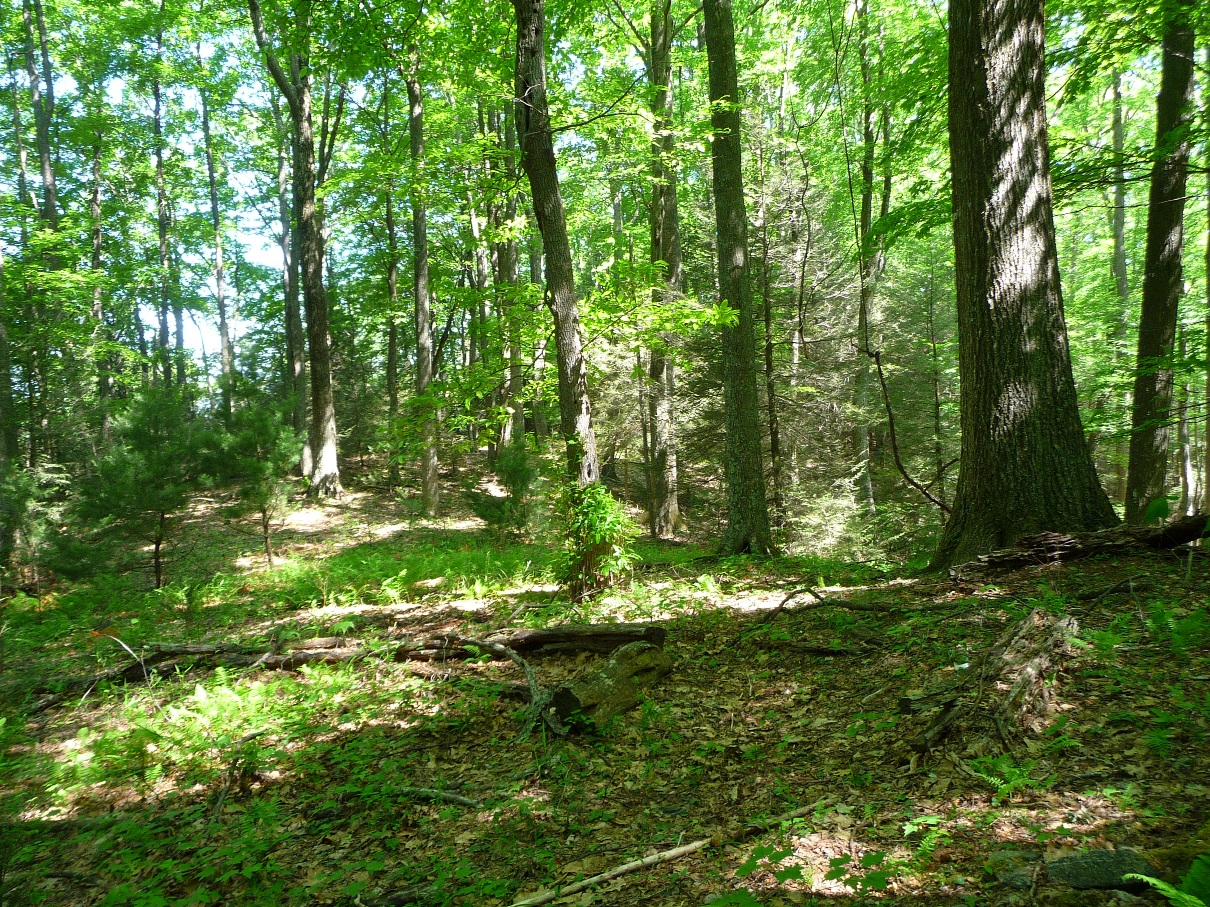
One section opens out into a sunny curve, which after walking most of the trail in thick overgrowth, is a marked change from all the rest of the trail.

Soon after this open curve section of trail, you head back into the "rain forest jungle" type of trail, but get occasional glimpses off to the north of the Nolichucky River Gorge.
After hiking almost 2 miles along Devil's Creek Trail (3.5 miles all together from the hike's beginning at Devil's Creek Gap), the trail opens out onto a ridge and at this point, just sort of disappears.
Can you see the trail?--Nahhh, me 'neither!
To reach Lost Cove Trail from here, continue to follow the ridge line downhill, and you'll come to Lost Cove Trail in approximately 0.3 mile. (See above for my recommendation that you **not** attempt this unless you have a GPS to get you back to where Devil's Creek Trail is visible).
If you do head down the ridge to Lost Cove Trail, once you reach it, you have a couple options. You could head UP Lost Cove Trail, to its beginning, which is on FS278 ... the same forest service road where you parked to begin this hike. FS278 traverses around FlatTop Mountain along its south face. A rough, "eye-ball the map" estimate of the walking distance along the road would probably be in the neighborhood of 4 miles or so back to the car. If you were with a group, you could also make this a car shuttle hike, leaving one car at the Lost Cove trail head on the eastern portion of FS278, and another car at the Devil's Gap section of this road.
You could also take the time to explore Lost Cove. The hike into the Cove from here is very easy walking, and all downhill (just keep in mind it will be all UPHILL on the way back!!)
About Lost Cove: This is a 700 or so acre area along the Nolichucky River that was home to a thriving community of mountain folk from the 1860's to the 1950's. There are no roads into the area (there never were, which was a primary reason for the Cove's isolation). There are several remaining buildings from this community still standing, an orchard (slowly being taken over by nature, as it has been un-cared for for 5 decades), stone fences, 2 cemeteries, even the concrete steps to what had been the church. I have found it to be a special place where I can still feel the spirit of the folks who lived there.
This area is private property, and I've never been able to ascertain who owns it, or if hiking into it is acceptable. Having been there several times myself ... my suggestion, if you choose to go, is to do what I do: Bring along an empty trash bag, and take out some of the tremendous amount of old cans and bottles left by years of abuse by previous visitors. Surely that's a wonderful form of payment that any property owner will accept!
I'll be posting a page devoted to Lost Cove soon, but in the meantime, here's a couple pictures from my most recent hike:
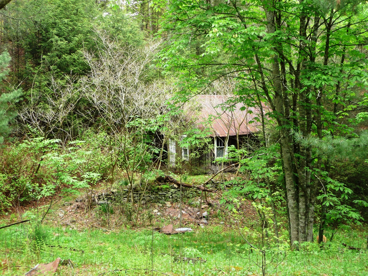
Old school building of Lost Cove
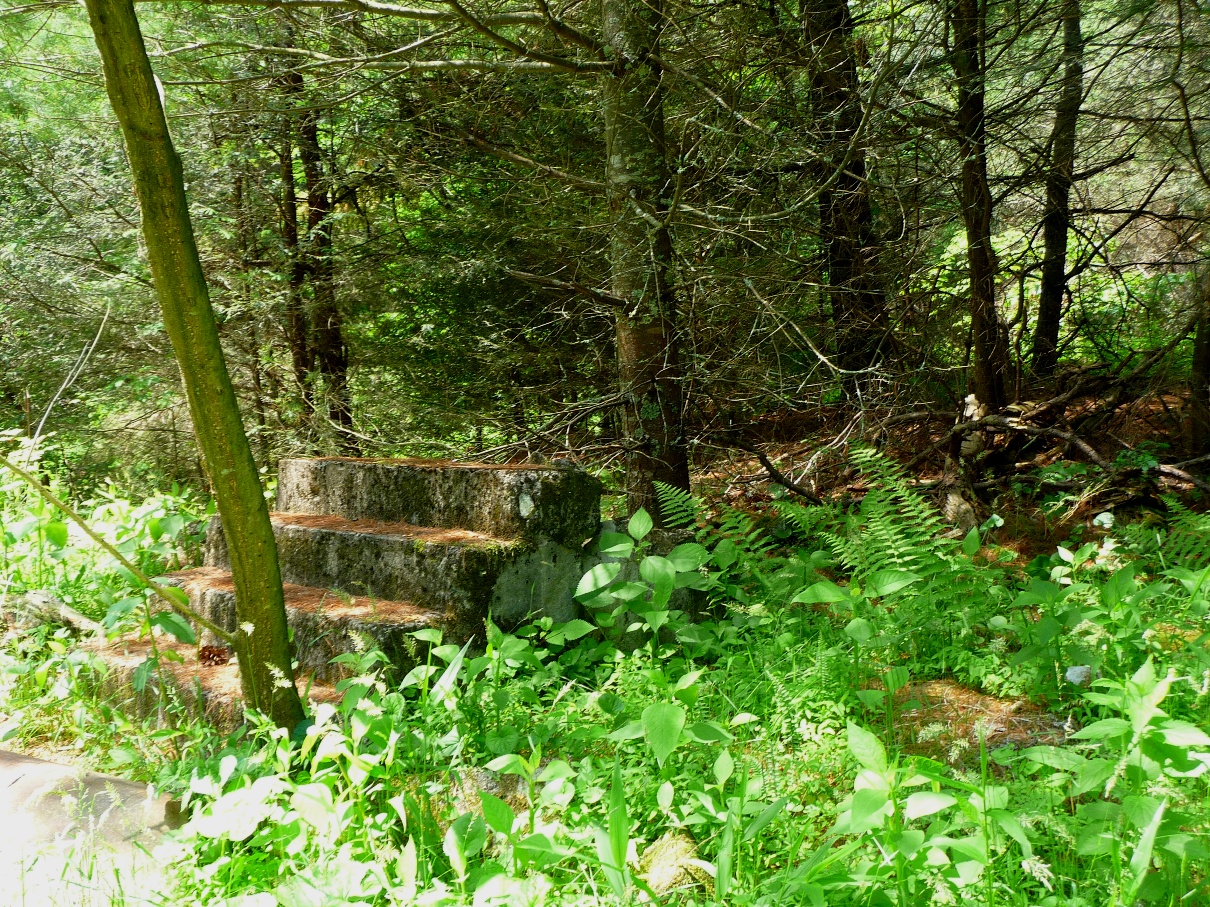
Church steps -- all that remain of the old church building
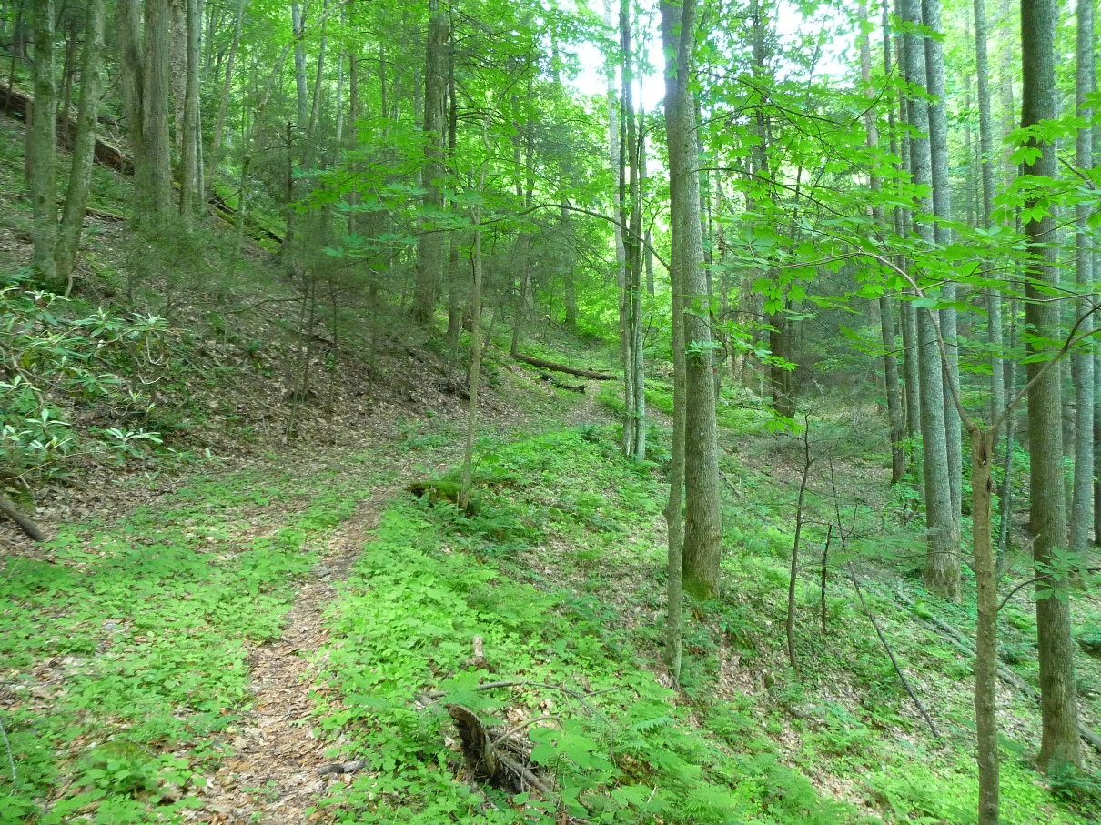
Trail heading down to the Nolichucky River from the Old School Building