
Little East Fork
to
Fork Mountain Loop
Click on any of the images on this page
for full size/full resolution pic.
This is an 8.4 loop that begins and ends at the Daniel Boone Boy Scout Camp off Lake Logan Road, just south of Waynesville, NC. The first 3.2 miles follows the established Little East Fork Trail as it follows the creek of the same name upstream. This trail will eventually cross Little East Fork Creek, and wind its way up the west side of the mountain whose ridge line is Shining Rock Ledge ... the north/south running ridge that runs from Ivestor Gap north to Shining Rock.
However, for this loop hike, just before the creek crossing, you will turn sharply right, heading northwest up the northeast facing side of Fork Mountain, following old, overgrown logging roads. These roads are not maintained, and in fact, aren't on any topo maps I've noticed. But they provide a delightful meandering pathway along this side of that mountain, as well as an access point to head up to Fork Mountain Trail which runs along the ridge of Fork Mountain, providing an access route to Birdstand Mountain and Ivestor Gap Trail and the delightful meadow that is just northwest of Ivestor Gap Trail. See this webpage for a description of that hike.
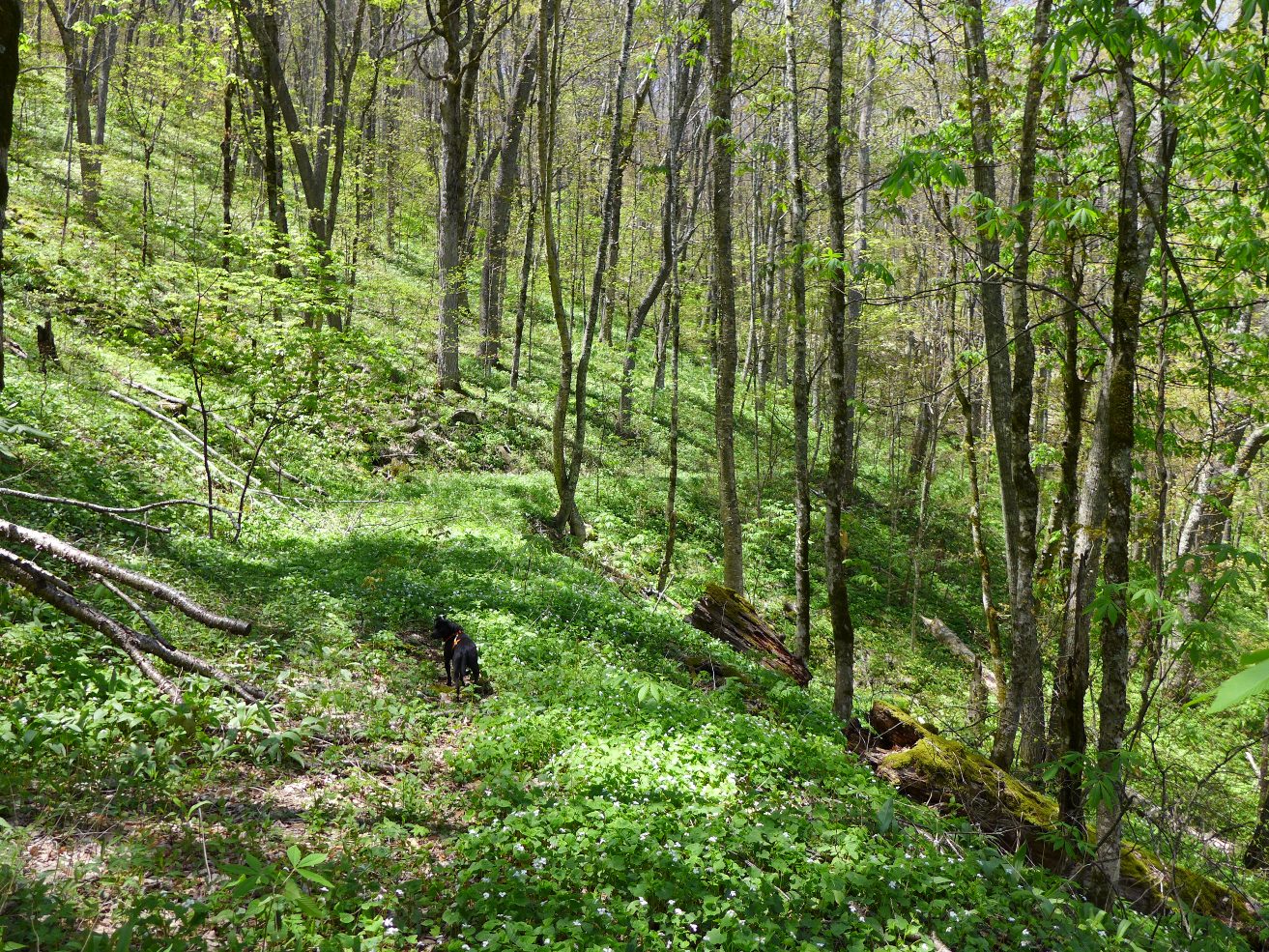
I did this hike in early May, and found the terrain to be lush green, with lots of creeks, springs, and even a small pond. Lots of wildflowers were along the route, especially the wettest section from the turnoff to Fork Mountain Trail back down to the Boy Scout Camp.
These old logging roads also provide a long range view of a waterfall coming down from Shining Rock Ledge, as well as passing by a small 20 foot waterfall along the route. Both are pretty low flow waterfalls, best seen and enjoyed after some hard rains.
The description listed below is hiking this loop in a clockwise direction: up Little East Fork Trail first, then along the Fork Mountain logging roads back to the Boy Scout Camp. Two advantages to doing it in this direction: first, by going upstream along Little East Fork Creek, you get over 3 miles of fabulous river views with its many cascades. If you did the hike in the opposite direction, you'd have to constantly look back up over your shoulder to catch these views.
Secondly, the logging roads marked on the GPS track below are several of many other logging roads which intersect this loop. The GPS track for download includes waypoints for these other logging roads. However, if going in the direction opposite of what is posted below, there is one intersection which you are sure to miss since it has you leaving a wider logging road to head up the hillside to a narrower one. I also forgot to mark that intersection, so that tricky spot does NOT have a waypoint. Next time I hike this loop I will be sure to add in that location and update this page accordingly. Doing the loop in the direction listed here will have you automatically join the wider logging road as the narrower one you are one just feeds into it.
Since this entire hike is within the wilderness area, no trails are blazed or signed. The old logging roads are more or less easy to locate and follow. At times they narrow down quite a bit to almost single track width, and in some places have a lot of overgrowth and fallen limbs, as well as a handful of significant downfalls of large trees.
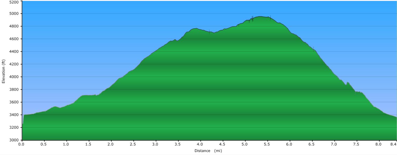
Elevation Profile of the trail
Click for larger image
Click here for a larger map
GPX data for download (zip file which includes both GPX format, as well as GDB format for Garmin users):
Little East Fork / Fork Mountain Loop.
DIRECTIONS
The northern terminus of the Little East Fork Trail begins right at the Daniel Boone Boy Scout Camp, located southeast of Waynesville, NC. Take highway 215 south (if coming from Waynesville) and turn left onto Little East Fork Road (SR 1129) There is a small sign at this intersection for the camp, and the turn comes immediately after the second of two concrete bridges on the highway that are less than 1/2 mile apart.
Follow Little East Fork road until you come into the camp (approximately 3 1/2 miles from highway 215 ... I didn't measure this ... just a rough estimate). The road becomes a well maintained dirt road. Continue driving through the camp until you come to the place where pavement begins going straight ahead and where the camp's road turns right (often gated), crossing the river on a bridge.
Straight ahead is private property, and is labeled as such. Just before the gated road to the right, there are spots for parking for hikers. Park here, and begin your hike by crossing the creek on the bridge, and then turning left. The road continues through more of the camp, and then enters the Shining Rock Wilderness of Pisgah National Forest.
For the first 3.2 miles, you will follow Little East Fork Creek. There are numerous places to head down to the creek to photograph (and/or play in) various cascades and swimming holes.
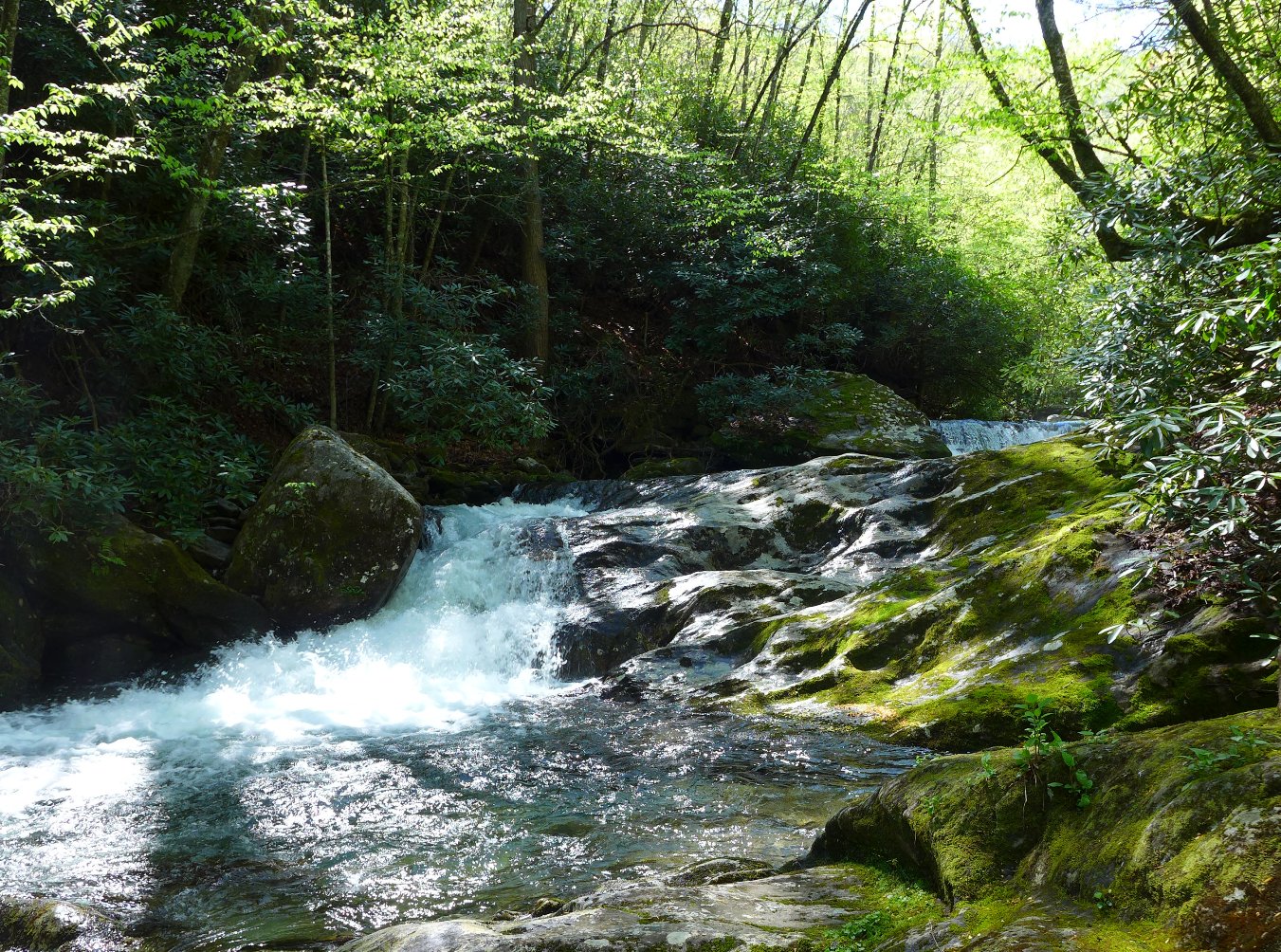
View of one of many rapids along Little East Fork Creek
3.2 miles from the parking area, Little East Fork Trail will cross the creek. About 50 or 100 feet before this, you'll see an old logging road turn sharply to the right, heading up Fork Mountain. Turn here. The remainder of the hike will be along these old logging roads, eventually bringing you back to Little East Fork Trail, one half mile from the parking area.
The logging roads are more or less easy to follow. There are places where they are beginning to get overgrown; there are also places where they are totally blocked.
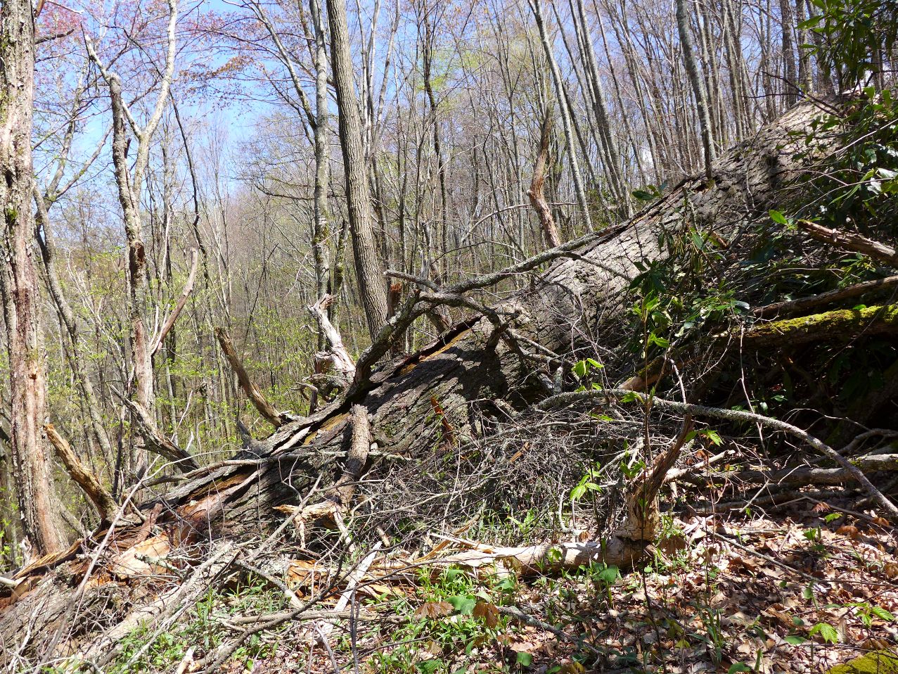
One of about 4 major tree falls
that the hiker
must navigate around
Of course, there also sections of trail shown in the photo at the top of this page!
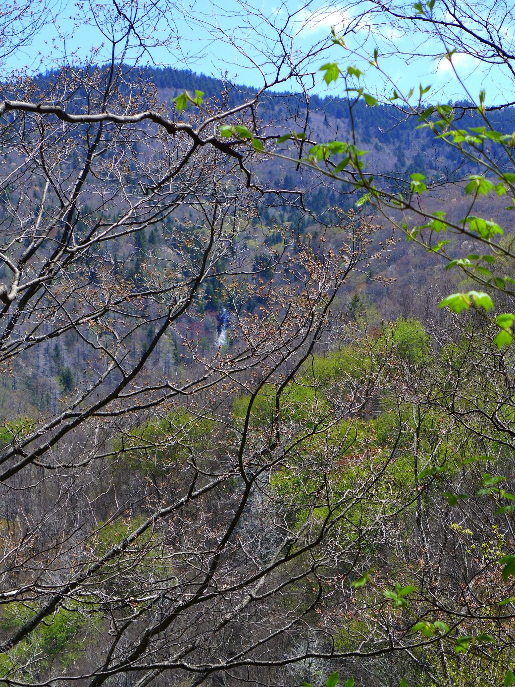
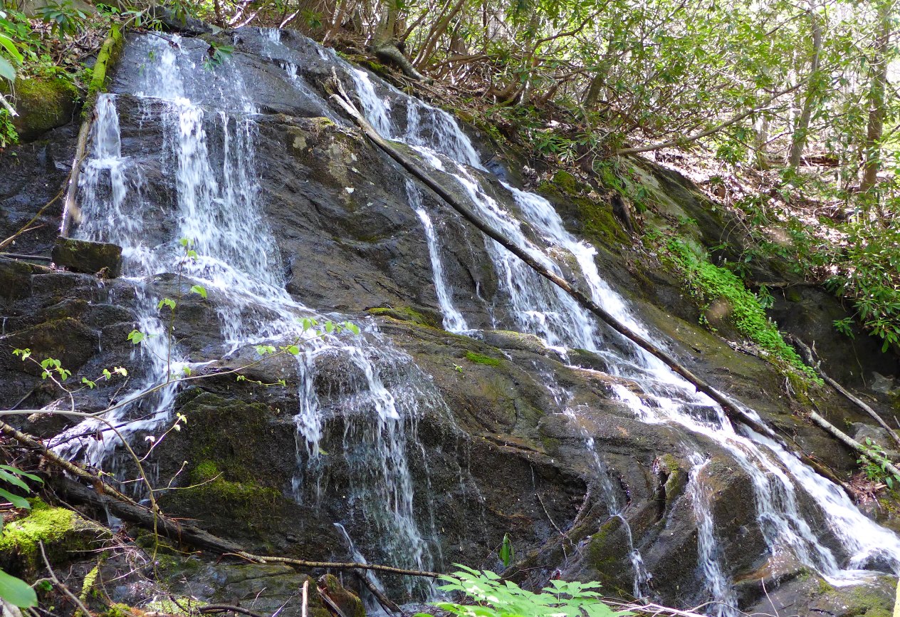
On your ascent up Fork Mountain, you will cross three creek crossings. As you gain altitude, you will get some great views of Shining Rock, Flower Knob, and Grassy Cove to the east. Between the second and third creek crossing, as you are still on the side of the mountain that faces Shining Rock Ledge, look for a waterfall that is coming down that hillside, about halfway down from the crest, at around the 4700 elevation contour. This waterfall originates from a spring off the side of Flower Knob, and is on an unnamed tributary of Little East Fork Creek. The pictures below show the waterfall near the center of each photo (best seen in the full size photos ... click to view)
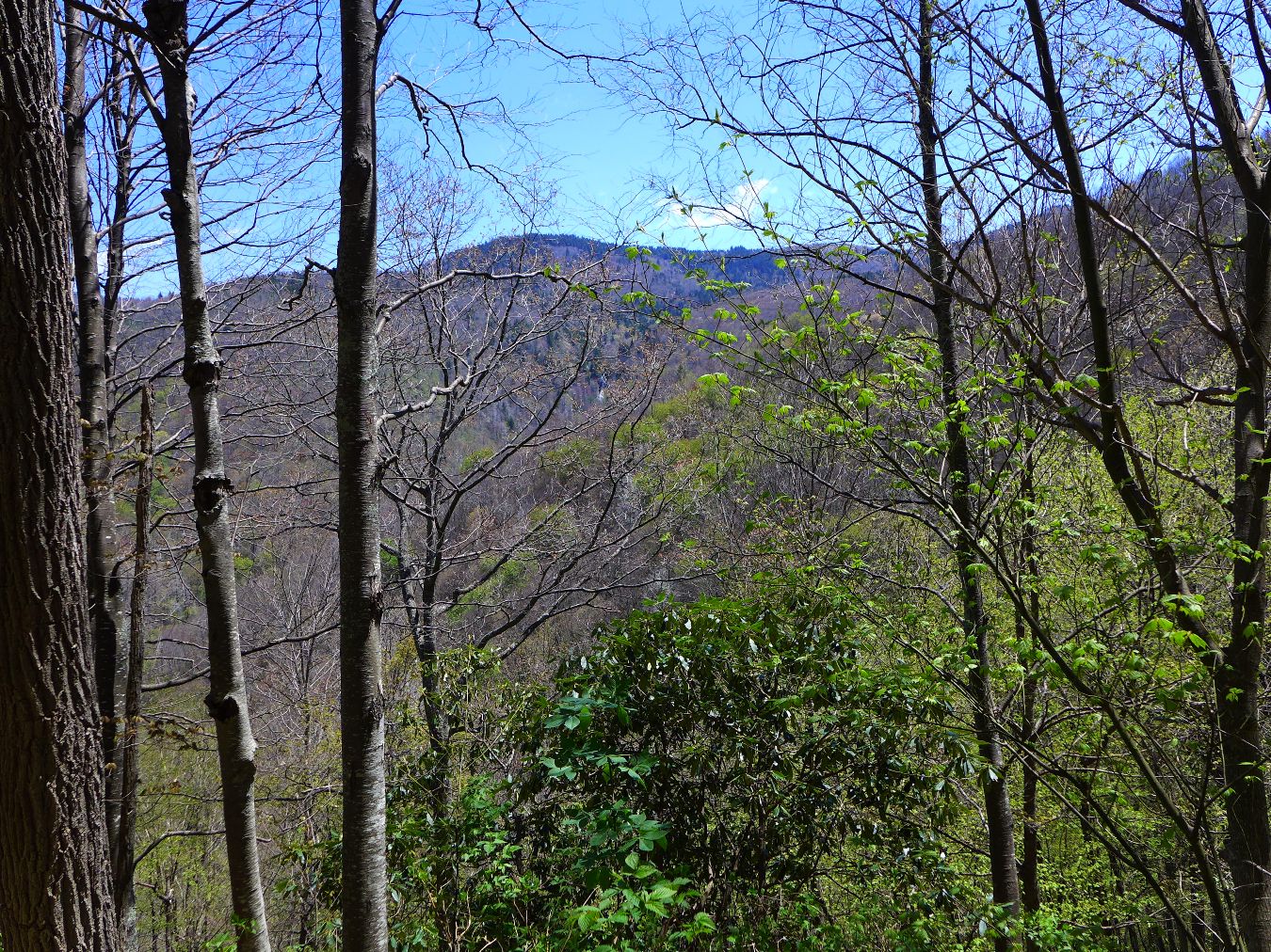
Waterfall coming down from Shining Rock Ledge
Long range view (above)
Zoomed in view (below)
When the logging road gets to around the 4900 elevation point, you'll see a spur road turning off sharply to your left. (There is a campsite's fire ring here). This spur trail takes you on up to Fork Mountain Trail, connecting you with Ivestor Gap to the southeast and Birdstand Mountain to the northwest.
To continue this loop, continue straight. Up until this point, you have been constantly gaining elevation; from here on, you will now be going downhill back to the Boy Scout Camp. This side of the mountain is much wetter than the side coming up ... you'll pass a number of springs, a small waterfall, and even a small pond. A springtime hike will also provide a multitude of wildflowers. The day I hiked it in May I saw trillium (near the end of their blooms), Solomon Seal just beginning to bloom as well as False Solomon Seal, bloodroot, and large, large patches of showy orchis, along with several other wildflowers I didn't know the names of.
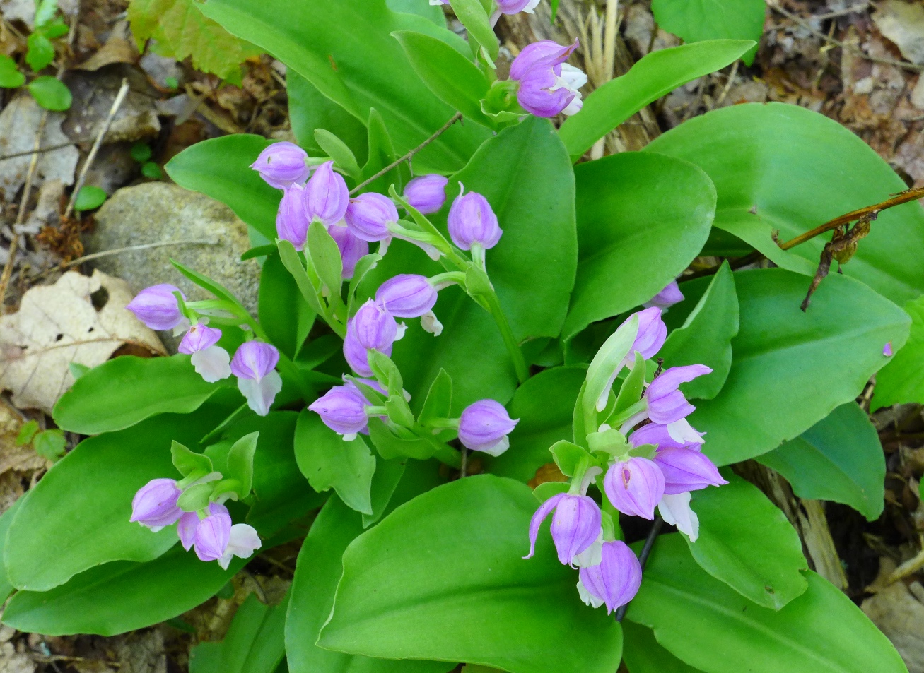
Showy Orchis
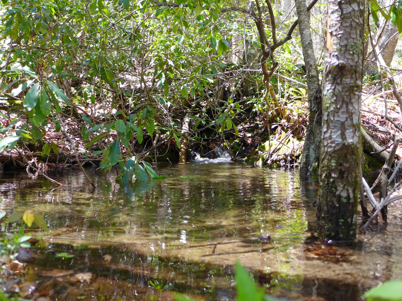
This small pond I think had formed simply because of all the rain we've had.
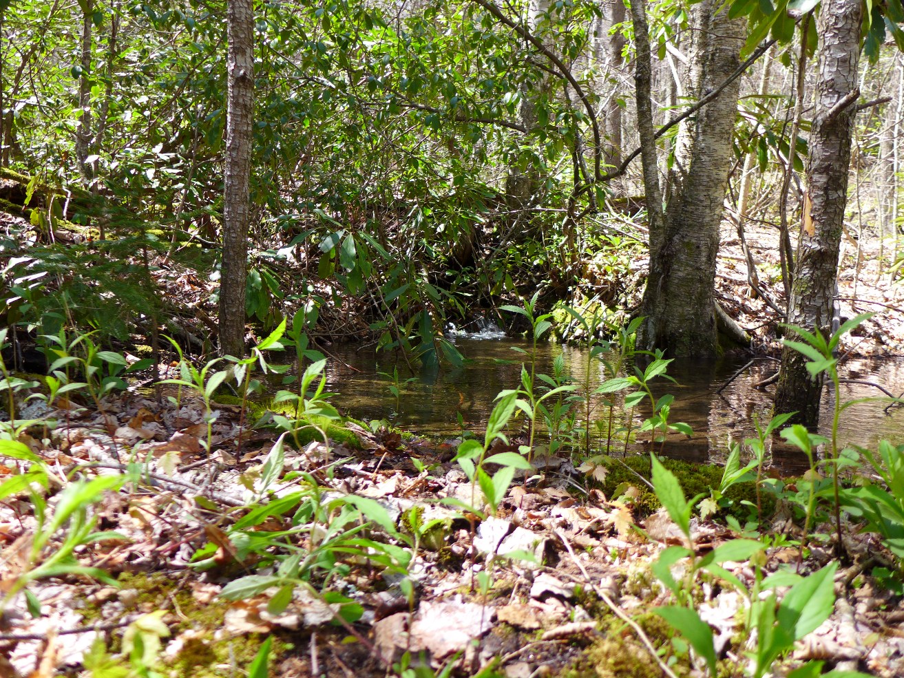
Small Pond which had formed
Full view (above)
Zoomed in view (below)
2.2 miles from the turn off to Fork Mountain Trail, you come to a small (20 foot), low flow waterfall:
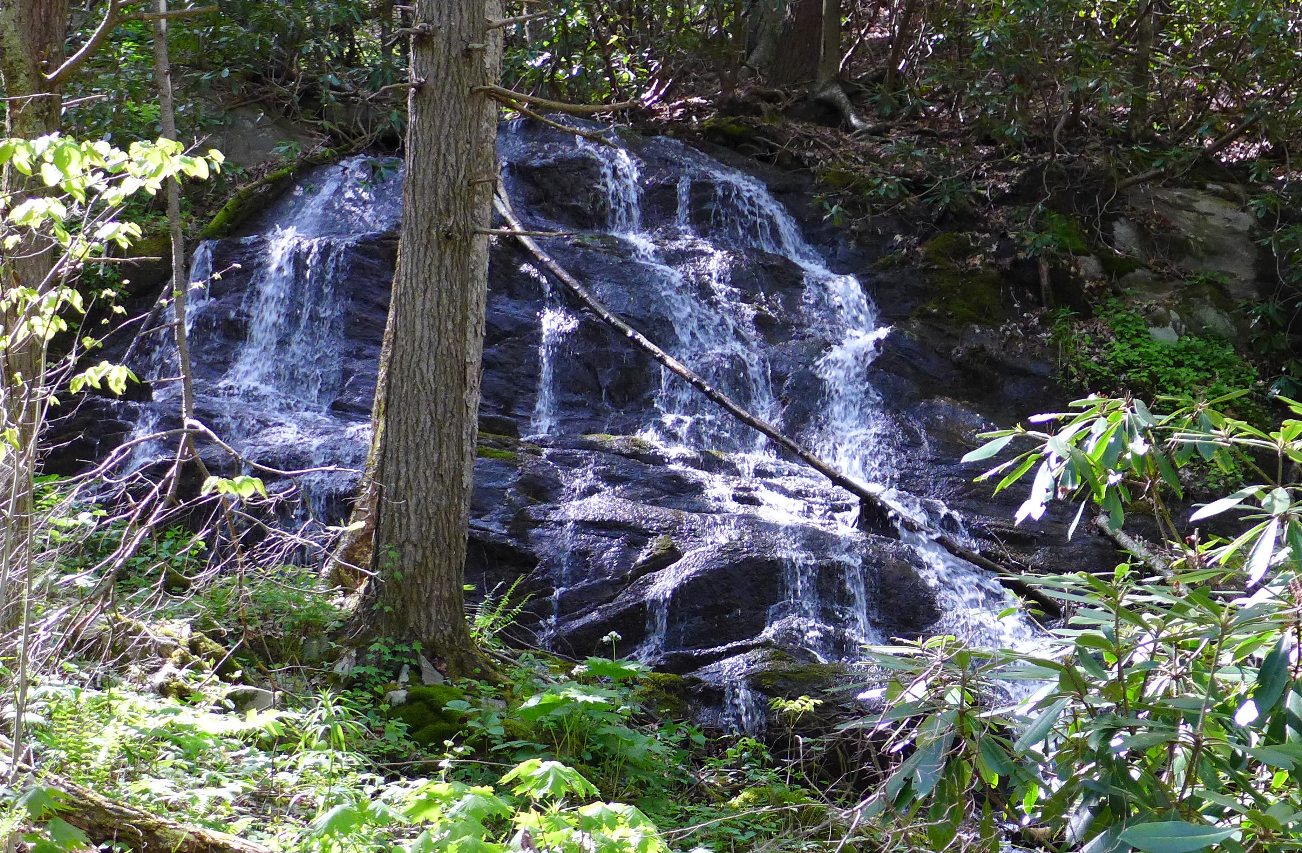
Waterfall along the Trail
At this point, the trail just sort of disappears. To continue your loop, make a right turn, heading downhill. Follow the creek downstream, just following the path of least resistance. Immediately after the waterfall, you will want to be on the north side of the creek, but somewhere along the 3750 foot contour line you will want to cross over to the other side of the creek. Along about the 3500 foot elevation point, you'll pick up a path that becomes more and more clear the closer you get to Little East Fork Trail.
Once you rejoin Little East Fork Trail, turn left, and the parking area is in another 0.5 mile.